Category:Lebanon-Quadrangle
County Coal Data
Mines that Appear in Lebanon-Quadrangle
*9998 & 9999 = Unknown dates
Unlocated Mines in Lebanon-Quadrangle
Mine that have known coal production but no known location
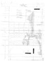
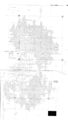
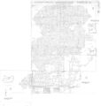
Historical Mined Out Area Maps
WPA
These maps were constructed as part of the nationwide Works Projects Administration (WPA), generally between 1934 and 1937 with some later updates or revisions,
Disclaimer
Maps for some locations might have multiple versions/seams, please inspected these areas closely for differences.
Notes and corrections were made by ISGS staff.
These maps are reproductions from microfilm, they may be of poor quality with text difficult to read.
There are no Quade Maps for this county
Federal Land Bank of St. Louis, Preliminary Reports on Subsidence Investigations
Federal Land Bank of St. Louis, Preliminary Reports on Subsidence Investigations (refered by Coal Section Staff as "Quade Maps")
Mining engineers working for the Federal Land Bank of St. Louis mapped areas of subsidence due to coal mining in the early 1930s. These reports often include county maps of mine properties with mined-out areas including shaft locations, as well as subsidence areas.
Disclaimer
Maps for some locations might have multiple versions/seams, please inspected these areas closely for differences.
These maps are accompanied by a report, please download and inspect this document.
Notes and corrections were made by ISGS staff.
There are no Quade Maps for this county
Photographs
Pages in category "Lebanon-Quadrangle"
The following 12 pages are in this category, out of 12 total.
Media in category "Lebanon-Quadrangle"
The following 22 files are in this category, out of 22 total.
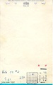
 M0200 minenotes.pdf 737 × 1,183, 15 pages; 3.15 MB
 M0200mrg.jpg 2,526 × 3,390; 894 KB
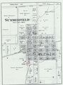
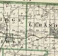
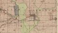
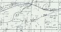 M0304 atlas1874.jpg 1,857 × 992; 276 KB
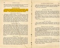
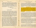
 M0304 coalreport1884 p569.pdf 1,589 × 1,247; 374 KB
 M0304 minenotes.pdf 737 × 1,183, 6 pages; 1.19 MB
 M0304.jpg 2,658 × 3,390; 434 KB
 M0340.jpg 1,925 × 3,390; 1.33 MB
 M1630149 coalreport1897 p120.pdf 839 × 1,185; 206 KB
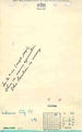
 M3485 minenotes.pdf 737 × 1,183, 18 pages; 5.33 MB
 M3486 coalreport1884.pdf 1,587 × 1,272; 333 KB
 M3486mrg.jpg 3,218 × 3,390; 1.48 MB
 M3593 atlas1874.jpg 3,501 × 4,726; 2.04 MB
 M3593 coalreport1884 p569.pdf 1,589 × 1,247; 371 KB
 M3593 minenotes.pdf 737 × 1,183, 3 pages; 618 KB
 M3594 351065.jpg 3,008 × 3,390; 829 KB
 M3594 coalreport1884 p569.pdf 1,589 × 1,247; 372 KB
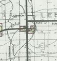
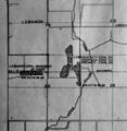 M3594 maswpa.jpg 686 × 701; 122 KB
 M3595 351012.jpg 2,524 × 3,390; 331 KB
 M3595 atlas1876.jpg 443 × 427; 115 KB
 M3595 coalreport1884.pdf 1,589 × 1,247; 373 KB
 M4270 GFolio195.jpg 764 × 432; 599 KB
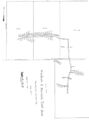
 M4271 quade.jpg 612 × 660; 99 KB


