Mine Index Number: 3661
| Company Name:
|
Kelly Coal Company
|
| Mine Name:
|
Kelly No. 47 Mine
|
| Start Date:
|
1887
|
End Date:
|
1907
|
| Type of Mine:
|
Underground
|
| Total acres shown:
|
4,921 The boundaries between the Kelly mines (No.s 1 through 5 and 46 and 47, mine index numbers 3731, 3729, 3663, 3660, 3740, 3664 and 3661) cannot be distinguished with any accuracy. The total area for these Kelly mines is in line with production of all the Kelly mines.
|
| Acres after map date:
|
|
General Area of mining acres shown:
|
|
|
|
Shaft, Slope, Drift or Tipple Location(s)
| Type
|
County
|
Township-Range
|
Section
|
Part Section
|
| Main shaft (10'x19') Ventilation was probably provided by underground connections to other mines.
|
Vermilion
|
18N 11W
|
5
|
SE NW NE
|
Geology
| Herrin
|
90-100
|
|
|
6.0-8.0
|
MRP
|
Geological Problems Reported
Faults were shown on a source map in the southeastern and northeastern parts of the mine.
Production
| Company
|
Mine Name
|
Date
|
Production (tons)
|
Production Notes
Coal Report production (if available)
Sources of Data
| State Archive, MSHA_1168
|
3-1907
|
1:2400
|
1:2400
|
Final
|
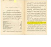
Annotated Bibliography (Data source - brief description of information)
| Coal Reports - Production, ownership, years of operation, depth, thickness, mining method.
|
| Directory of Illinois Coal Mines (Vermilion County) - Mine names, mine index, ownership, years of operation.
|
| ENR Document 85/01 - Mining method.
|
| Mine notes (Vermilion County) - Shaft location, seam.
|
| Company map, State Archive, MSHA_1168, courtesy Robert Gibson, DNR - Mine outline, shaft location, mining method, geologic problems.
|
Mine Notes
Mine Images
Company map: MSHA_1168
Map Date: 3-1907
Coal Co.: Kelly Coal Company
Mine Name: Kelly No. 47 Mine
Image Credit: Illinois Department of Natural Resources - Office of Mines and Minerals
Full Res Download
Photographs