Mine Index Number: 2936
| Company Name:
|
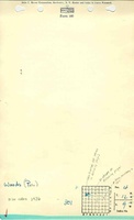
Pete Woods
|
| Mine Name:
|
Woods Mine
|
| Start Date:
|
{{{year-start}}}
|
End Date:
|
{{{year-end}}}
|
| Type of Mine:
|
Underground
|
| Total acres shown:
|
|
| Acres after map date:
|
|
General Area of mining acres shown:
|
|
|
|
"{{{year-start}}}" contains an extrinsic dash or other characters that are invalid for a date interpretation."{{{year-end}}}" contains an extrinsic dash or other characters that are invalid for a date interpretation.
Shaft, Slope, Drift or Tipple Location(s)
| Type
|
County
|
Township-Range
|
Section
|
Part Section
|
| Main shaft
|
Macoupin
|
Macoupin
|
4
|
|
Geology
Geological Problems Reported
Production
| Company
|
Mine Name
|
Date
|
Production (tons)
|
| [[Pete Woods Not listed in the Coal Reports under this name. The mine notes indicate this mine opened in 1934 or 1936.]]
|
|
|
|
|
|
Property "Company" (as page type) with input value "Pete Woods Not listed in the Coal Reports under this name. The mine notes indicate this mine opened in 1934 or 1936." contains invalid characters or is incomplete and therefore can cause unexpected results during a query or annotation process.
Production Notes
Coal Report production (if available)
Sources of Data
Annotated Bibliography (Data source - brief description of information)
| Coal Reports - Production, ownership, years of operation.
|
| Directory of Illinois Coal Mines (Macoupin County) - Mine names, mine index, ownership, years of operation.
|
| Mine notes (Macoupin County) - Mine type, shaft location, seam, depth, thickness.
|
Mine Notes
Mine Images
Photographs