Mine Index Number: 2936
| Company Name:
|
Pete Woods
|
| Mine Name:
|
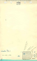
Woods Mine
|
| Start Date:
|
Circa 1935
|
End Date:
|
Unknown
|
| Type of Mine:
|
Underground
|
| Total acres shown:
|
None
|
| Acres after map date:
|
|
General Area of mining acres shown:
|
|
|
|
Shaft, Slope, Drift or Tipple Location(s)
| Type
|
County
|
Township-Range
|
Section
|
Part Section
|
| Mine
|
Macoupin
|
12N 9W
|
4
|
NW NW SE
|
Geology
Geological Problems Reported
Production
| Company
|
Mine Name
|
Date
|
Production (tons)
|
| Pete Woods Not listed in the Coal Reports under this name. The mine notes indicate this mine opened in 1934 or 1936.
|
Woods
|
circa 1935
|
Unknown
|
|
|
Production Notes
Coal Report production (if available)
Sources of Data
| Mine notes
|
Undated
|
1:62500
|
1:62500
|
Secondary source
|
Annotated Bibliography (Data source - brief description of information)
| Directory of Illinois Coal Mines (Macoupin County) - Mine names, mine index, ownership.
|
| Mine notes (Macoupin County) - Mine location, seam, thickness, years of operation.
|
Mine Notes
Mine Images
Photographs