1028: Difference between revisions
Alan.Myers (talk | contribs) No edit summary |
Alan.Myers (talk | contribs) No edit summary |
||
| Line 9: | Line 9: | ||
|mine_type=Underground | |mine_type=Underground | ||
|mined-out-area=9,226 | |mined-out-area=9,226 | ||
|indicated=No | |||
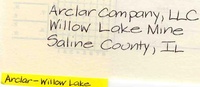
|county1=Saline | |county1=Saline | ||
|quad1=Eldorado | |quad1=Eldorado | ||
| Line 94: | Line 95: | ||
{{Source Map | {{Source Map | ||
|Source Map=Company, digital outline | |Source Map=Company, digital outline | ||
|Map Date= | |Map Date=2013 | ||
|Original Scale=1:24000 | |Original Scale=1:24000 | ||
|Digitized Scale=1:24000 | |Digitized Scale=1:24000 | ||
Revision as of 16:33, August 25, 2022
Mine Index Number: 1028
| Company Name: | Big Ridge, Inc. | ||
|---|---|---|---|
| Mine Name: | Willow Lake Mine | ||
| Start Date: | 2002 | End Date: | November 17, 2012 |
| Type of Mine: | Underground | ||
| Total acres shown: | 9,226 | ||
| Acres after map date: | General Area of mining acres shown: | ||
Shaft, Slope, Drift or Tipple Location(s)
| Type | County | Township-Range | Section | Part Section |
|---|
| Main slope | Saline | 9S 7E | 1 | NE SW SW |
| Air shaft | Saline | 9S 7E | 1 | SW NE SW |
| Air shaft | Saline | 9S 7E | 1 | SW NE SW |
| Air shaft | Saline | 8S 8E | 20 | NW SE NW |
Geology
| Thickness (ft) | |||||
|---|---|---|---|---|---|
| Seam | Depth (ft) | Min | Max | Ave | Mining Method |
| Springfield | MRP |
Geological Problems Reported
Production
| Company | Mine Name | Date | Production (tons) |
| Arclar Coal Company | Willow Lake | 2002-2009 | 26,187,759 |
| Big Ridge, Inc. | Willow Lake | 2010-2012 | 7,236,212This production includes tonnages from the Willow Lake surface mine (mine index 1033). |
| Total Production: 33,423,971 | |||
Production Notes
Coal Report production (if available)
Sources of Data
| Source Map | Map Date | Original Scale | Digitized Scale | Map Type |
| Company, Coal Section files | 2-29-2012 | 1:4800 | 1:4800 | Not final |
| Company, digital outline | 2013 | 1:24000 | 1:24000 | Final |
Annotated Bibliography (Data source - brief description of information)
| Coal Reports - Production, ownership, years of operation. |
| Directory of Illinois Coal Mines (Saline County) - Mine names, mine index, ownership, years of operation. |
| Mine notes (Saline County) - Mine type, shaft location, seam, depth, thickness. |
| Company map, Coal Section digital files (2012 active mines) - Slope and shaft locations, mine outline, mining method. |
| Company map, digital outline supplied to Illinois Department of Mines and Minerals - Mine outline. |
Mine Notes
Mine Images
![[[:Willow Lake|Willow Lake]]](https://wikiimage.isgs.illinois.edu/ilmines/saline/thumbnails/m1028_6_375k_2013_th.jpg)
Photographs