1044: Difference between revisions
No edit summary |
Alan.Myers (talk | contribs) No edit summary |
||
| Line 9: | Line 9: | ||
|mine_type=Surface | |mine_type=Surface | ||
|mined-out-area=3,296 | |mined-out-area=3,296 | ||
|indicated=No | |||
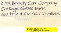
|county1=Gallatin | |county1=Gallatin | ||
|county2=Saline | |county2=Saline | ||
| Line 74: | Line 75: | ||
|Date=2000-2009 | |Date=2000-2009 | ||
|Production=4,347,151{{#info: The 2000-2005 production is included in the totals for Wildcat Hills Eagle Valley mine (mine index [1022]).|note}} | |Production=4,347,151{{#info: The 2000-2005 production is included in the totals for Wildcat Hills Eagle Valley mine (mine index [1022]).|note}} | ||
|Sum=No | |||
}} | }} | ||
{{Production | {{Production | ||
|Company=Peabody Midwest Mining | |Company=Peabody Midwest Mining | ||
|Mine-Name=Wildcat Hills Cottage Grove | |Mine-Name=Wildcat Hills Cottage Grove | ||
|Date=2010- | |Date=2010-2019 | ||
|Production= | |Production=12,250,083 | ||
|Sum=No | |||
}} | }} | ||
{{Production | {{Production | ||
|Production= | |Production=16,597,234 | ||
|Sum=Yes | |||
| | |||
}} | }} | ||
===Production Notes=== | ===Production Notes=== | ||
Revision as of 08:56, August 25, 2022
Mine Index Number: 1044
| Company Name: | Peabody Midwest Mining | ||
|---|---|---|---|
| Mine Name: | Wildcat Hills Cottage Grove Mine | ||
| Start Date: | 2000 | End Date: | Active |
| Type of Mine: | Surface | ||
| Total acres shown: | 3,296 | ||
| Acres after map date: | General Area of mining acres shown: | ||
Shaft, Slope, Drift or Tipple Location(s)
| Type | County | Township-Range | Section | Part Section |
|---|
| Pit | Gallatin | 9S 7E | 1, 2, 3, 10, 11, 12, 14 |
| Pit | Gallatin | 9S 8E | 4, 5, 6, 7, 8, 9 |
Geology
| Thickness (ft) | |||||
|---|---|---|---|---|---|
| Seam | Depth (ft) | Min | Max | Ave | Mining Method |
| Danville The Danville Coal is mined only in the northern portions of the northernmost pits. | Surface |
| AllenbyThe Allenby Coal was said to have been mined in 2003, and again 2006-2009. The Allenby Coal is commonly found in channel deposits, so it is unclear which pits this coal was mined in. | 50 | 2.0 | Surface |
| Herrin | 65 | 3.7 | Surface |
| Briar Hill | Surface |
| Springfield The Springfield Coal is mined in the southernmost pit, and in portions of the northern pits, south of the underground mines in the Springfield Coal. | Surface |
Geological Problems Reported
Geologic problems are confidential information and are not reported for active mines.
Production
| Company | Mine Name | Date | Production (tons) |
| Black Beauty Coal Company | Wildcat Hills Cottage Grove | 2000-2009 | 4,347,151The 2000-2005 production is included in the totals for Wildcat Hills Eagle Valley mine (mine index [1022]). |
| Peabody Midwest Mining | Wildcat Hills Cottage Grove | 2010-2019 | 12,250,083 |
| Total Production: 16,597,234 | |||
Production Notes
Coal Report production (if available)
Sources of Data
| Source Map | Map Date | Original Scale | Digitized Scale | Map Type |
| Company, Coal Section files | 2009 | unknown | 1:24000 | Not final |
| Coal Section files | 2012 | unknown | 1:24000 | Not final |
Annotated Bibliography (Data source - brief description of information)
| Coal Reports - Production, ownership, years of operation. |
| Directory of Illinois Coal Mines (Saline County) - Mine names, mine index, ownership, years of operation. |
| Company map, Coal Section files (2009 active mines) - Mine outline, mining method. |
| Coal Section files, digital map - Mine outline. |
Mine Notes
Mine Images
Photographs