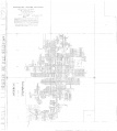
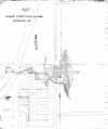
Greenview Quadrangle
Mining in the Greenview Quadrangle
The first mining that took place in the Greenview Quadrangle was in 1880, when the Greenview Coal Company sank their shaft (mine index 4207). The mine was about 100 feet deep and located next to the Chicago & Alton Railroad. During the next year, Ed Hughes opened his mine near Sweetwater (mine index 4157, in SE 31-T9N-R5W). The other mines were all considerably deeper than the first mine, ranging from 122 to 185 feet deep. All worked in the Springfield Coal, and presumably had similar geologic problems as the mine in Sangamon County to the southeast (horsebacks, clay dikes, etc.), but little is known of the operating difficulties of the Menard County mines.
Map and Directory PDF Download
Coal Mines In Illinois Greenview Quadrangle
Mines that Appear on the Greenview Quadrangle
Unlocated Mines
Menard County
Pages in category "Greenview Quadrangle"
The following 11 pages are in this category, out of 11 total.
Media in category "Greenview Quadrangle"
The following 14 files are in this category, out of 14 total.
- M0531 minenotes.pdf 731 × 1,202, 10 pages; 2.77 MB
- M0531.jpg 3,038 × 3,390; 1.43 MB
- M0612 352210.jpg 3,390 × 2,170; 1.05 MB
- M0612 coalreport1915 p130.pdf 727 × 1,193; 352 KB
- M0612 minenotes.pdf 731 × 1,202, 13 pages; 3.13 MB
- M4157 coalreport1884 p506.pdf 791 × 1,216; 354 KB
- M4157 coalreport1885 p77.pdf 775 × 1,231; 354 KB
- M4207 352226.jpg 2,839 × 3,390; 984 KB
- M4207 coalreport1884 p506.pdf 791 × 1,216; 356 KB
- M4207 coalreport1885 p78.pdf 1,652 × 1,293; 798 KB
- M4207 coalreport1889 p37.pdf 1,647 × 1,304; 925 KB
- M7783 1901 Sheet2.jpg 3,186 × 2,330; 1.08 MB
- M7783 coalreport1895 p54.pdf 750 × 1,185; 1.31 MB
- M7783 coalreport1900.pdf 1,545 × 1,204; 310 KB


