Mine Index Number: 0033
| Company Name:
|
Brewerton Coal Company
|
| Mine Name:
|
Brewerton No. 2 Mine
|
| Start Date:
|
1903
|
End Date:
|
February 1933
|
| Type of Mine:
|
Underground
|
| Total acres shown:
|
1,559
|
| Acres after map date:
|
27
|
General Area of mining acres shown:
|
|
|
|
Shaft, Slope, Drift or Tipple Location(s)
| Type
|
County
|
Township-Range
|
Section
|
Part Section
|
| Main shaft
|
Logan
|
20N 2W
|
30
|
NE SE NE
|
| Air shaft
|
Logan
|
20N 2W
|
30
|
SE SE NE
|
Geology
| Springfield
|
280
|
4.0
|
6.0
|
5.1
|
RPB
|
Geological Problems Reported
A 12 to 14 foot thick bed of sand was located 50 feet below the surface. This sand contained a lot of water. Clay dikes or ‘horsebacks’ were common in this mine. The microfilm source map indicated areas of squeeze in the southeastern part of the mine.
Production
| Company
|
Mine Name
|
Date
|
Production (tons)
|
|
|
|
|
|
| Total Production: 5,653,571
|
Production Notes
Coal Report production (if available)
Sources of Data
| Microfilm, document 352524
|
11-1931
|
1:2400
|
1:3972
|
Not final
|
| Microfilm, document 352538
|
10-03-1922
|
1:2400
|
1:3972
|
Not final
|
Annotated Bibliography (Data source - brief description of information)
| Coal Reports - Production, ownership, years of operation.
|
| Directory of Illinois Coal Mines (Logan County) - Mine names, mine index, ownership, years of operation.
|
| Mine notes (Logan County) - Mine type, shaft location, seam, depth, thickness, geologic problems.
|
| Microfilm map, document 352524, reel 03139, frames 244-246 - Shaft locations, mine outline (north, east, west).
|
| ISGS map library, 4103.L6 i5.1-3, original map for Federal Land Bank Report - Mine outline (north).
|
Mine Notes
Mine Images
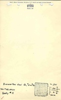
Microfilm: 352524
Map Date: 11-1931
Coal Co.: Brewerton Coal Company
Mine Name: Brewerton No. 92 Mine
Full Res Download
Map library: 4103.L6 i5.1-3
Map Date: 11-1934
Coal Co.: Brewerton Coal Company
Mine Name: Brewerton No. 92 Mine
Image Credit: Illinois State Geological Survey
Full Res Download
Photographs