Mine Index Number: 0042
| Company Name:
|
Macon County Coal Company
|
| Mine Name:
|
Macon County No. 1 Mine
|
| Start Date:
|
1903
|
End Date:
|
1947
|
| Type of Mine:
|
Underground
|
| Total acres shown:
|
668
|
| Acres after map date:
|
5
|
General Area of mining acres shown:
|
|
|
|
Shaft, Slope, Drift or Tipple Location(s)
| Type
|
County
|
Township-Range
|
Section
|
Part Section
|
| Main shaft
|
Macon
|
16N 2E
|
14
|
SW SW SW
|
| Air shaft
|
Macon
|
16N 2E
|
15
|
SE SE SE
|
Geology
| Springfield
|
560 (544-624)
|
4.0
|
5.0
|
4.5
|
LWThe mine was opened in RP method and went to longwall operation in 1906.
|
Geological Problems Reported
The roof was 1-2 feet of black shale, which contained numerous concretions that ranged from 2 to 1,050 pounds. A thin limestone (2-16 inches) was above the black shale, and this had to be shot down when the floor heaved to keep sufficient clearance for the haulage motors and cars. A gray shale was present above the limestone, and this made a poor roof, continually falling in small amounts. Pyrite was present in lenses and fracture facings throughout the coal both vertically and laterally. Clay horsebacks were abundant and clay slips were common. The floor was 8 to 9 feet of underclay that was soft and heaved badly. This clay contained too much calcium carbonate to be used for brick manufacturing.
Production
| Company
|
Mine Name
|
Date
|
Production (tons)
|
|
|
|
|
|
| Total Production: 4,588,459
|
Production Notes
Coal Report production (if available)
Sources of Data
| Company, 4103.M33 i5.1-1, sheet 1
|
3-23-1946
|
1:2400
|
1:2400
|
Not final
|
Annotated Bibliography (Data source - brief description of information)
| Coal Reports - Production, ownership, years of operation, depth.
|
| Directory of Illinois Coal Mines (Macon County) - Mine names, mine index, ownership, years of operation.
|
| ENR Document 85/01 - Mining method.
|
| Mine notes (Macon County) - Mine type, shaft location, seam, depth, thickness, geologic problems.
|
| Company map, ISGS map library, 4103.M33 i5.1-1, sheet 1 - Shaft locations, mine outline, mining method.
|
Mine Notes
Mine Images
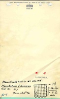
Company: 4103.M33 i5.1-1
Map Date: 3-23-1946
Coal Co.: Macon County Coal Company
Mine Name: Macon County No. 1 Mine
Image Credit: Illinois State Geological Survey
Full Res Download
Photographs