Mine Index Number: 0059
| Company Name:
|
Old Ben Coal Corporation
|
| Mine Name:
|
Old Ben No. 17 Mine
|
| Start Date:
|
1902
|
End Date:
|
March 1923
|
| Type of Mine:
|
Underground
|
| Total acres shown:
|
1,201
|
| Acres after map date:
|
|
General Area of mining acres shown:
|
|
|
|
Shaft, Slope, Drift or Tipple Location(s)
| Type
|
County
|
Township-Range
|
Section
|
Part Section
|
| Main shaft
|
Williamson
|
8S 2E
|
24
|
SW NE NW
|
| Air shaft
|
Williamson
|
8S 2E
|
24
|
SW NE NW
|
Geology
| Herrin
|
208-300
|
7.0
|
9.0
|
8.5
|
RPP, HERMany pillars were drawn on the east side of the mine; this resulted in surface subsidence a month later. (One death resulted from a roof fall while pulling pillars in 1915.)
|
Geological Problems Reported
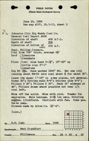
A large fault was noted 2200 feet west of the shaft. This made a “hill” where the floor was 77 feet higher than at the shaft. Faults were also noted on the source map in the southwestern part of the mine. The west side was downthrown 40 feet and halted westward expansion. The roof was gray shale over much of the mine, with black shale and limestone comprising the roof over the eastern part of the mine. 300 feet east of the shaft, a gray shale lens was present (200 feet long and 2 feet wide) that split the coal in two benches, with 75% of the coal below the lens and 25% above. Rolls were present but infrequent, in one case cutting out half the coal seam for a 20-
foot length. Some calcareous concretions were present, but their effect on mining was not noted. Some gas was noted; gas explosions in 1909, 1912, and 1920 resulted in three deaths. The floor was underclay varying in thickness from 0 to 4 feet. It was thicker in the east part of the mine, under the black shale and limestone roof.
Production
| Company
|
Mine Name
|
Date
|
Production (tons)
|
|
|
|
|
|
| Total Production: 7,806,246
|
Production Notes
Coal Report production (if available)
Sources of Data
| Company, Old Ben Archive Collection
|
1-14-1928
|
1:2400
|
1:2400
|
Final
|
Annotated Bibliography (Data source - brief description of information)
| Coal Reports - Production, ownership, years of operation, depth, geologic problems.
|
| Directory of Illinois Coal Mines (Williamson County) - Mine names, mine index, ownership, years of operation.
|
| Mine notes (Williamson County) - Mine type, shaft location, seam, thickness, geologic problems.
|
| Company map, Old Ben Coal Company Archive Collection - Shaft locations, mine outline, mining method, geologic problems.
|
| Microfilm map, document 353183, reel 03142, frame 80 - Geologic problem (fault in southwest).
|
Mine Notes
Mine Images
![[[:Old Ben No. 17|Old Ben No. 17]]](https://wikiimage.isgs.illinois.edu/ilmines/williamson/thumbnails/m0059mrg.jpg) These files may not be true to scale and are not georgistered. These files may not be true to scale and are not georgistered.
|
Map Type:
|
Company
|
| Map ID:
|
Old Ben Archive Collection
|
| Company:
|
Old Ben Coal Corporation
|
| Mine Name:
|
Old Ben No. 17
|
| Caption:
|
|
| Map Date:
|
07/01/1936
|
| Map Status:
|
Final
|
| Image Credit:
|
|
| Note:
|
|
| More Info:
|
M0059mrg.tif
|
| Full Res Download:These files are true to scale and most are georegistered for gis software. These files may be a very large (>1GB) download!
|
https://wikiimage.isgs.illinois.edu/ilmines/williamson/m0059mrg.zip
|
Photographs


![[[:Old Ben No. 17|Old Ben No. 17]]](https://wikiimage.isgs.illinois.edu/ilmines/williamson/thumbnails/m0059mrg.jpg)