Mine Index Number: 0061
| Company Name:
|
Seymour Coal Mining Corporation
|
| Mine Name:
|
Freeman Spur Mine
|
| Start Date:
|
1904
|
End Date:
|
June 1952
|
| Type of Mine:
|
Underground
|
| Total acres shown:
|
2,459 2,453 in Herrin Coal, 6 in Springfield Coal
|
| Acres after map date:
|
|
General Area of mining acres shown:
|
|
|
|
Shaft, Slope, Drift or Tipple Location(s)
| Type
|
County
|
Township-Range
|
Section
|
Part Section
|
| Main shaft
|
Williamson
|
8S 2E
|
22
|
SW SE SW
|
| Air shaft
|
Williamson
|
8S 2E
|
22
|
SW SE SW
|
| Slope (blind)
|
Williamson
|
8S 2E
|
22
|
SW SE SW
|
Geology
| Herrin
|
143
|
7.0
|
10.0
|
8.0-9.0
|
RPP, HERISGS mine notes indicated that pillars were drawn where possible.
|
Geological Problems Reported
The Cottage Grove Fault System runs through the northeastern workings, with two northwest-trending faults. Several small faults were reported, and a large fault was reported 300 feet west of the shaft. This fault has 20 feet of displacement with the downthrown side to the west. The source map showed portions of the mine where faulting, bad top and water were problems (along the western side of the mine in the north half 22-T8S-R2E and along the eastern side of the mine in SW 14-T8S-R2E). The roof was a massive gray shale that required the upper 18 to 24 inches of coal left to support the roof in the entries, but the top coal was generally mined in the rooms. The roof was treacherous where the top coal was taken down. Coal stringers extended up into the roof, and this also caused roof falls. Roof rolls were frequent. The coal bed contained local dips and hills, some affecting coal thickness.
Production
| Company
|
Mine Name
|
Date
|
Production (tons)
|
|
|
|
|
|
| Total Production: 17,128,052
|
Production Notes
Coal Report production (if available)
Sources of Data
| Microfilm, document 351447
|
7-12-1952
|
1:2400
|
1:2483
|
Final
|
| Microfilm, document 353148
|
9-1929
|
1:2400
|
1:2483
|
Not final
|
Annotated Bibliography (Data source - brief description of information)
| Coal Reports - Production, ownership, years of operation.
|
| Directory of Illinois Coal Mines (Williamson County) - Mine names, mine index, ownership, years of operation.
|
| Mine notes (Williamson County) - Mine type, shaft location, seam, depth, thickness, geologic problems, mining method.
|
| Microfilm map, document 351447, reel 03136, frames 137-140 - Shaft locations, mine outline (Herrin seam), mining method, geologic problems.
|
| Microfilm map, document 353148, reel 03142, frame 27 - Slope location, mine outline (Springfield seam).
|
| W.J. Nelson (ISGS), Catalog of Coal Mines in Williamson County, 2003 - Geologic problems.
|
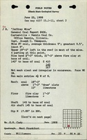
Mine Notes
Mine Images
Microfilm: 351447
Map Date: 7-12-1952
Coal Co.: Seymour Coal Mining Corporation
Mine Name: Freeman Spur Mine
Full Res Download
Microfilm: 353148
Map Date: 9-1929
Coal Co.: Pratt Brothers Coal Company
Mine Name: Jeffrey Mine
Full Res Download
Photographs