Mine Index Number: 0068
| Company Name:
|
Bell and Zoller Coal and Mining Company
|
| Mine Name:
|
Bell and Zoller No. 15 Mine
|
| Start Date:
|
1905
|
End Date:
|
May 1951
|
| Type of Mine:
|
Underground
|
| Total acres shown:
|
4,014
|
| Acres after map date:
|
|
General Area of mining acres shown:
|
|
|
This mine is connected underground to Staunton No. 7 Mine (mine index 0189).
|
Shaft, Slope, Drift or Tipple Location(s)
| Type
|
County
|
Township-Range
|
Section
|
Part Section
|
| Main shaft (8.83 x 15.5 ft)
|
Macoupin
|
7N 6W
|
9
|
NE NW NE
|
| Air shaft (8.83 x 15.5 ft)
|
Macoupin
|
7N 6W
|
9
|
SE NW NE
|
Geology
| Herrin
|
387
|
7.0
|
8.75
|
7.5-7.67
|
MRPRPP around the outer portions of the mine, the interior is MRP.
|
Geological Problems Reported
Portions of the black shale roof (a minimum of 2 to 4 inches) were rotten, and were overlain by 2 inches of clod. The clod was dark gray and hard when fresh, but after exposure and oxidation, it became lighter and crumbled in the hand. The roof conditions in the northern part of the mine were very good; in the southern part, there was some soapstone. Limestone protrusions into the seam caused some difficulty with mining. Some slips were present in the black shale, especially around the protrusions. The shale was very hard to keep up and sooner or later was taken down up to the limestone cap rock. Concretions were present, but few in number. Squeezes were noted in the NE 1/4 of section 9 (1911 and 1924), and NW 1/4 of section 4 (1938).
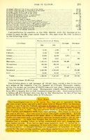
Production
| Company
|
Mine Name
|
Date
|
Production (tons)
|
|
|
|
|
|
| Total Production: 27,522,191
|
Production Notes
Coal Report production (if available)
Sources of Data
| State archive, IL_1123
|
5-11-1951
|
1:4800
|
1:4800
|
Final
|
| Company, 4103.M34 i5.1-13
|
5-1-1942
|
1:4800
|
1:4800
|
Not final
|
Annotated Bibliography (Data source - brief description of information)
| Coal Reports - Production, ownership, years of operation, shaft sizes.
|
| Directory of Illinois Coal Mines (Macoupin County) - Mine names, mine index, ownership, years of operation.
|
| Mine notes (Macoupin County) - Mine type, shaft location, seam, depth, thickness, geologic problems.
|
| State archive, IL_1123 - Shaft locations, mine outline, mining method.
|
| Company map, ISGS map library 4103.M34 i5.1-13 - Shaft locations.
|
| Company map, ISGS map library, Old Ben Coal Co. archive collection - Geologic problems.
|
Mine Notes
Mine Images
![[[:Bell and Zoller No. 15|Bell and Zoller No. 15]]](https://go.illinois.edu/ILMImages/macoupin/thumbnails/m0068_IL_1123_th.jpg) These files may not be true to scale and are not georgistered. These files may not be true to scale and are not georgistered.
|
Map Type:
|
State Archive
|
| Map ID:
|
IL_1123
|
| Company:
|
Bell and Zoller Coal and Mining Company
|
| Mine Name:
|
Bell and Zoller No. 15
|
| Caption:
|
|
| Map Date:
|
05-11-1951
|
| Map Status:
|
Final
|
| Image Credit:
|
|
| Note:
|
|
| More Info:
|
M0068 IL 1123
|
| Full Res Download:These files are true to scale and most are georegistered for gis software. These files may be a very large (>1GB) download!
|
https://go.illinois.edu/ILMImages/macoupin/m0068 IL 1123.zip
|
Photographs