Mine Index Number: 0154
| Company Name:
|
Franco Mining Corporation
|
| Mine Name:
|
Franco No. 1 Mine
|
| Start Date:
|
1915
|
End Date:
|
June 1938
|
| Type of Mine:
|
Underground
|
| Total acres shown:
|
930
|
| Acres after map date:
|
2
|
General Area of mining acres shown:
|
|
|
|
Shaft, Slope, Drift or Tipple Location(s)
| Type
|
County
|
Township-Range
|
Section
|
Part Section
|
| Main shaft
|
Williamson
|
8S 2E
|
11
|
NW NW SE
|
| Air shaft
|
Williamson
|
8S 2E
|
11
|
NW NW SE
|
Geology
| Herrin
|
234-236
|
8.0
|
13.0
|
8.0-9.83
|
RPP, HER
|
Geological Problems Reported
A fault was shown on the mine map in the northeast portion of the mine that halted further mine expansion in that direction. A less-disruptive fault was also shown in the southwestern corner of the mine. An area in the northwestern corner of the mine squeezed. A 1927 gas explosion killed 7 men. In the southwestern part of the mine, a roof fall has produced an area of 4-foot subsidence on the surface. The roof was a medium hard, light gray shale, irregularly bedded, and very difficult to keep up. At times, no coal was left to support the roof, and roof falls were common, making the roof shale an important impurity in the product. At other times (1917 Coal Report, p. 275), 2 feet of top coal was left to support the roof, but this was recovered on retreat, along with pillar extraction. Pillar extraction was common in 1917 and 1918, but its extent throughout the mine is unknown. A few minor rolls and many slips were present, but there was no displacement of the coal, so these had a minor effect on mining. The coal had a clay parting and clay and stony pyrite laminae. Some pyrite was impregnated in the coal, and a vertical network of veinlets and rare or sporadic small stony lenses (0.25 by 2 inches). Sometimes bottom coal was left in the rooms.
Production
| Company
|
Mine Name
|
Date
|
Production (tons)
|
|
|
|
|
|
| Total Production: 8,155,436
|
Production Notes
Coal Report production (if available)
Sources of Data
| Company, 4103.W52 i5.1-84
|
5-15-1938
|
1:2400
|
1:2400
|
Not final
|
Annotated Bibliography (Data source - brief description of information)
| Coal Reports - Production, ownership, years of operation, mining method.
|
| Directory of Illinois Coal Mines (Williamson County) - Mine names, mine index, ownership, years of operation.
|
| Mine notes (Williamson County) - Mine type, shaft location, seam, depth, thickness, geologic problems.
|
| Company map, ISGS map library, 4103.W52 i5.1-84 - Shaft locations, mine outline, mining method, geologic problems.
|
Mine Notes
Mine Images
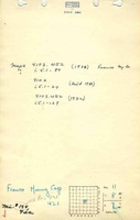
Company: 4103.W52 i5.1-84
Map Date: 5-15-1938
Coal Co.: Franco Mining Corporation
Mine Name: Franco No. 1 Mine
Full Res Download
Photographs