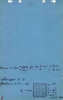
Mine Index Number: 0160
| Company Name:
|
Skaggs Coal Company
|
| Mine Name:
|
Skaggs Mine
|
| Start Date:
|
1905
|
End Date:
|
January 1931
|
| Type of Mine:
|
Underground
|
| Total acres shown:
|
427 280 in Herrin Coal, 147 in Springfield Coal
|
| Acres after map date:
|
95
|
General Area of mining acres shown:
|
|
|
|
Shaft, Slope, Drift or Tipple Location(s)
| Type
|
County
|
Township-Range
|
Section
|
Part Section
|
| Main shaft (7 x 14 ft)
|
Williamson
|
8S 2E
|
34
|
NW SE SE
|
| Air shaft
|
Williamson
|
8S 2E
|
34
|
SW NE SE
|
| Blind shaft
|
Williamson
|
8S 2E
|
34
|
NE SW SE
|
Geology
| Herrin (1905-1925)
|
62-80
|
7.5
|
9.5
|
8.5-9.0
|
MRP
|
| Springfield (1926-1931)
|
109-115
|
|
|
3.67-4.0
|
RP
|
Geological Problems Reported
The Herrin Coal dipped to the north and became 40 feet deeper than at the shaft. The roof was 2 to 20 feet of shale, which was often difficult to keep up. The eastern and northeastern parts of the mine had roof falls propagate to the surface, creating sinkholes. The Herrin Coal contained a few slips, and joints were filled with pyrite. The slips had little displacement, but hindered mining by altering the grades of the haulage routes. The floor clay was 18 to 24 inches thick and was plastic, but reports indicate the clay did not heave. It often contained concretions.
Production
| Company
|
Mine Name
|
Date
|
Production (tons)
|
| Sincerity Coal Company
|
Sincerity
|
1921-1927
|
783,649 Production after map date; however, some of this tonnage (after 1925) was produced from the Springfield Coal, which has a separate map.
|
|
|
|
|
|
|
|
| Total Production: 1,946,711
|
Production Notes
Coal Report production (if available)
Sources of Data
| Microfilm, document 353276
|
7-30-1922
|
1:2400
|
1:3972
|
Not final
|
| ISGS map library, 4103.W52 i5.1-189
|
8-11-1934
|
1:63360
|
1:63360
|
Secondary source
|
Annotated Bibliography (Data source - brief description of information)
| Coal Reports - Production, ownership, years of operation, seams, depth, thickness, mining method.
|
| Directory of Illinois Coal Mines (Williamson County) - Mine names, mine index, ownership, years of operation.
|
| Mine notes (Williamson County) - Mine type, shaft location, seams, depth, thickness, geologic problems.
|
| Microfilm map, document 353276, reel 03142, frame 220 - Shaft locations, mine outline (northern, Herrin Coal), mining method.
|
| ISGS map library, 4103.W52 i5.1-189, work map for Federal Land Bank Report map - Shaft location, mine outline (southern and Springfield Coal).
|
Mine Notes
Mine Images
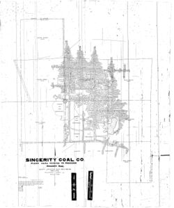
Microfilm: 353276
Map Date: 7-30-1922
Coal Co.: Sincerity Coal Company
Mine Name: Sincerity Mine
Full Res Download
 These files may not be true to scale and are not georgistered. These files may not be true to scale and are not georgistered.
|
Map Type:
|
ISGS map library
|
| Map ID:
|
4103.w52 i5.1-189
|
| Company:
|
|
| Mine Name:
|
|
| Caption:
|
Work map for Federal Land Bank Report map
|
| Map Date:
|
8/11/34
|
| Map Status:
|
Secondary
|
| Image Credit:
|
|
| Note:
|
|
| More Info:
|
Willsn co.jpg
|
| Full Res Download:These files are true to scale and most are georegistered for gis software. These files may be a very large (>1GB) download!
|
https://wikiimage.isgs.illinois.edu/ilmines/williamson/willsn co.zip
|
Photographs


