Mine Index Number: 0191
| Company Name:
|
Henrietta Coal Company
|
| Mine Name:
|
Home Trade Mine
|
| Start Date:
|
1898
|
End Date:
|
July 1931
|
| Type of Mine:
|
Underground
|
| Total acres shown:
|
229
|
| Acres after map date:
|
5
|
General Area of mining acres shown:
|
|
|
|
Shaft, Slope, Drift or Tipple Location(s)
| Type
|
County
|
Township-Range
|
Section
|
Part Section
|
| Main shaft
|
Madison
|
4N 8W
|
10
|
NW SE SE
|
| Air shaft
|
Madison
|
4N 8W
|
10
|
NW SE SE
|
Geology
| Herrin
|
135
|
4.5
|
6.5
|
5.0-5.3
|
MRP
|
Geological Problems Reported
The east portion of the mine had a light gray shale roof that was soft and massive, and tended to come down easily. There were also some infrequent slips, which didn’t affect the coal but required timbering.
Production
| Company
|
Mine Name
|
Date
|
Production (tons)
|
|
|
|
|
|
| Total Production: 1,041,453
|
Production Notes
Coal Report production (if available)
Sources of Data
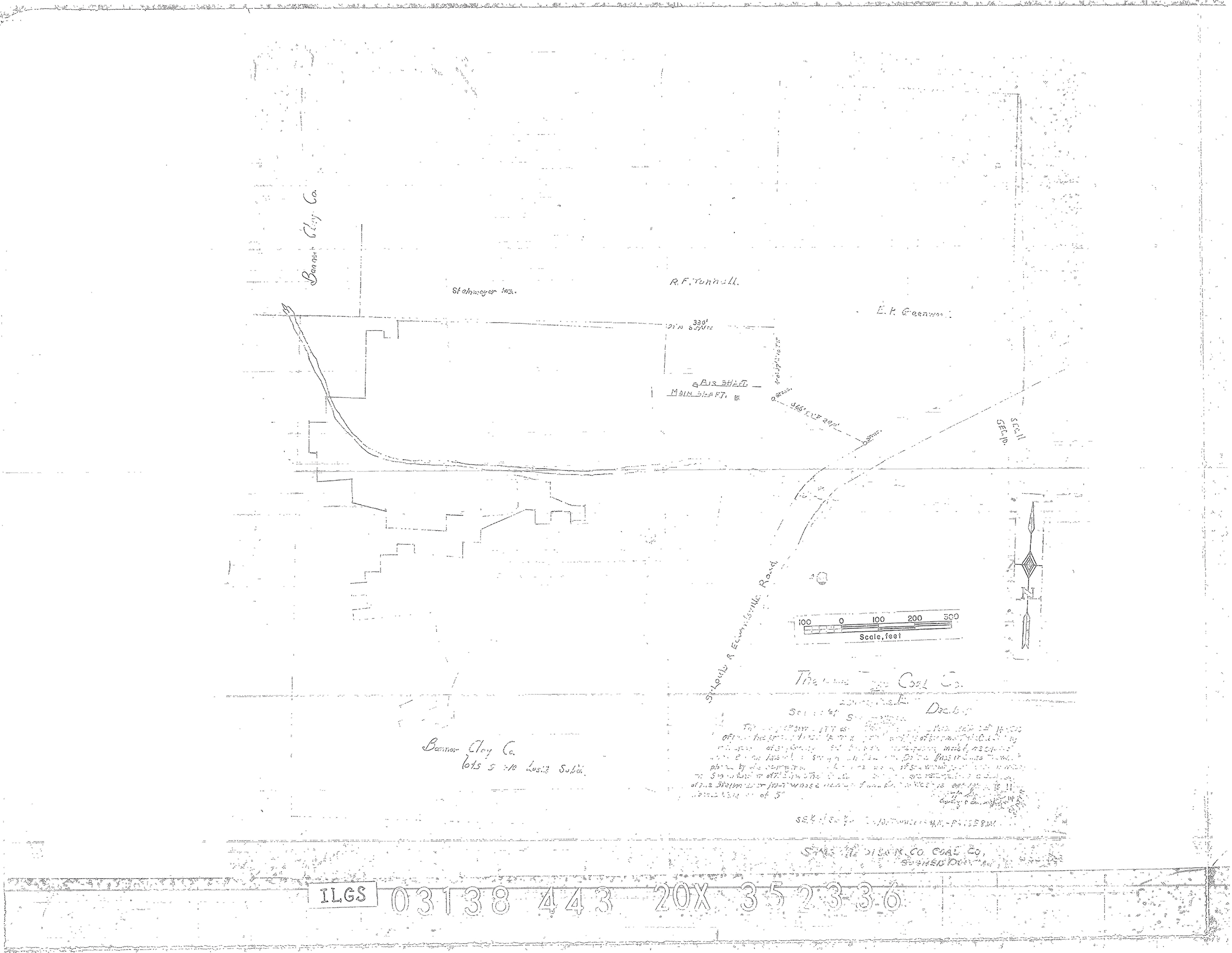
| Microfilm, document 352353
|
5-1930
|
1:2400
|
1:4303
|
Not final
|
| Microfilm, document 352336
|
12-1909
|
1:1200
|
1:1655
|
Not final
|
Annotated Bibliography (Data source - brief description of information)
| Coal Reports - Production, ownership, years of operation.
|
| Directory of Illinois Coal Mines (Madison County) - Mine names, mine index, ownership, years of operation.
|
| Mine notes (Madison County) - Mine type, shaft location, seam, depth, thickness, geologic problems.
|
| Microfilm map, document 352353, reel 03138, frames 466, 467 - Shaft location, mine outline, mining method.
|
| Microfilm map, document 352336, reel 03138, frame 443 - Air shaft location.
|
Mine Notes
Mine Images
![[[:Home Trade|Home Trade]]](https://wikiimage.isgs.illinois.edu/ilmines/madison/thumbnails/M0191mrg_th.jpg) These files may not be true to scale and are not georgistered. These files may not be true to scale and are not georgistered.
|
Map Type:
|
Microfilm
|
| Map ID:
|
352353 3138 466-467
|
| Company:
|
Madison County Coal Company
|
| Mine Name:
|
Home Trade
|
| Caption:
|
|
| Map Date:
|
May 1930
|
| Map Status:
|
Not Final
|
| Image Credit:
|
|
| Note:
|
2 yrs. from final
|
| More Info:
|
M0191mrg
|
| Full Res Download:These files are true to scale and most are georegistered for gis software. These files may be a very large (>1GB) download!
|
https://wikiimage.isgs.illinois.edu/ilmines/madison/M0191mrg.zip
|
 These files may not be true to scale and are not georgistered. These files may not be true to scale and are not georgistered.
|
Map Type:
|
Microfilm
|
| Map ID:
|
352336 3138 443
|
| Company:
|
Home Trade Coal Company
|
| Mine Name:
|
|
| Caption:
|
|
| Map Date:
|
December 1909
|
| Map Status:
|
Not Final
|
| Image Credit:
|
|
| Note:
|
22 years from a final date
|
| More Info:
|
M0191air
|
| Full Res Download:These files are true to scale and most are georegistered for gis software. These files may be a very large (>1GB) download!
|
https://wikiimage.isgs.illinois.edu/ilmines/madison/m0191air.zip
|
Photographs
Additional Notes