Mine Index Number: 0228
| Company Name:
|
Standard Mining and Converters Corporation
|
| Mine Name:
|
Standard No. 2 Mine
|
| Start Date:
|
1919
|
End Date:
|
April 1947
|
| Type of Mine:
|
Underground
|
| Total acres shown:
|
408
|
| Acres after map date:
|
|
General Area of mining acres shown:
|
|
|
|
Shaft, Slope, Drift or Tipple Location(s)
| Type
|
County
|
Township-Range
|
Section
|
Part Section
|
| Main shaft
|
Macoupin
|
10N 6W
|
4
|
SW SE SW
|
| Air shaft
|
Macoupin
|
10N 6W
|
4
|
SE SW SW
|
Geology
| Herrin
|
311-326
|
3.0
|
8.3
|
6.0-6.42
|
RPP
|
Geological Problems Reported
The shale roof fell badly, whether the roof consisted of black fissile shale or massive light gray shale referred to as “clod”. Small slips and limestone rolls were present in the roof throughout the mine. “The limestone here, contrary to its usual character, does not make a good roof but breaks easily and, in fact, most of the roof has fallen to the second limestone above. Where the lower limestone falls, the shale remains in place for awhile and then falls, making it an extremely precarious roof. Slips go clear to the second limestone, and timbering does no good.” Irregularities within the seam that were noted include shale bands up to 1 inch thick and thinner charcoal bands, as well as pyrite bands and lenses, and abundant calcite or gypsum fracture fillings that were present throughout the coal vertically and laterally.
Production
| Company
|
Mine Name
|
Date
|
Production (tons)
|
| Zeigler Coal and Coke Company
|
Standard BPurchased 2-28-1951 from Consolidated Coal Company, no production was reported by either company
|
1951-1951 Purchased 2-28-1951 from Consolidated Coal Company, no production was reported by either company
|
(none)
|
|
|
|
|
|
|
|
| Total Production: 2,301,689
|
Production Notes
Coal Report production (if available)
Sources of Data
| State archive, IL_1101
|
4-1-1943
|
1:2400
|
1:2400
|
Not final The map date would indicate that this is a not final map, however the outline was compared to a final map and found to be complete. This map source was used because of the poor quality of the final map.
|
Annotated Bibliography (Data source - brief description of information)
| Coal Reports - Production, ownership, years of operation.
|
| Directory of Illinois Coal Mines (Macoupin County) - Mine names, mine index, ownership, years of operation.
|
| Mine notes (Macoupin County) - Mine type, shaft location, seam, depth, thickness, geologic problems, ownership.
|
| State archive, IL_1101 - Shaft locations, mine outline, mining method.
|
| Microfilm map, document 352559, reel 03139, frames 315, 316 - Ownership.
|
Mine Notes
Mine Images
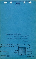
![[[:Standard No. 2|Standard No. 2]]](https://go.illinois.edu/ILMImages/macoupin/thumbnails/m0228_il_1101_01.jpg) These files may not be true to scale and are not georgistered. These files may not be true to scale and are not georgistered.
|
Map Type:
|
State Archive
|
| Map ID:
|
IL_1101_01
|
| Company:
|
Standard Mining and Converters Corporation
|
| Mine Name:
|
Standard No. 2
|
| Caption:
|
|
| Map Date:
|
04-01-1943
|
| Map Status:
|
Not Final
|
| Image Credit:
|
|
| Note:
|
The map date would indicate that this is a not final map, however the outline was compared to a final map and found to be complete. This map source was used because of the poor quality of the final map.
|
| More Info:
|
M0228 il 1101 01
|
| Full Res Download:These files are true to scale and most are georegistered for gis software. These files may be a very large (>1GB) download!
|
https://go.illinois.edu/ILMImages/macoupin/m0228 il 1101 01.zip
|
 These files may not be true to scale and are not georgistered. These files may not be true to scale and are not georgistered.
|
Map Type:
|
Microfilm
|
| Map ID:
|
352559
|
| Company:
|
Consolidated Coal Company
|
| Mine Name:
|
|
| Caption:
|
|
| Map Date:
|
02-28-1951
|
| Map Status:
|
Final
|
| Image Credit:
|
|
| Note:
|
No advancement under Consolidated Coal Co. ownership
Purchased by Zeigler Coal & Coke - Feb-28-1951
No advancement under Zeigler Coal & Coke ownership
Purchased by Southwest Steel Corp. - Memphis, Tenn - Dec-17-1951
This map shows workings at time of purchase by Southwest Steel Corp.
|
| More Info:
|
M0228
|
| Full Res Download:These files are true to scale and most are georegistered for gis software. These files may be a very large (>1GB) download!
|
https://go.illinois.edu/ILMImages/macoupin/m0228.zip
|
Photographs