Mine Index Number: 0245
| Company Name:
|
Wenneborg Coal Company
|
| Mine Name:
|
Wenneborg No. 3 Mine
|
| Start Date:
|
1888
|
End Date:
|
1948
|
| Type of Mine:
|
Underground
|
| Total acres shown:
|
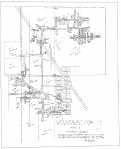
66 The area shown on the accompanying map is too small for the reported production. A general area of mining has been added to show the approximate size of the mine. (The source maps show only the major haulage routes of the older parts of the mine.)
|
| Acres after map date:
|
|
General Area of mining acres shown:
|
|
|
|
Shaft, Slope, Drift or Tipple Location(s)
| Type
|
County
|
Township-Range
|
Section
|
Part Section
|
| Main shaft * (7x12) The main shaft caved in circa 1894-1896, and coal was hoisted out of the escapement shaft until 1905. The mine was shut down because of the lack of an escapement shaft in 1906 and 1907. The northern shaft on the accompanying map was labeled on the source map as the hoist shaft and the southern shaft was the escape shaft. There may be another shaft location not shown on the source map that was the original hoist shaft that collapsed.
|
Christian
|
14N 3W
|
14
|
SE SE NW
|
| Air / escape shaft The main shaft caved in circa 1894-1896, and coal was hoisted out of the escapement shaft until 1905. The mine was shut down because of the lack of an escapement shaft in 1906 and 1907. The northern shaft on the accompanying map was labeled on the source map as the hoist shaft and the southern shaft was the escape shaft. There may be another shaft location not shown on the source map that was the original hoist shaft that collapsed.
|
Christian
|
14N 3W
|
14
|
NE SE NW
|
Geology
| Herrin
|
333
|
6.0
|
7.0
|
6.5
|
RPP
|
Geological Problems Reported
Production
| Company
|
Mine Name
|
Date
|
Production (tons)
|
|
|
|
|
|
| Total Production: 628,654
|
Production Notes
Coal Report production (if available)
Sources of Data
| Company, 4103.C4 i5.1-11
|
8-12-1949
|
1:2400
|
1:2400
|
Final
|
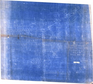
| Company, IL_445
|
10-8-1908
|
1:960
|
1:960
|
Not final
|
Annotated Bibliography (Data source - brief description of information)
| Coal Reports - Production, ownership, years of operation.
|
| Directory of Illinois Coal Mines (Christian County) - Mine names, mine index, ownership, years of operation.
|
| ENR Document 85/01 - Mining method.
|
| Mine notes (Christian County) - Mine type, shaft location, seam, depth, thickness, shaft size, abandonment date.
|
| Company map, ISGS map library, 4103.C4 i5.1-11 - Shaft locations, mine outline, mining method.
|
| Company map, State Archive, IL_445 - Mine outline (eastern).
|
Mine Notes
Mine Images
Company: IL_445
Map Date: 10-8-1908
Coal Co.: Wenneborg Coal Company
Mine Name: Wenneborg No. 3 Mine
Image Credit: Illinois Department of Natural Resources - Office of Mines and Minerals
Full Res Download
Company: 4103.C4 i5.1-11
Map Date: 8-12-1949
Coal Co.: Wenneborg Coal Company
Mine Name: Wenneborg No. 3 Mine
Image Credit: Illinois State Geological Survey
Full Res Download
Photographs

