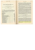
Category:Christian-County
(Redirected from Christian-County)
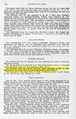
County Coal Data
Mines that Appear in Christian-County
- 9998 & 9999 = Unknown dates
Unlocated Mines in Christian-County
Mine that have known coal production but no known location
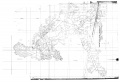
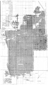
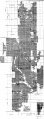
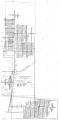
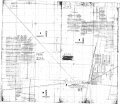
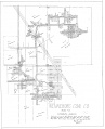
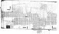
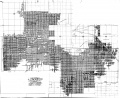
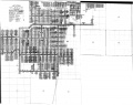
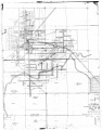
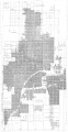
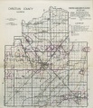
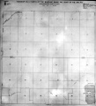
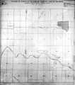
Historical Mined Out Area Maps
WPA
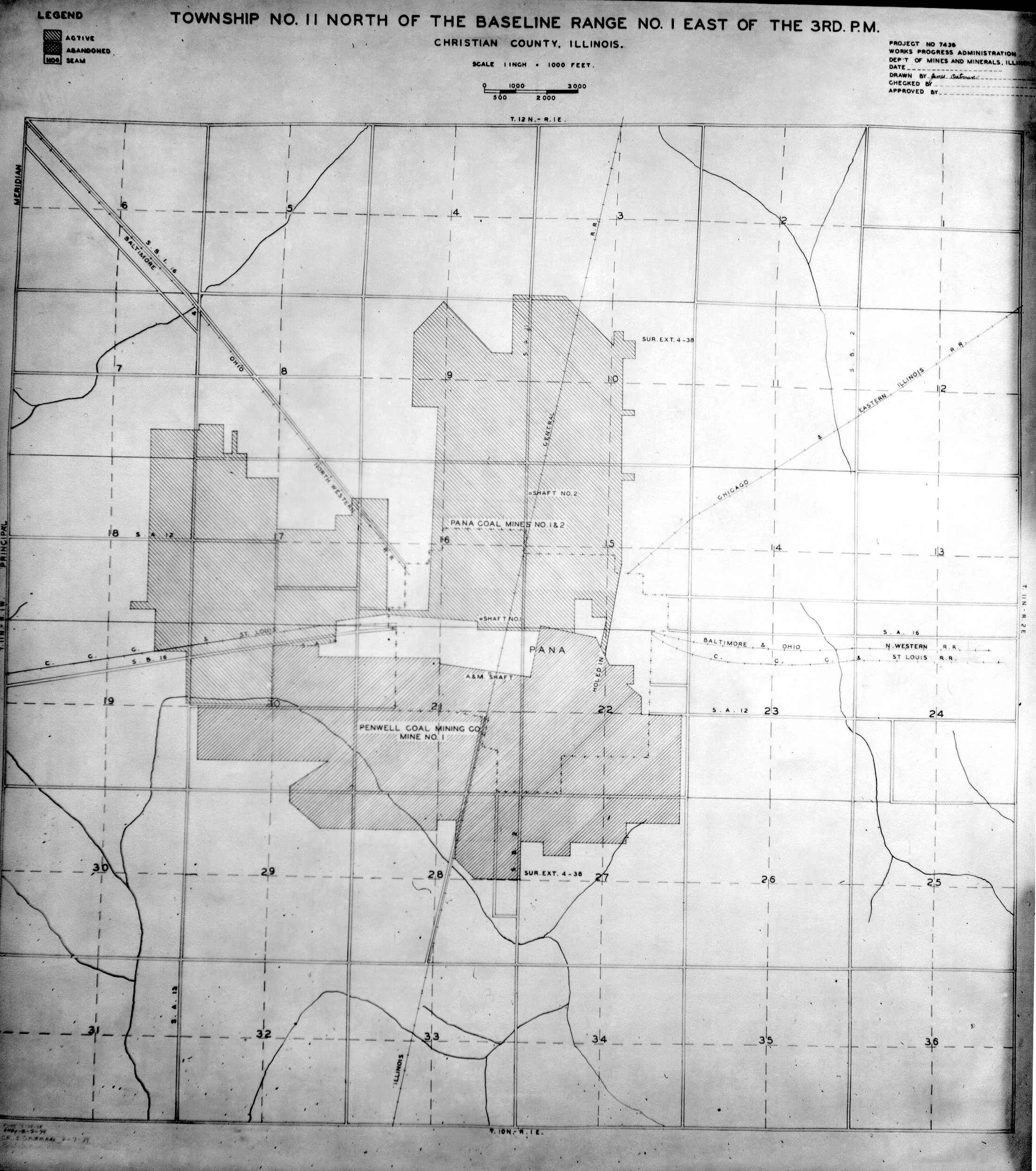
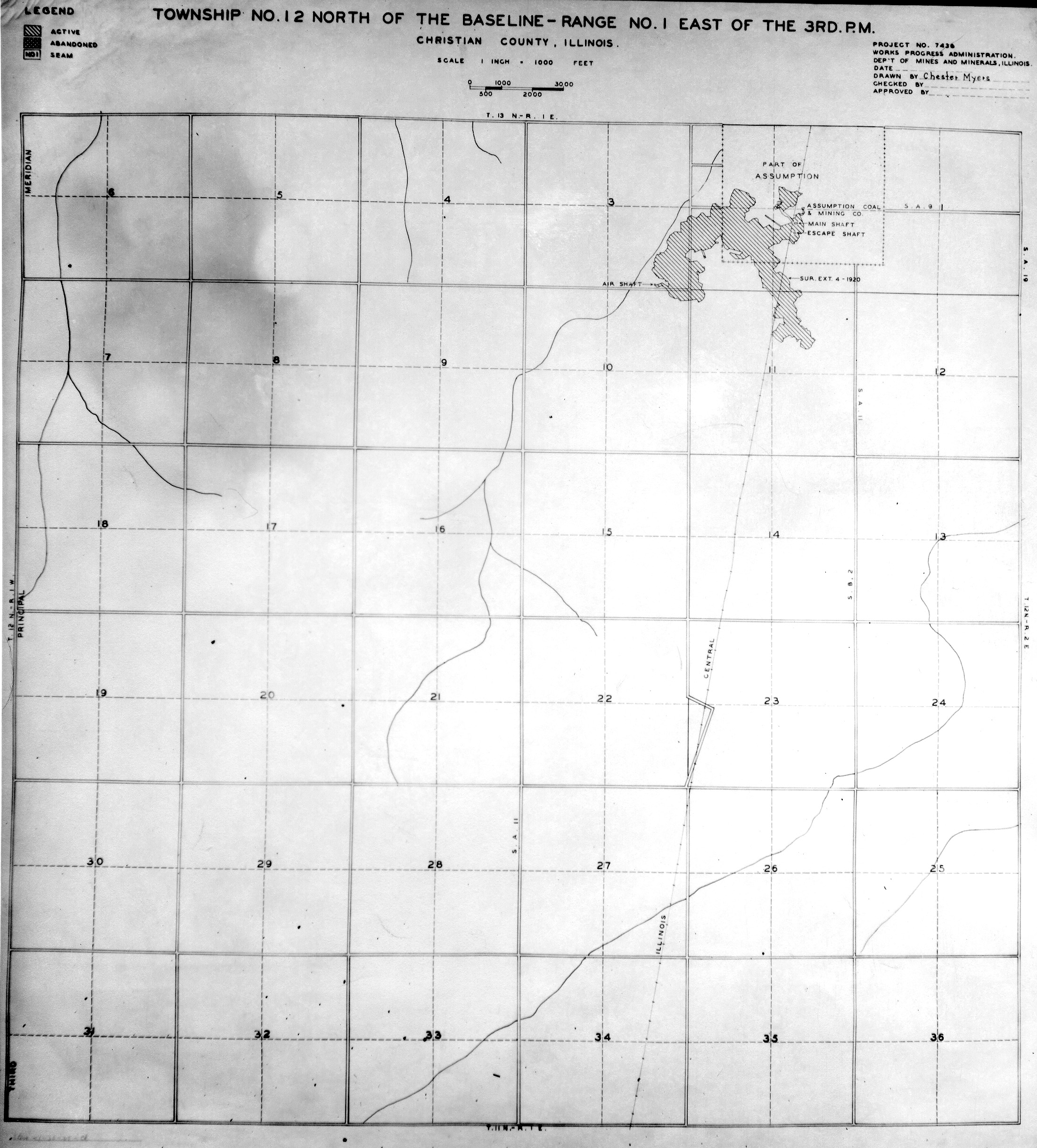
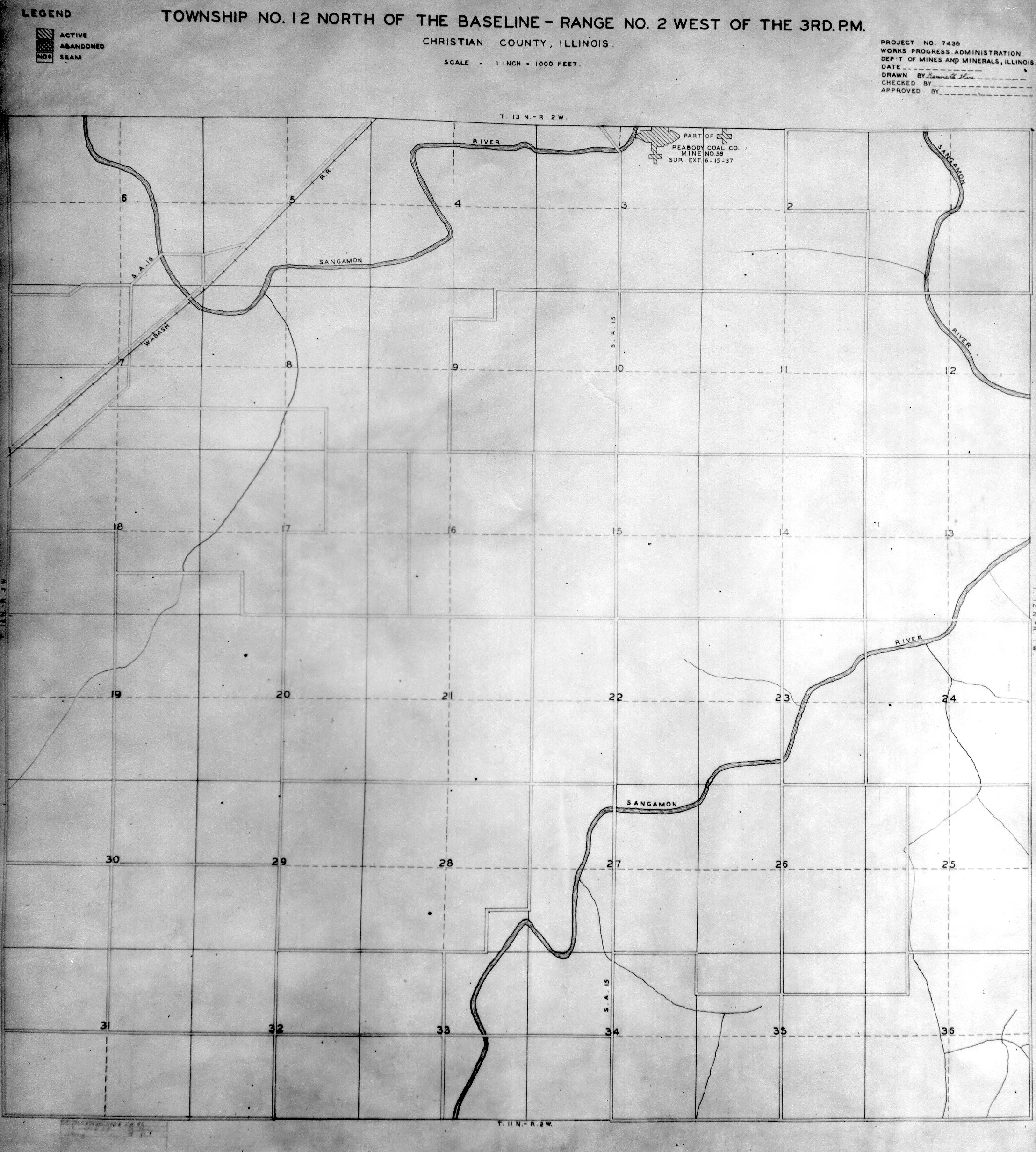
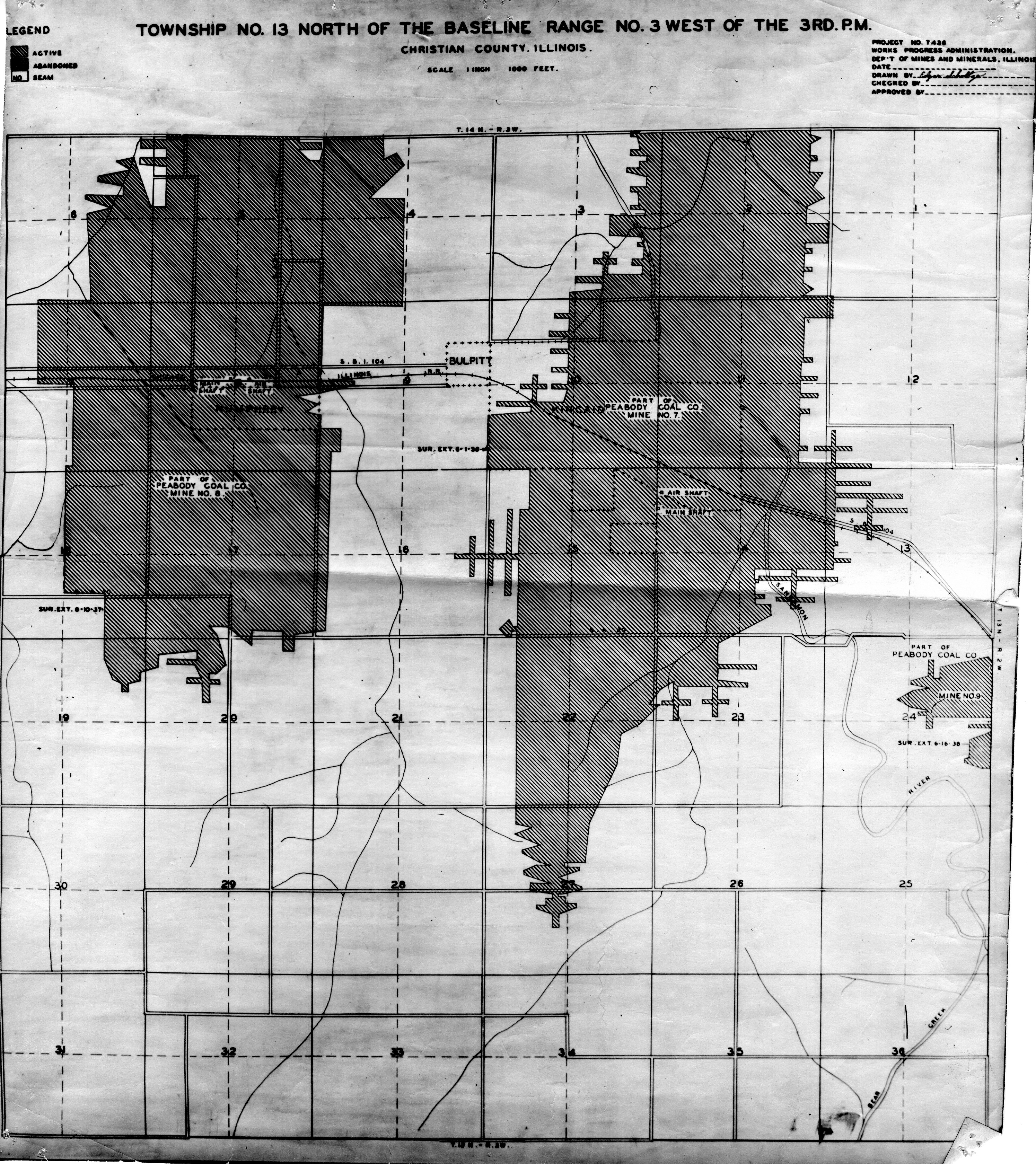
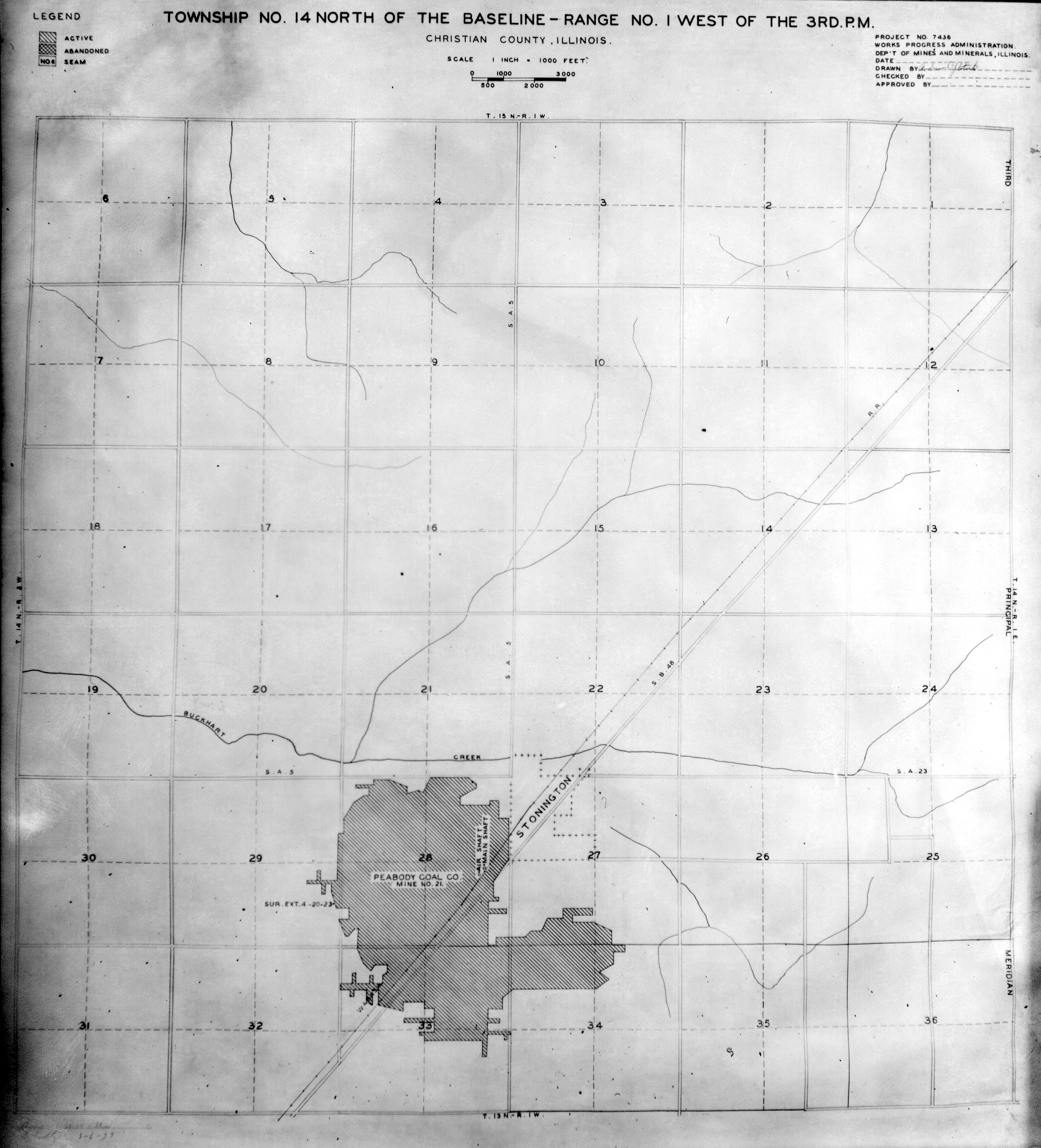
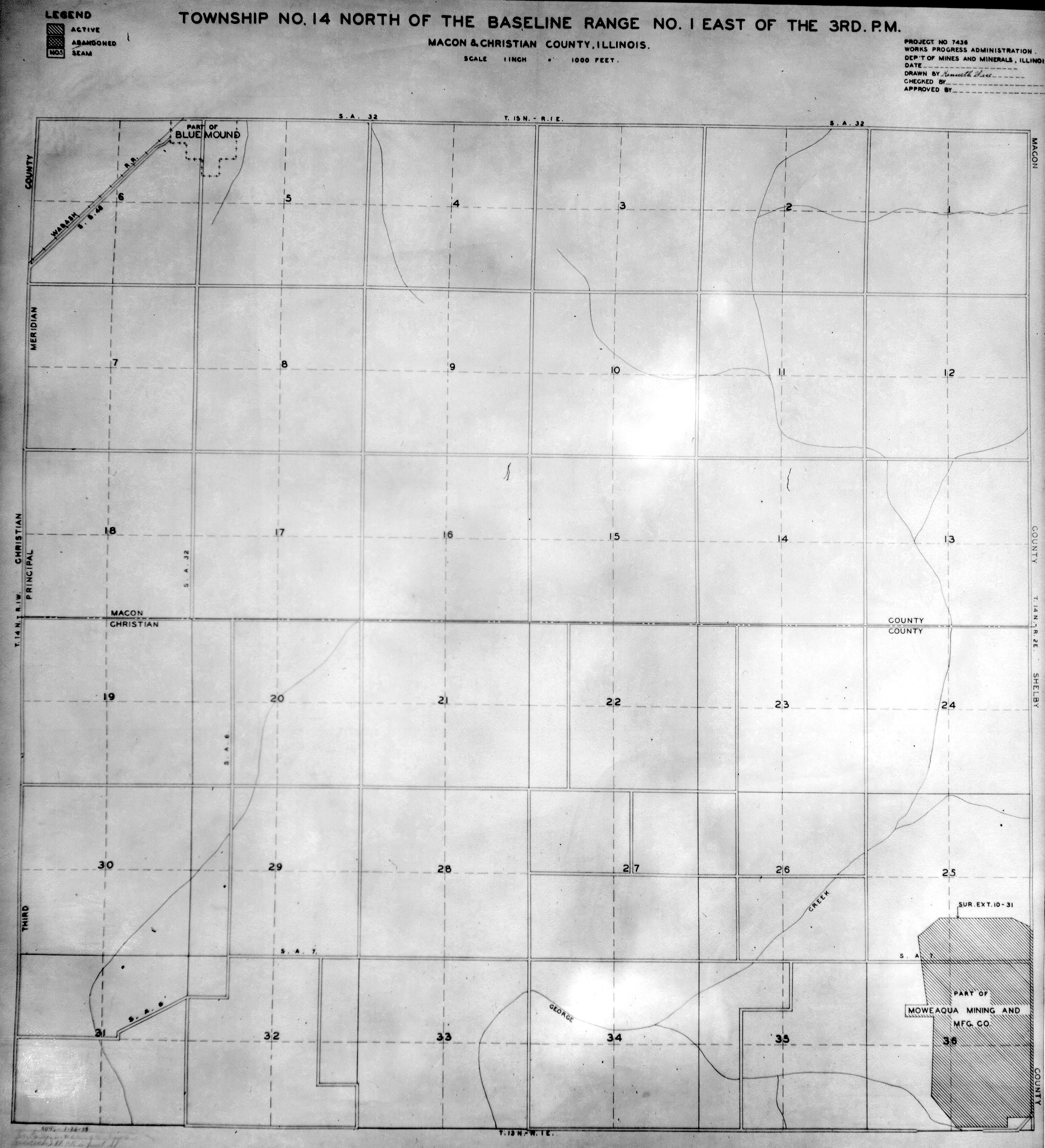
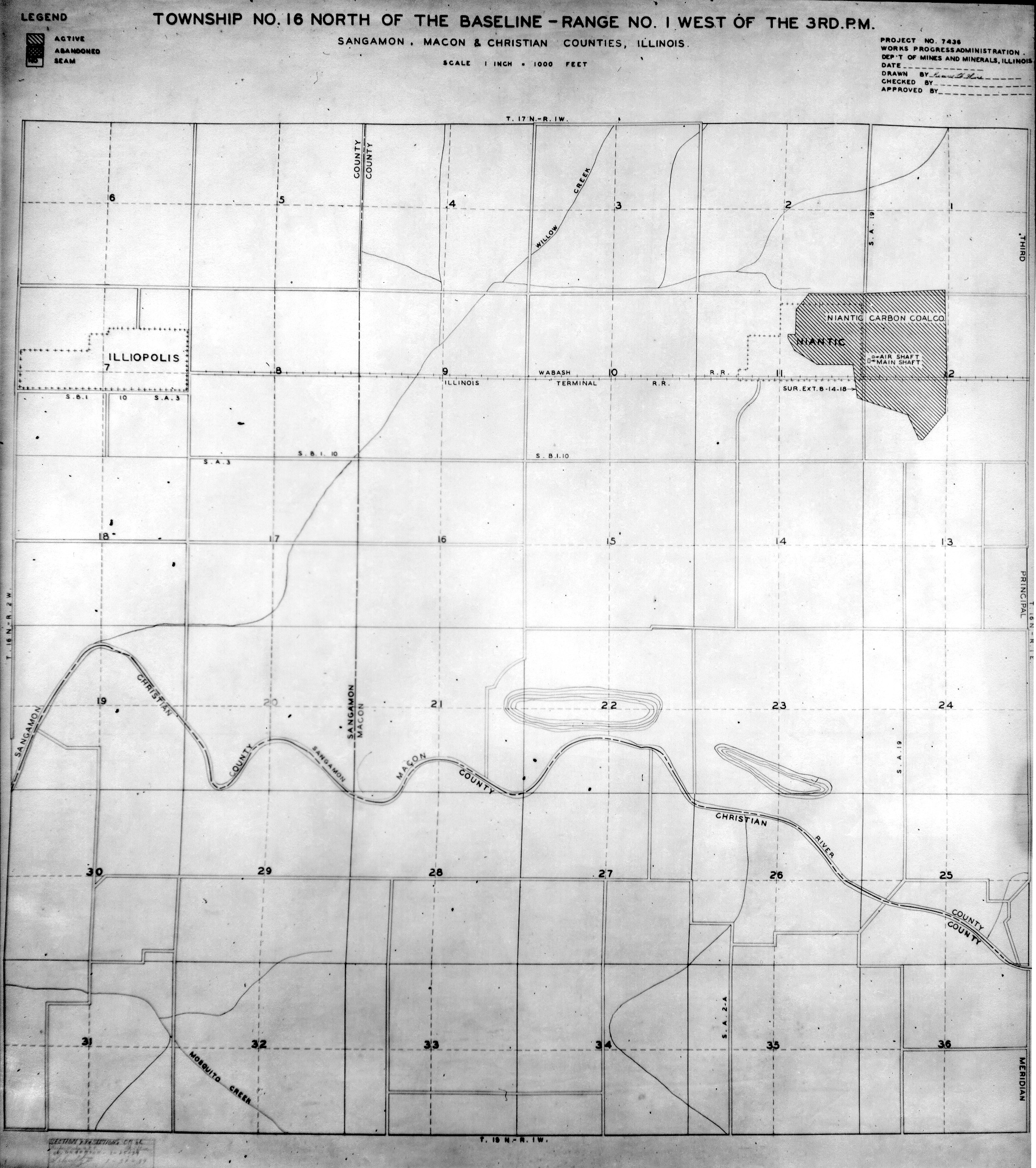
These maps were constructed as part of the nationwide Works Projects Administration (WPA), generally between 1934 and 1937 with some later updates or revisions,
Disclaimer
Maps for some locations might have multiple versions/seams, please inspected these areas closely for differences.
Notes and corrections were made by ISGS staff.
These maps are reproductions from microfilm, they may be of poor quality with text difficult to read.


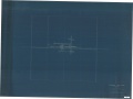
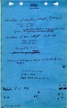
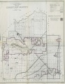
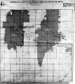
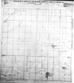
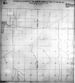
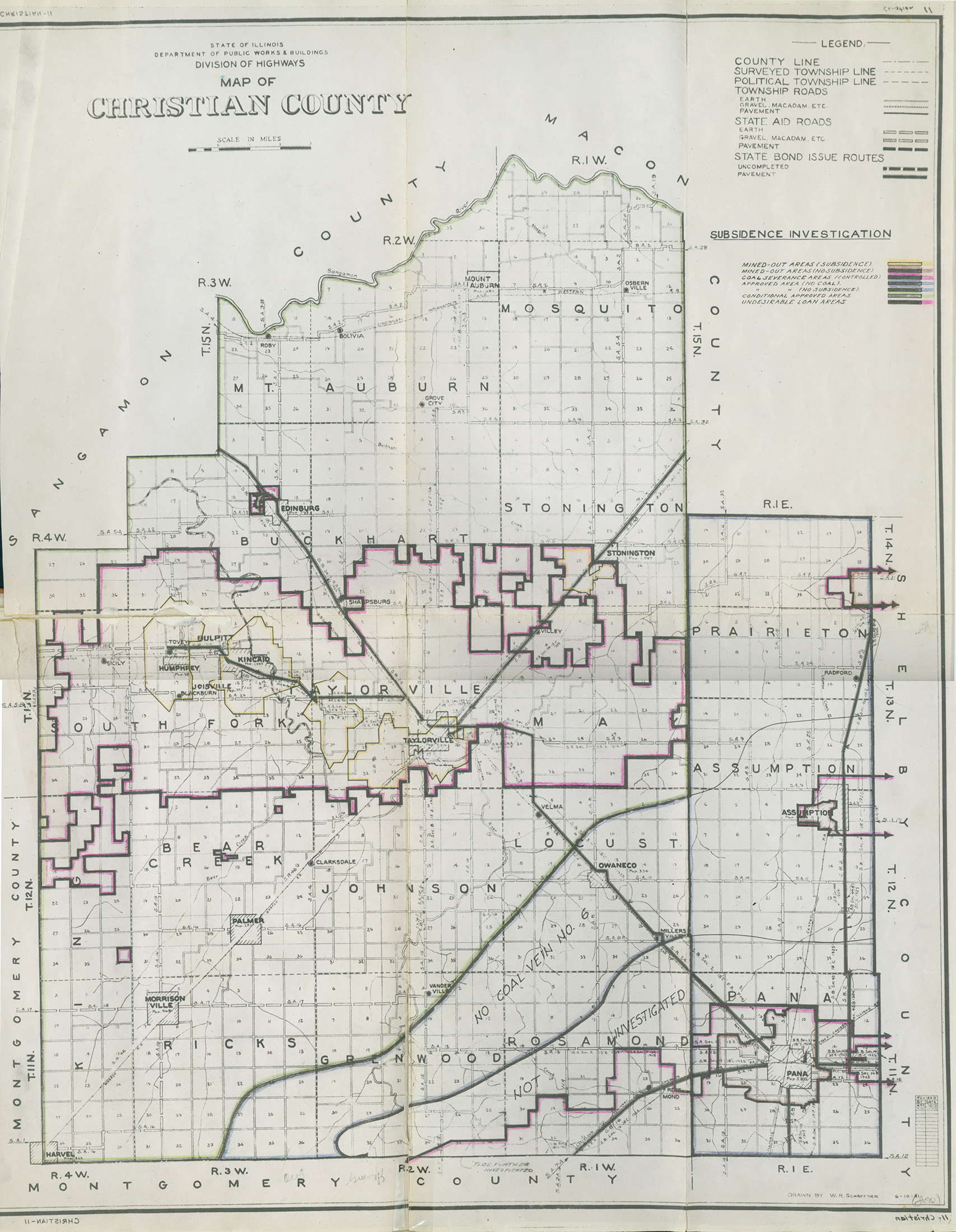
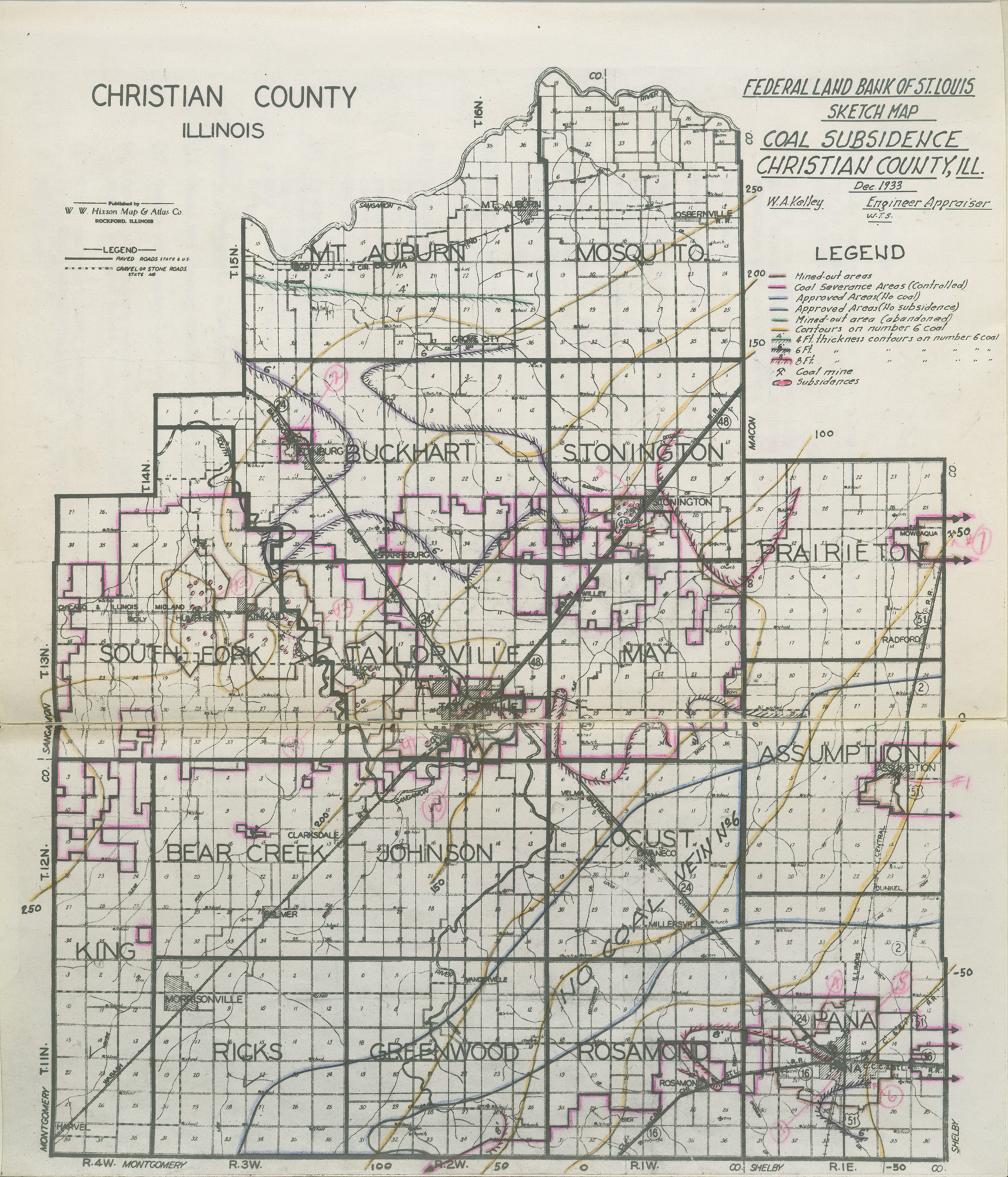
Federal Land Bank of St. Louis, Preliminary Reports on Subsidence Investigations
Federal Land Bank of St. Louis, Preliminary Reports on Subsidence Investigations (refered by Coal Section Staff as "Quade Maps")
Mining engineers working for the Federal Land Bank of St. Louis mapped areas of subsidence due to coal mining in the early 1930s. These reports often include county maps of mine properties with mined-out areas including shaft locations, as well as subsidence areas.
Disclaimer
Maps for some locations might have multiple versions/seams, please inspected these areas closely for differences.
These maps are accompanied by a report, please download and inspect this document.
Notes and corrections were made by ISGS staff.


Photographs
Pages in category "Christian-County"
The following 17 pages are in this category, out of 17 total.
Media in category "Christian-County"
The following 97 files are in this category, out of 97 total.
 M0021 coalreport1888 p417.pdf 714 × 1,200; 465 KB
 M0021 coalreport1889 p54.pdf 731 × 1,181; 419 KB
 M0021 coalreport1912 p271.pdf 787 × 1,241; 390 KB
 M0021 coalreport1928 p138.pdf 656 × 979, 2 pages; 92 KB
 M0021 fieldnotes.pdf 752 × 1,195; 342 KB
 M0021 IL 634.jpg 2,403 × 3,390; 1.72 MB
 M0021 minenotes.pdf 745 × 1,189, 26 pages; 5.49 MB
 M0021.jpg 3,390 × 2,333; 1.47 MB
 M0217 coalreport1932 disaster.pdf 1,672 × 1,229, 6 pages; 14.92 MB
 M0217 minenotes.pdf 727 × 1,160, 17 pages; 3.15 MB
 M0219 fieldnotes.pdf 754 × 1,197; 351 KB
 M0219 minenotes.pdf 745 × 1,189, 21 pages; 5 MB
 M0219.jpg 1,920 × 3,390; 2.67 MB
 M0220 coalreport1914 p171.pdf 806 × 1,254; 434 KB
 M0220 IL595.jpg 3,390 × 2,542; 1.94 MB
 M0220 minenotes.pdf 745 × 1,189, 14 pages; 3.53 MB
 M0220.jpg 1,252 × 3,390; 1.8 MB
 M0221 coalreport1890 p356.pdf 737 × 1,204; 526 KB
 M0221 coalreport1891 p132.pdf 793 × 1,275; 1.44 MB
 M0221 coalreport1891 p133.pdf 793 × 1,275; 1.4 MB
 M0221 coalreport1893 p64.pdf 1,666 × 1,227; 394 KB
 M0221 coalreport1903 p233.pdf 741 × 1,152; 344 KB
 M0221 coalreport1905 p268.pdf 633 × 977; 100 KB
 M0221 coalreport1906 p290.pdf 752 × 1,181; 371 KB
 M0221 minenotes.pdf 700 × 1,172, 13 pages; 3.7 MB
 M0221.jpg 1,696 × 3,390; 1.04 MB
 M0222 coalreport1889 p54.pdf 733 × 1,181; 414 KB
 M0222 coalreport1891 p131.pdf 793 × 1,275; 1.36 MB
 M0222 coalreport1903 p233.pdf 739 × 1,177; 352 KB
 M0222 coalreport1906 p290.pdf 752 × 1,181; 366 KB
 M0222 IL503 v2.jpg 3,390 × 2,250; 1.02 MB
 M0222 IL504.jpg 2,093 × 3,390; 2.29 MB
 M0222 IL516.jpg 2,584 × 3,390; 2.17 MB
 M0222 minenotes.pdf 760 × 1,189, 13 pages; 3.77 MB
 M0222.jpg 3,390 × 2,925; 2.73 MB
 M0245 coalreport1889 p54.pdf 714 × 1,150; 402 KB
 M0245 coalreport1892 p574.pdf 700 × 1,168; 455 KB
 M0245 coalreport1898 p180.pdf 712 × 1,170; 362 KB
 M0245 coalreport1906 p290.pdf 752 × 1,181; 366 KB
 M0245 IL445.jpg 3,390 × 3,055; 4.52 MB
 M0245 minenotes.pdf 750 × 1,187, 13 pages; 3.71 MB
 M0245.jpg 2,754 × 3,390; 1.11 MB
 M0371 coalreport1888 p416.pdf 1,587 × 1,300; 1,000 KB
 M0371 coalreport1889 p54.pdf 733 × 1,181; 415 KB
 M0371 coalreport1891 p132.pdf 793 × 1,275; 1.44 MB
 M0371 coalreport1903 p232.pdf 720 × 1,172; 341 KB
 M0371 coalreport1908 p301.pdf 629 × 970; 110 KB
 M0371 minenotes.pdf 760 × 1,189, 7 pages; 2.01 MB
 M0371.jpg 3,390 × 1,979; 2.53 MB
 M0661 coalreport1900 p139.pdf 1,556 × 1,191; 349 KB
 M0661 coalreport1901 p192.pdf 1,333 × 1,158; 336 KB
 M0661 coalreport1902 p183.pdf 804 × 1,250; 1.38 MB
 M0661 minenotes.pdf 745 × 1,189, 14 pages; 3.21 MB
 M0661.jpg 3,390 × 2,778; 3.37 MB
 M0679 minenotes.pdf 745 × 1,189, 29 pages; 6.6 MB
 M0679.jpg 3,390 × 2,671; 2.32 MB
 M0693 minenotes.pdf 745 × 1,189, 291 pages; 31.22 MB
 M0729 coalreport1885 p126.pdf 602 × 975, 2 pages; 150 KB
 M0729 coalreport1887 p100.pdf 1,291 × 1,650; 1.08 MB
 M0729 coalreport1888 p414.pdf 1,589 × 1,297; 1,002 KB
 M0729 coalreport1893 p63.pdf 779 × 1,208; 203 KB
 M0729 coalreport1903 p232.pdf 727 × 1,179; 342 KB
 M0729 coalreport1908 p301.pdf 629 × 970; 110 KB
 M0729 minenotes.pdf 760 × 1,189, 14 pages; 3.73 MB
 M0730 coalreport1904 p261.pdf 1,631 × 1,220; 369 KB
 M0730 coalreport1905 p267.pdf 633 × 977; 100 KB
 M0730 coalreport1908 p303.pdf 629 × 970; 87 KB
 M0730 coalreport1918 p171.pdf 883 × 1,295; 1.64 MB
 M0730 minenotes.pdf 750 × 1,187, 5 pages; 1.53 MB
 M0730.jpg 3,390 × 3,278; 2.37 MB
 M0731 coalreport1888 p416.pdf 725 × 1,193; 416 KB
 M0731 coalreport1889 p54.pdf 733 × 1,181; 415 KB
 M0731 coalreport1892 p574.pdf 712 × 1,166; 357 KB
 M0731 coalreport1893 p64.pdf 1,666 × 1,227; 392 KB
 M0731 coalreport1895 p85.pdf 750 × 1,185; 1.53 MB
 M0731 coalreport1896 p127.pdf 768 × 1,135; 318 KB
 M0731 coalreport1897 p96.pdf 839 × 1,185, 2 pages; 1.96 MB
 M0731 coalreport1903 p233.pdf 739 × 1,177; 352 KB
 M0731 IL461.jpg 2,113 × 3,390; 2.5 MB
 M0731 minenotes.pdf 745 × 1,189, 9 pages; 1.98 MB
 M0731.jpg 2,646 × 3,390; 2.14 MB
 M2040 minenotes.pdf 745 × 1,189, 6 pages; 1.58 MB
 M2040.jpg 1,749 × 3,390; 2.13 MB
 M4779 minenotes.pdf 745 × 1,189; 176 KB
 M4779.jpg 1,942 × 1,272; 692 KB
 QUADE CHRISTIAN MINE MAP.jpg 1,707 × 2,200; 1.02 MB
 QUADE CHRISTIAN SKETCH MAP.jpg 1,713 × 2,000; 1.13 MB
 WPA CHRISTIAN 11N1E.jpg 2,215 × 2,504; 1.73 MB
 WPA CHRISTIAN 12N1E.jpg 2,200 × 2,436; 1.27 MB
 WPA CHRISTIAN 12N2W.jpg 2,216 × 2,464; 1.57 MB
 WPA CHRISTIAN 13N2W.jpg 2,280 × 2,560; 1.84 MB
 WPA CHRISTIAN 13N3W.jpg 2,990 × 3,360; 4.11 MB
 WPA CHRISTIAN 14N1W.jpg 2,228 × 2,456; 1.46 MB
 WPA MACON CHRISTIAN 14N1E.jpg 2,224 × 2,444; 1.55 MB
 WPA MACON SANGAMON CHRISTIAN 16N1W.jpg 2,256 × 2,544; 1.59 MB
 WPA MENARD SANGAMON 17N7W.jpg 1,828 × 2,048; 999 KB
 WPA SANGAMON CHRISTIAN 13N4W.jpg 2,265 × 2,513; 1.53 MB


