Mine Index Number: 0661
| Company Name:
|
Peabody Coal Company
|
| Mine Name:
|
Peabody No. 58 Mine
|
| Start Date:
|
1901
|
End Date:
|
1952
|
| Type of Mine:
|
Underground
|
| Total acres shown:
|
4,817
|
| Acres after map date:
|
|
General Area of mining acres shown:
|
|
|
|
Shaft, Slope, Drift or Tipple Location(s)
| Type
|
County
|
Township-Range
|
Section
|
Part Section
|
| Main shaft
|
Christian
|
13N 2W
|
33
|
SW NW NE
|
| Escape shaft
|
Christian
|
13N 2W
|
33
|
SW NW NE
|
Geology
| Herrin
|
480
|
6.5
|
9.0
|
7.7
|
BRP
|
Geological Problems Reported
The roof was a very good black shale and required no top coal to hold it up. The coal from this mine was of a superior quality, even compared to the Peabody No. 9 Mine (mine index 219) nearby. The visible impurities were in the form of pyrite bands in the middle band of the seam and were few and easily removed, which was not the case with the visible impurities of the coal from the Peabody No. 9 Mine coal.
Production
| Company
|
Mine Name
|
Date
|
Production (tons)
|
| Springfield District Coal Company
|
Springfield District No. 8Although the Coal Report indicates that Springfield No. 6 Mine (mine index 731) had a name change to Springfield District No. 8, the reserves were combined with the recently closed Taylorville Mine, and the coal was hoisted from this shaft. The production from the No. 8 Mine is assigned to this index number by the ISGS convention of shafts retaining the same index number.
|
1916-1918
|
734,957
|
|
|
|
|
|
|
|
| Total Production: 30,897,578
|
Production Notes
Coal Report production (if available)
Sources of Data
| Company
|
3-28-1952
|
1:24000
|
1:24000
|
Final
|
Annotated Bibliography (Data source - brief description of information)
| Coal Reports - Production, ownership, years of operation.
|
| Directory of Illinois Coal Mines (Christian County) - Mine names, mine index, ownership, years of operation.
|
| ENR Document 85/01 - Mining method.
|
| Mine notes (Christian County) - Mine type, shaft location, seam, depth, thickness, geologic problems.
|
| Company map, ISGS map library, 4103.C4 i5.1-12 - Shaft locations, mine outline, mining method.
|
Mine Notes
Mine Images
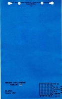
Company: 4103.C4 i5.1-12
Map Date: 3-28-1952
Coal Co.: Peabody Coal Company
Mine Name: Peabody No. 58 Mine
Full Res Download
Photographs
Additional Notes