Mine Index Number: 2040
| Company Name:
|
Peabody Coal Company
|
| Mine Name:
|
Peabody No. 7 Mine
|
| Start Date:
|
1912
|
End Date:
|
1952
|
| Type of Mine:
|
Underground
|
| Total acres shown:
|
7,127
|
| Acres after map date:
|
|
General Area of mining acres shown:
|
|
|
|
Shaft, Slope, Drift or Tipple Location(s)
| Type
|
County
|
Township-Range
|
Section
|
Part Section
|
| Main shaft
|
Christian
|
13N 3W
|
14
|
SW NW NW
|
| Air shaft
|
Christian
|
13N 3W
|
14
|
SW NW NW
|
| Air shaft
|
Christian
|
13N 3W
|
27
|
SE SE SW
|
Geology
| Herrin
|
349-365
|
|
|
6.5-7.5
|
RPP
|
Geological Problems Reported
The source map shows a probable sandstone channel that limited mine expansion in the southeastern part of the mine. Only three pairs of entries were driven across the channel to access the coal on the other side, implying that almost no coal was minable there. The coal was either eroded or never deposited. Another channel was between the Peabody No. 7 and Peabody No. 9 Mines (mine index 219). The source map showed unmined areas in 36-T14N-R3W (SE NW, S ½ NE and SE SW), some marked by the same symbol used to denote channels elsewhere on the same map.
Production
| Company
|
Mine Name
|
Date
|
Production (tons)
|
|
|
|
|
|
| Total Production: 44,961,379
|
Production Notes
Coal Report production (if available)
Sources of Data
| Microfilm, document 351393
|
5-29-1952
|
1:4800
|
1:9600
|
Final
|
Annotated Bibliography (Data source - brief description of information)
| Coal Reports - Production, ownership, years of operation, depth, thickness.
|
| Directory of Illinois Coal Mines (Christian County) - Mine names, mine index, ownership, years of operation.
|
| Mine notes (Christian County) - Mine type, shaft location, seam.
|
| Microfilm map, document 351393, reel 03135, frames 470-475 - Shaft locations, mine outline, mining method.
|
Mine Notes
Mine Images
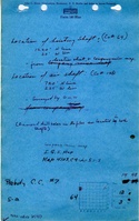
Microfilm: 351393
Map Date: 5-29-1952
Coal Co.: Peabody Coal Company
Mine Name: Peabody No. 7 Mine
Image Credit: Illinois State Geological Survey
Full Res Download
Photographs
Additional Notes