Kincaid Quadrangle
Mining in the Kincaid Quadrangle
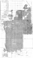
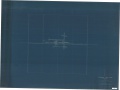
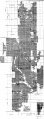
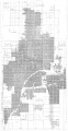
Mining in this quadrangle took place in the Herrin Coal. Since the seam ranged from 300 to over 400 feet deep, development here began a little later than at nearby towns. The earliest mine was Peabody No. 7 Mine (mine index 2040), which opened in 1912. Mining was continuous until Peabody No. 10 Mine (mine index 693) closed in 1994. The accompanying map shows what may have been the largest obstacle to mining for the planning engineers – the sandstone channels that eroded the coal and made nearby roof conditions troublesome.
Map and Directory PDF Download
Coal Mines In Illinois Kincaid Quadrangle
Mines that Appear on the Kincaid Quadrangle
Unlocated Mines
Christian County
Pages in category "Kincaid Quadrangle"
The following 5 pages are in this category, out of 5 total.
Media in category "Kincaid Quadrangle"
The following 10 files are in this category, out of 10 total.
 M0219 fieldnotes.pdf 754 × 1,197; 351 KB
 M0219 minenotes.pdf 745 × 1,189, 21 pages; 5 MB
 M0219.jpg 1,920 × 3,390; 2.67 MB
 M0220 coalreport1914 p171.pdf 806 × 1,254; 434 KB
 M0220 IL595.jpg 3,390 × 2,542; 1.94 MB
 M0220 minenotes.pdf 745 × 1,189, 14 pages; 3.53 MB
 M0220.jpg 1,252 × 3,390; 1.8 MB
 M0693 minenotes.pdf 745 × 1,189, 291 pages; 31.22 MB
 M2040 minenotes.pdf 745 × 1,189, 6 pages; 1.58 MB
 M2040.jpg 1,749 × 3,390; 2.13 MB


