Mine Index Number: 0220
| Company Name:
|
Peabody Coal Company
|
| Mine Name:
|
Peabody No. 8 Mine
|
| Start Date:
|
1914
|
End Date:
|
1954
|
| Type of Mine:
|
Underground
|
| Total acres shown:
|
8,571
|
| Acres after map date:
|
|
General Area of mining acres shown:
|
|
|
|
Shaft, Slope, Drift or Tipple Location(s)
| Type
|
County
|
Township-Range
|
Section
|
Part Section
|
| Main shaft
|
Christian
|
13N 3W
|
8
|
SE SE NW
|
| Air shaft
|
Christian
|
13N 3W
|
8
|
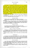
SW SW NE Another air shaft may be present in NE 29-T14N-R3W on the Edinburg Quadrangle, but it is not clearly labeled and there are three small squares that could be shaft symbols. The ventilation arrows indicate the likelihood of an air shaft.
|
Geology
| Herrin
|
370
|
7.0
|
8.0
|
7.5
|
RPP
|
Geological Problems Reported
The source map shows a mining pattern indicating a fault that interfered with mining in NW SENE 17-T13N-R3W. This normal fault extended southeast into Peabody No. 10 Mine (mine index 693), where the coal was downthrown 7 to 15 feet to the northeast. The immediate roof over the coal was a black shale that varied from 0 to 5 feet thick. Above the shale was a limestone that also ranged from 0 to 5 feet thick. Timbering was required where the roof was shale over 30 inches thick. When the shale was less than 30 inches, it was taken down when the coal was removed. The limestone made a very good roof. Slips and sandstone rolls were observed in the mine. Rolls were more common in the western part of the mine, and had the effect of lowering the top of the coal 3 to 4 feet. Impurities in the coal were pyrite in lenses and bands, and calcite in fracture fillings. The soft underclay floor heaved, and several bad squeezes had occurred at the mine.
Production
| Company
|
Mine Name
|
Date
|
Production (tons)
|
Production Notes
Coal Report production (if available)
Sources of Data
| Company, 4103.C4 i5.1-10
|
7-29-1954
|
1:12000
|
1:12000
|
Final
|
| Company, IL_595
|
6-15-1914
|
1:2400
|
1:2400
|
Not final
|
Annotated Bibliography (Data source - brief description of information)
| Coal Reports - Production, ownership, years of operation, depth.
|
| Directory of Illinois Coal Mines (Christian County) - Mine names, mine index, ownership, years of operation.
|
| Mine notes (Christian County) - Mine type, shaft location, seam, thickness, geologic problems.
|
| Company map, ISGS map library, 4103.C4 i5.1-10 - Shaft locations, mine outline, mining method.
|
| Company map, State Archive, IL_595 - Shaft locations.
|
Mine Notes
Mine Images
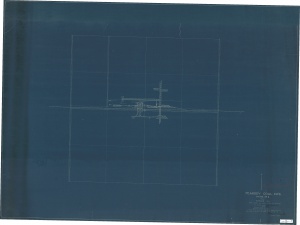
Company: IL_595
Map Date: 6-15-1914
Coal Co.: Peabody Coal Company
Mine Name: Peabody No. 8 Mine
Full Res Download
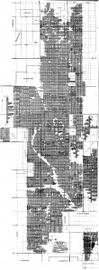
Company: 4103.C4 i5.1-10
Map Date: 7-29-1954
Coal Co.: Peabody Coal Company
Mine Name: Peabody No. 8 Mine
Image Credit: Illinois State Geological Survey
Full Res Download
Photographs


