Mine Index Number: 0278
| Company Name:
|
Mt. Pulaski Miners Association
|
| Mine Name:
|
Mt. Pulaski Mine
|
| Start Date:
|
1882
|
End Date:
|
1915
|
| Type of Mine:
|
Underground
|
| Total acres shown:
|
90
|
| Acres after map date:
|
|
General Area of mining acres shown:
|
|
|
|
Shaft, Slope, Drift or Tipple Location(s)
| Type
|
County
|
Township-Range
|
Section
|
Part Section
|
| Shaft
|
Logan
|
18N 2W
|
14
|
SW SW SE
|
Geology
| Springfield
|
365
|
3.5
|
4.3
|
4.0
|
LW
|
Geological Problems Reported
Clay dikes, or ‘horsebacks’, were present. There were also water problems.
Production
| Company
|
Mine Name
|
Date
|
Production (tons)
|
| B. F. Fox
|
Fox
|
1882-1883
|
unknown Coal production not available
|
|
|
|
|
|
|
|
| Total Production: 464,091
|
Production Notes
Coal Report production (if available)
Sources of Data
| Map library, 4103.L6 i5.1-3
|
8-30-1933
|
1:62500
|
1:6250
|
Secondary source
|
| Sanborn Fire Insurance Maps
|
1893
|
Unknown
|
1:24000
|
Secondary source
|
Annotated Bibliography (Data source - brief description of information)
| Coal Reports - Production, ownership, years of operation.
|
| Directory of Illinois Coal Mines (Logan County) - Mine names, mine index, ownership, years of operation.
|
| Mine notes (Logan County) - Mine type, shaft location, seam, depth, thickness, geologic problems.
|
| Map library, 4103.L6 i5.1-3, original map for Federal Land Bank Report (Logan County) - Mine outline.
|
| Sanborn Fire Insurance Maps, Mt. Pulaski, 1893, Sheet 5 - Shaft location.
|
Mine Notes
Mine Images
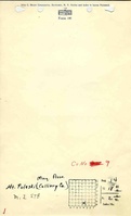
Map library: 4103.L6 i5.1-3
Map Date: 8-30-1933
Coal Co.: Mt. Pulaski Miners Association
Mine Name: Mt. Pulaski Mine
Full Res Download
Photographs