Mine Index Number: 0280
| Company Name:
|
Blue Mound Coal Company
|
| Mine Name:
|
Blue Mound No. 1 Mine
|
| Start Date:
|
1904
|
End Date:
|
1913
|
| Type of Mine:
|
Underground
|
| Total acres shown:
|
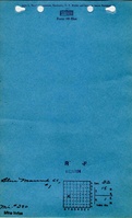
65 Production indicates approximately 65 acres were mined. A general area of mining on the accompanying map indicates the approximate size of the area mined.
|
| Acres after map date:
|
|
General Area of mining acres shown:
|
|
|
|
Shaft, Slope, Drift or Tipple Location(s)
| Type
|
County
|
Township-Range
|
Section
|
Part Section
|
| Main shaft (7 x 15 ft)
|
Macon
|
15N 1E
|
32
|
NE NW SW
|
| Air shaft (8 x 12 ft)
|
Macon
|
15N 1E
|
32
|
NW SW According to the 1904 Coal Report, the air / escape shaft construction was 150 feet deep. The location of the air shaft is not known, but is assumed to be near the hoist shaft.
|
Geology
| Springfield
|
467
|
3.5
|
6.5
|
5.0
|
RP
|
Geological Problems Reported
Some gas was reported at the active face of the workings.
Production
| Company
|
Mine Name
|
Date
|
Production (tons)
|
|
|
|
|
|
| Total Production: 290,161
|
Production Notes
Coal Report production (if available)
Sources of Data
| Mine notes
|
Undated
|
(text only)
|
1:24000 Point plotted onto 1:24,000 USGS topographic map and digitized.
|
Secondary source
|
| Sanborn Map Company
|
5-1910
|
Unknown
|
1:24000 Point plotted onto 1:24,000 USGS topographic map and digitized.
|
Secondary source
|
Annotated Bibliography (Data source - brief description of information)
| Coal Reports - Production, ownership, years of operation, seam, air shaft size.
|
| Directory of Illinois Coal Mines (Macon County) - Mine names, mine index, ownership, years of operation.
|
| Mine notes (Macon County) - Mine type, shaft location, shaft size, depth, thickness, mining method, geologic problems.
|
| Sanborn Map Company, Blue Mound, 1910 - Shaft location (direction from railroad tracks).
|
Mine Notes
Mine Images
Photographs