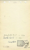
Mine Index Number: 0329
| Company Name:
|
A. N. Poli
|
| Mine Name:
|
Greenfield Mine
|
| Start Date:
|
1919
|
End Date:
|
1923
|
| Type of Mine:
|
Underground
|
| Total acres shown:
|
None
|
| Production Indicated Acres:
|
2
|
General Area of mining acres shown:
|
|
|
|
Shaft, Slope, Drift or Tipple Location(s)
| Type
|
County
|
Township-Range
|
Section
|
Part Section
|
| Main slope or shaft
|
Greene
|
11N 10W
|
27
|
SW NW SE
|
Geology
| Houchin Creek
|
55-95
|
4.0
|
8.0
|
6.0
|
Underground
|
Geological Problems Reported
The roof was soapstone (a massive light gray shale) and 18 inches of top coal was left to support the roof. Some water entered the mine through slips in the roof. The coal was banded with shale, pyrite, and black jack, charcoal or bone coal. The floor consisted of over 13 feet of clay.
Production
| Company
|
Mine Name
|
Date
|
Production (tons)
|
Production Notes
Coal Report production (if available)
Sources of Data
| Mine notes
|
Undated
|
1:62500
|
1:62500
|
Secondary source
|
Annotated Bibliography (Data source - brief description of information)
| Coal Reports - Production, ownership, years of operation, depth.
|
| Directory of Illinois Coal Mines (Greene County) - Mine names, mine index, ownership, years of operation.
|
| Mine notes (Greene County) - Mine type, shaft or slope location, depth, thickness, geologic problems.
|
Mine Notes
Mine Images
Photographs