Mine Index Number: 0689
| Company Name:
|
Freeman Coal Mining Corporation
|
| Mine Name:
|
Freeman No. 3 Mine
|
| Start Date:
|
1948
|
End Date:
|
September 1955
|
| Type of Mine:
|
854
|
| Total acres shown:
|
|
| Acres after map date:
|
|
General Area of mining acres shown:
|
|
|
|
Shaft, Slope, Drift or Tipple Location(s)
| Type
|
County
|
Township-Range
|
Section
|
Part Section
|
| Main shaft
|
Williamson
|
8S 2E
|
10
|
SE SW NW
|
| Air shaft
|
Williamson
|
8S 2E
|
10
|
NW NW SW
|
Geology
| Herrin
|
211-217
|
|
|
8.33-8.5
|
MRP
|
Geological Problems Reported
The source maps show two large, parallel northwest-trending faults in the northwestern part of the workings. The northeastern fault has 20 feet of throw, the southwestern has 10 to 60 feet of displacement.
Production
| Company
|
Mine Name
|
Date
|
Production (tons)
|
|
|
|
|
|
| Total Production: 5,705,788
|
Production Notes
Coal Report production (if available)
Sources of Data
| Microfilm, document 353246
|
9-27-1955
|
1:2400
|
1:5297
|
Final
|
Annotated Bibliography (Data source - brief description of information)
| Coal Reports - Production, ownership, years of operation, seam, depth, thickness.
|
| Directory of Illinois Coal Mines (Williamson County) - Mine names, mine index, ownership, years of operation.
|
| Mine notes (Williamson County) - Mine type, shaft location, seam.
|
| Microfilm map, document 353246, reel 03142, frame 187 - Shaft locations, mine outline, mining method.
|
| W.J. Nelson (ISGS), Catalog of Coal Mines in Williamson County, 2003 - Geologic problems.
|
Mine Notes
Mine Images
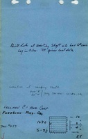
Microfilm: 353246
Map Date: 9-27-1955
Coal Co.: Freeman Coal Mining Corporation
Mine Name: Freeburn No. 3 Mine
Full Res Download
Photographs