Mine Index Number: 0793
| Company Name:
|
Marissa Coal and Mining Company
|
| Mine Name:
|
Marissa Mine
|
| Start Date:
|
1882
|
End Date:
|
1909
|
| Type of Mine:
|
Underground
|
| Total acres shown:
|
119
|
| Acres after map date:
|
30
|
General Area of mining acres shown:
|
|
|
The mined area shown on the accompanying map is smaller than expected for the reported production, which indicates approximately 155 acres were mined. A general area of mining has been added to the accompanying map.
|
Shaft, Slope, Drift or Tipple Location(s)
| Type
|
County
|
Township-Range
|
Section
|
Part Section
|
| Main shaft
|
St. Clair
|
3S 6W
|
27
|
SW NE SE
|
| Air shaft
|
St. Clair
|
3S 6W
|
27
|
SW NE SE
|
Geology
Geological Problems Reported
Production
| Company
|
Mine Name
|
Date
|
Production (tons)
|
|
|
|
|
|
| Total Production: 1,067,280
|
Production Notes
Coal Report production (if available)
Sources of Data
| State archive, IL_134_01
|
7-23-1906
|
1:2400
|
1:2400
|
Not final
|
Annotated Bibliography (Data source - brief description of information)
| Coal Reports - Production, ownership, years of operation, mine type, seam, depth, thickness.
|
| Directory of Illinois Coal Mines (St. Clair County) - Mine names, mine index, ownership, years of operation.
|
| Mine notes (St. Clair County) - Shaft location.
|
| State archive, IL_134_01 - Shaft locations, mine outline, mining method.
|
Mine Notes
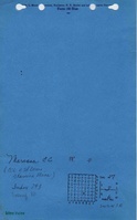
Mine Images
![[[:Marissa|Marissa]]](https://wikiimage.isgs.illinois.edu/ilmines/st_clair/thumbnails/m0793_IL_134_01_th.jpg) These files may not be true to scale and are not georgistered. These files may not be true to scale and are not georgistered.
|
Map Type:
|
State Archive
|
| Map ID:
|
IL_134_01
|
| Company:
|
Consolidated Coal Company of St. Louis
|
| Mine Name:
|
Marissa
|
| Caption:
|
|
| Map Date:
|
07-23-1906
|
| Map Status:
|
Not Final
|
| Image Credit:
|
|
| Note:
|
|
| More Info:
|
M0793 IL 134 01
|
| Full Res Download:These files are true to scale and most are georegistered for gis software. These files may be a very large (>1GB) download!
|
https://wikiimage.isgs.illinois.edu/ilmines/st clair/m0793 IL 134 01.zip
|
Photographs