Mine Index Number: 3621
| Company Name:
|
Marissa Coal Company
|
| Mine Name:
|
Okay Mine
|
| Start Date:
|
1888
|
End Date:
|
December 1948
|
| Type of Mine:
|
Underground
|
| Total acres shown:
|
372
|
| Acres after map date:
|
|
General Area of mining acres shown:
|
|
|
|
Shaft, Slope, Drift or Tipple Location(s)
| Type
|
County
|
Township-Range
|
Section
|
Part Section
|
| Main shaft (6.5 x 13 feet)
|
St. Clair
|
3S 6W
|
26
|
SE SW SW
|
| Air shaft
|
St. Clair
|
3S 6W
|
26
|
SE SW SW
|
Geology
| Herrin
|
120
|
6.0
|
8.0
|
6.5
|
MRP
|
Geological Problems Reported
Two faults were noted, 650 feet south of the shaft. One was traced 150 feet through contiguous rooms. The roof consisted of 0 to 5 feet of shale with limestone above. The shale contained pyrite balls of varying sizes. According to the mine notes, the miners said these pyrite balls indicated a good roof that had little tendency to fall. The coal seam contained numerous minor slips. The coal immediately above the blue band had pyrite & clay bands scattered throughout the layer. The blue band ranged from 0.25 to 1 inch thick and consisted of shale and pyrite. The coal under the blue band ranged from 17 to 22 inches. The floor was 3 inches to 1.5 feet of fire clay. A small amount of heaving was noted long after an area was mined.
Production
| Company
|
Mine Name
|
Date
|
Production (tons)
|
|
|
|
|
|
| Total Production: 2,443,095
|
Production Notes
Coal Report production (if available)
Sources of Data
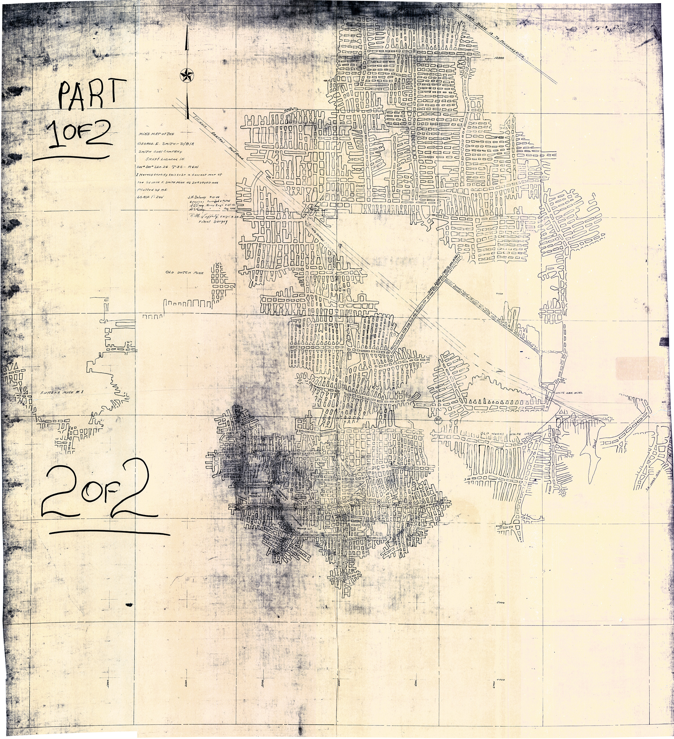
| State archive, IL_115_03
|
4-24-1952
|
1:2400
|
1:2400
|
Final
|
Annotated Bibliography (Data source - brief description of information)
| Coal Reports - Production, ownership, years of operation.
|
| Directory of Illinois Coal Mines (St. Clair County) - Mine names, mine index, ownership, years of operation.
|
| Mine notes (St. Clair County) - Mine type, shaft location & size, seam, depth, thickness, geologic problems.
|
| State archive, IL_115_03 - Shaft locations, mine outline, mining method.
|
Mine Notes
Mine Images
Photographs