Mine Index Number: 0797
| Company Name:
|
Silver Creek Coal and Mining Company
|
| Mine Name:
|
Darrow Mine
|
| Start Date:
|
1889
|
End Date:
|
1907
|
| Type of Mine:
|
Underground
|
| Total acres shown:
|
161
|
| Acres after map date:
|
|
General Area of mining acres shown:
|
|
|
|
Shaft, Slope, Drift or Tipple Location(s)
| Type
|
County
|
Township-Range
|
Section
|
Part Section
|
| Main shaft
|
St. Clair
|
2N 7W
|
28
|
NE NE SW
|
| Air shaft
|
St. Clair
|
2N 7W
|
28
|
NE NE SW
|
Geology
| Herrin
|
180-200
|
|
|
6.0-6.5
|
RP
|
Geological Problems Reported
Production
| Company
|
Mine Name
|
Date
|
Production (tons)
|
|
|
|
|
|
| Total Production: 695,887
|
Production Notes
Coal Report production (if available)
Sources of Data
| WPA, T2N-R7W
|
6-1-1905
|
1:12000
|
1:63360
|
Secondary source
|
Annotated Bibliography (Data source - brief description of information)
| Coal Reports - Production, ownership, years of operation, depth, thickness, mining method.
|
| Directory of Illinois Coal Mines (St. Clair County) - Mine names, mine index, ownership, years of operation.
|
| Mine notes (St. Clair County) - Shaft location, mine type, seam, depth.
|
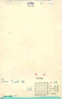
| WPA map, T2N-R7W - Shaft locations, mine outline.
|
Mine Notes
Mine Images
WPA: T2N-R7W
Map Date: 7-1-1922
Coal Co.: O'Fallon Coal Company
Mine Name: O'Fallon No. 1
Full Res Download
Photographs