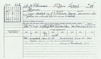
Mine Index Number: 2100
| Company Name:
|
L. S. Robinson
|
| Mine Name:
|
Plainview Mine
|
| Start Date:
|
1936
|
End Date:
|
1940
|
| Type of Mine:
|
Underground
|
| Total acres shown:
|
7
|
| Production Indicated Acres:
|
Less than 1
|
General Area of mining acres shown:
|
|
|
|
Shaft, Slope, Drift or Tipple Location(s)
| Type
|
County
|
Township-Range
|
Section
|
Part Section
|
| Main shaft
|
Fulton
|
4N 2E
|
8
|
NW SW NW
|
| Air shaft
|
Fulton
|
4N 2E
|
8
|
NW SW NW
|
Geology
| Springfield
|
25-33
|
|
|
5.5-6.0
|
MRP
|
Geological Problems Reported
Production
| Company
|
Mine Name
|
Date
|
Production (tons)
|
| A. H. Thomas
|
Plainview
|
1936-1939 The production shown is too small for the area shown on the source map. It is likely that the mine operated before 1936, perhaps under different ownership.
|
2,194
|
|
|
Production Notes
Coal Report production (if available)
Sources of Data
| ISGS map library, 4103.F8 i5.1-19
|
2-6-1940
|
1:1200
|
1:1200
|
Not final
|
Annotated Bibliography (Data source - brief description of information)
| Coal Reports - Production, ownership, years of operation.
|
| Directory of Illinois Coal Mines (Fulton County) - Mine names, mine index, ownership, years of operation.
|
| Mine notes (Fulton County) - Mine type, shaft location, seam, depth, thickness.
|
| Mine Inspector's reports, courtesy of Joe Pelc, IDNR - Mine type, seam, thickness.
|
| Company map, ISGS map library, 4103.F8 i5.1-19 - Shaft locations, mine outline, mining method.
|
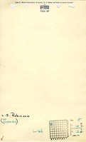
Mine Notes
Mine Images
 These files may not be true to scale and are not georgistered. These files may not be true to scale and are not georgistered.
|
Map Type:
|
Company
|
| Map ID:
|
4103.F8 i5.1-19
|
| Company:
|
L. S. Robinson
|
| Mine Name:
|
|
| Caption:
|
|
| Map Date:
|
02-06-1940
|
| Map Status:
|
Not Final
|
| Image Credit:
|
|
| Note:
|
|
| More Info:
|
M2100 geo
|
| Full Res Download:These files are true to scale and most are georegistered for gis software. These files may be a very large (>1GB) download!
|
https://go.illinois.edu/ILMImages/fulton/m2100 geo.zip
|
Photographs