Category:Fulton-County
(Redirected from Fulton-County)
County Coal Data
Mines that Appear in Fulton-County
- 9998 & 9999 = Unknown dates
Unlocated Mines in Fulton-County
Mine that have known coal production but no known location
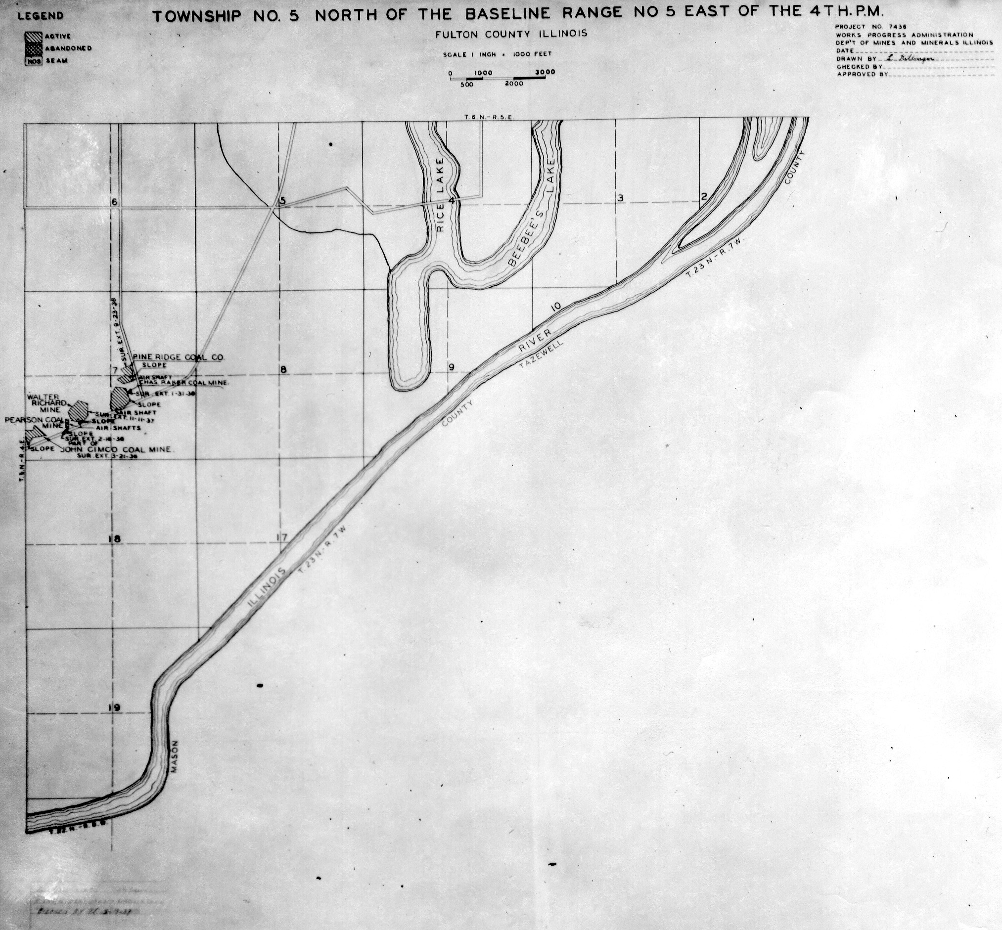
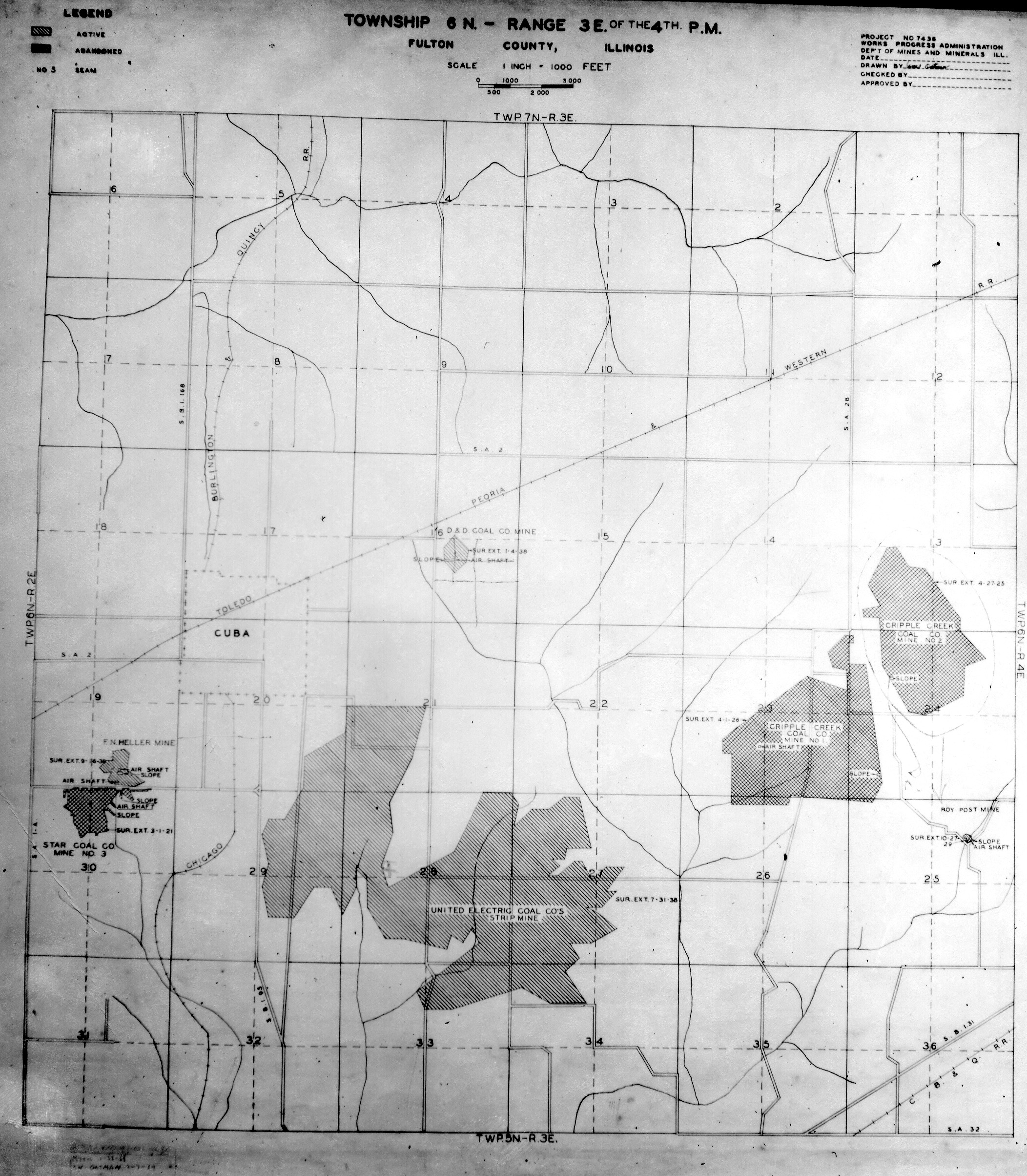
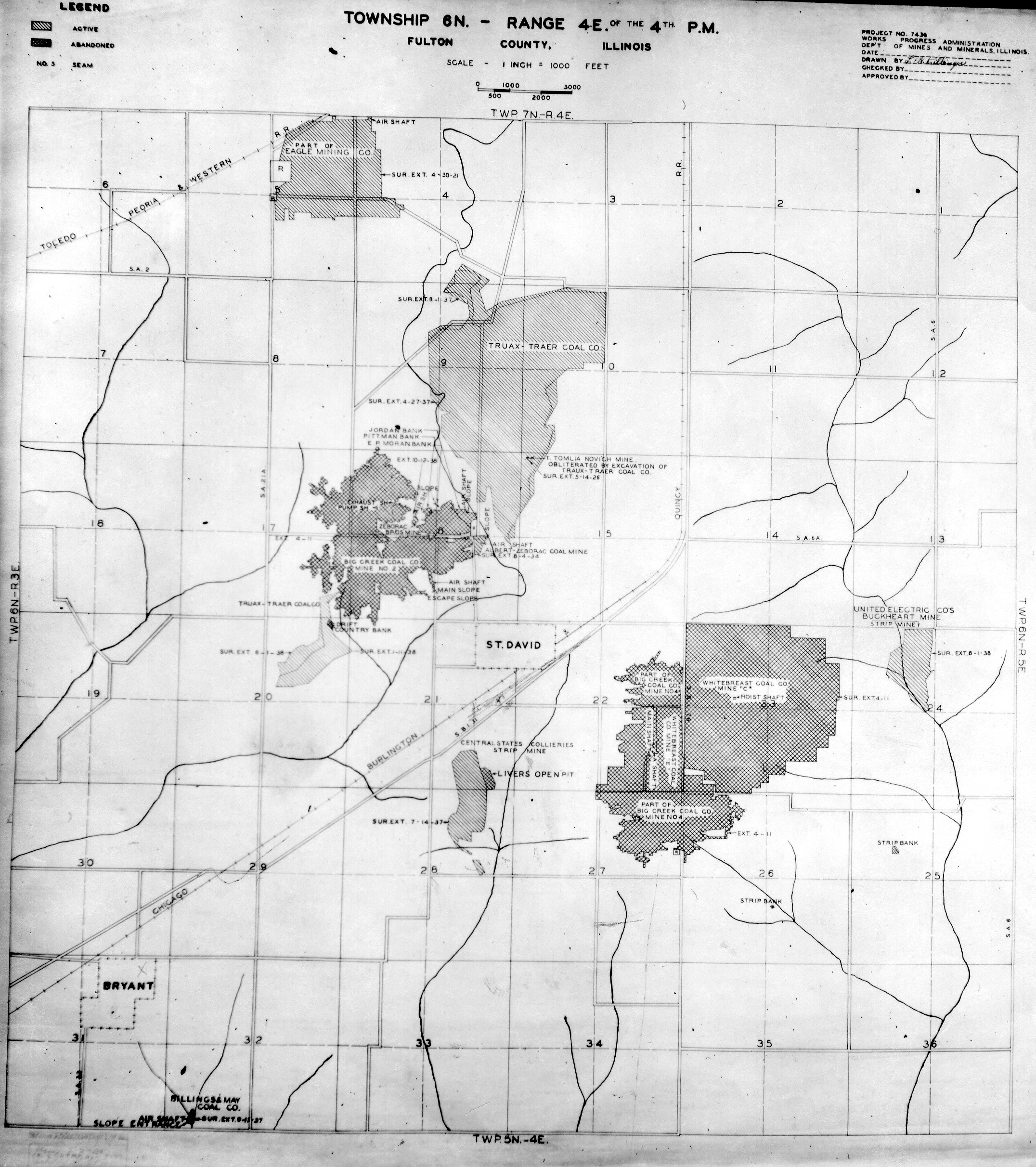
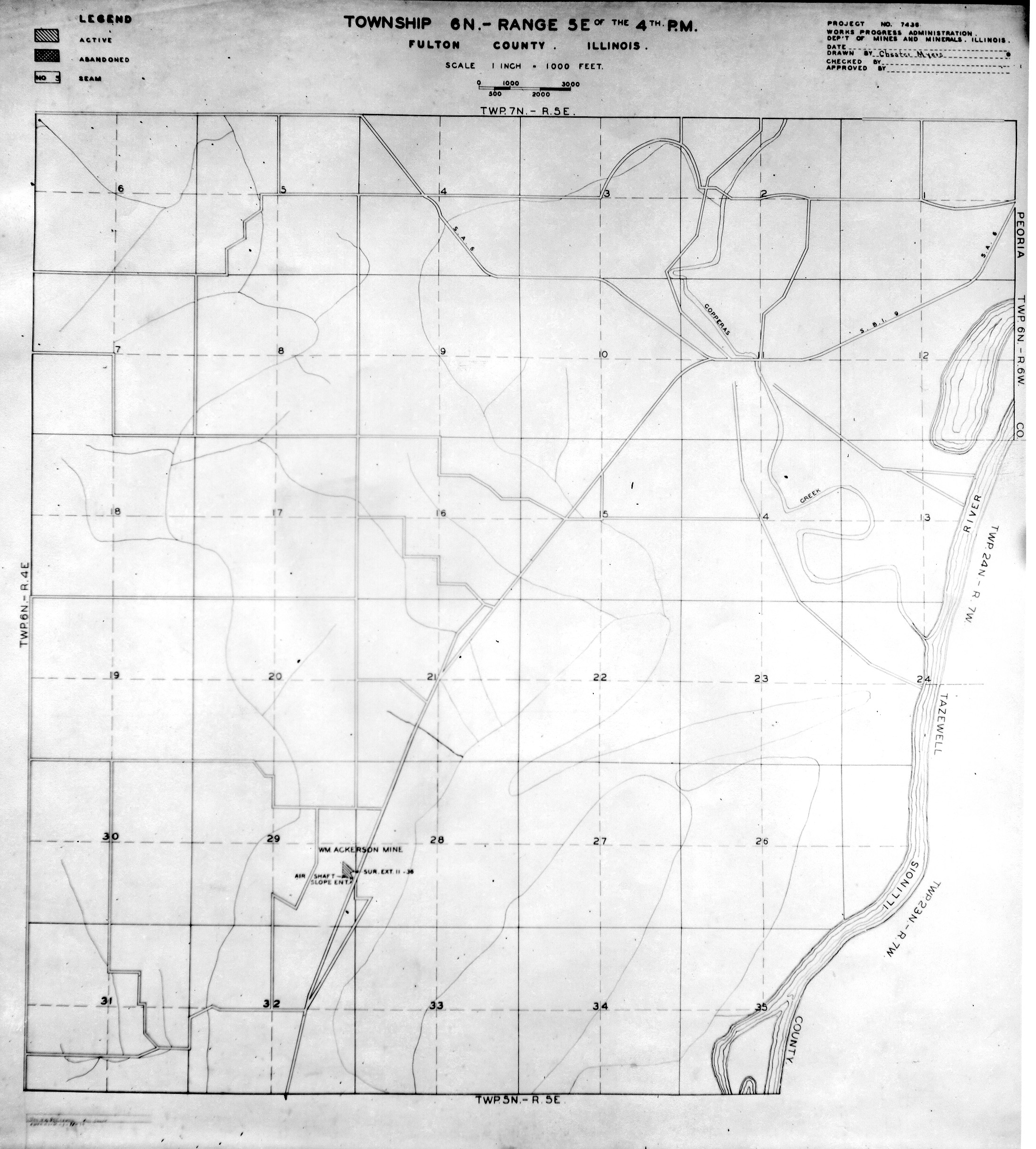
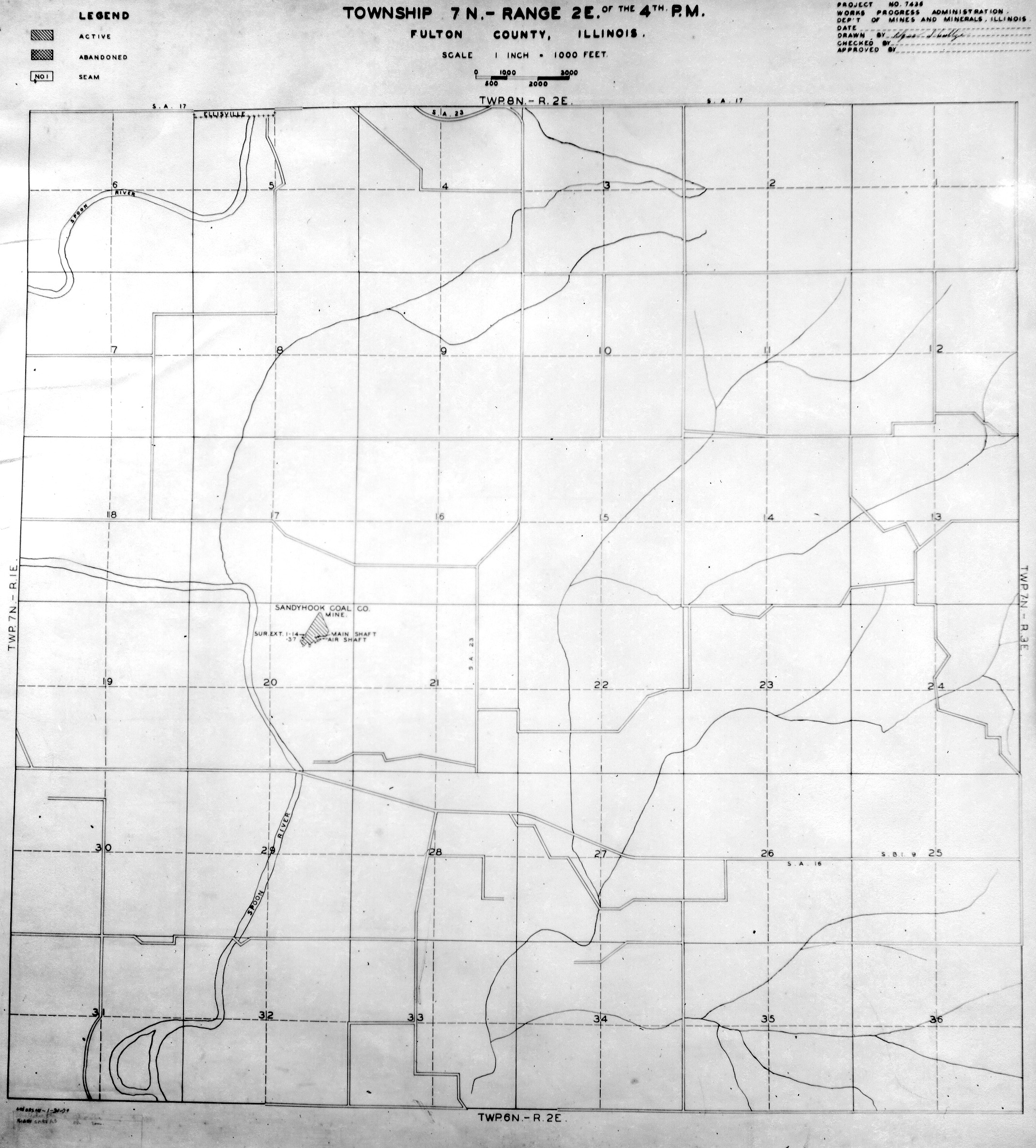
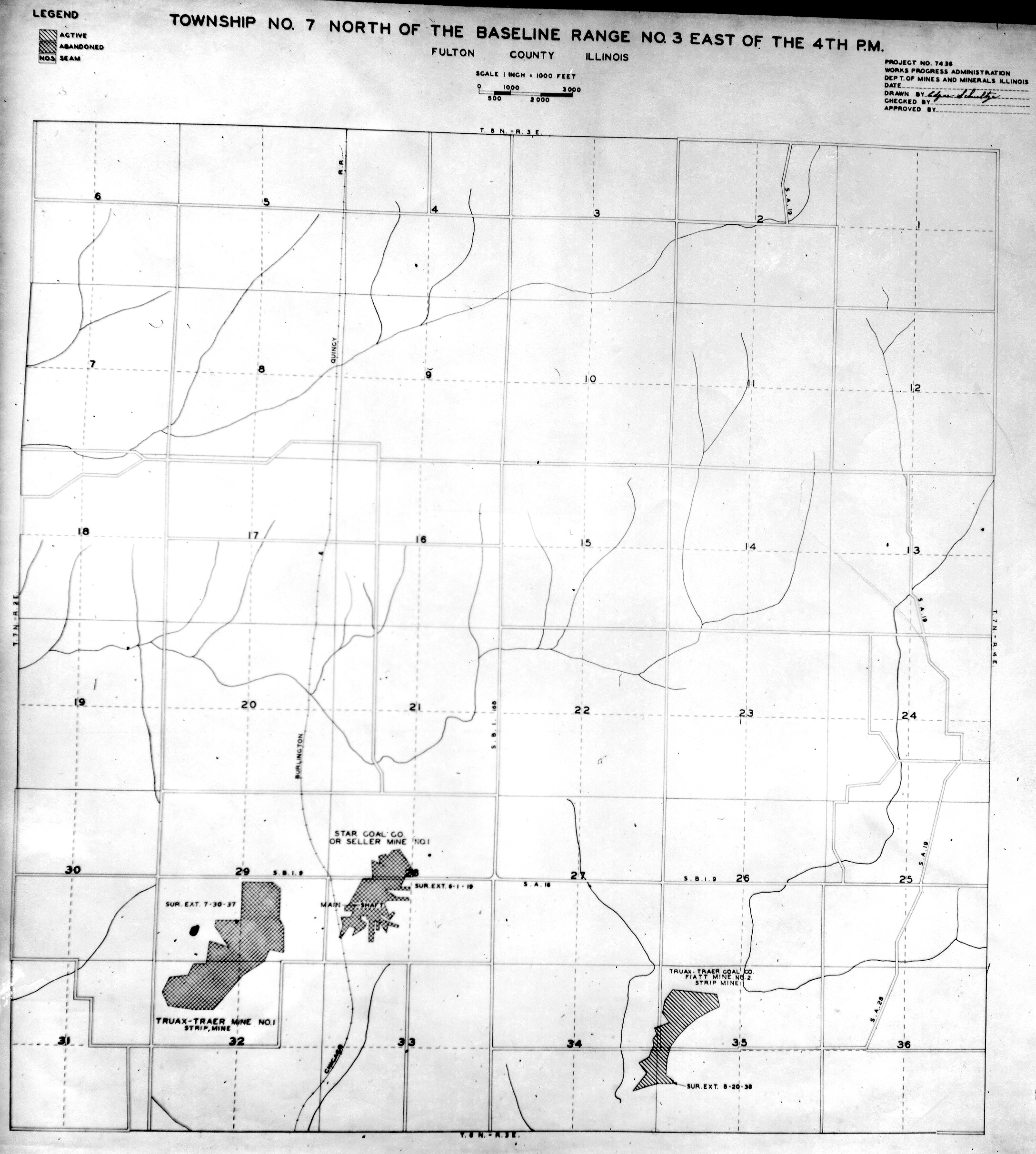
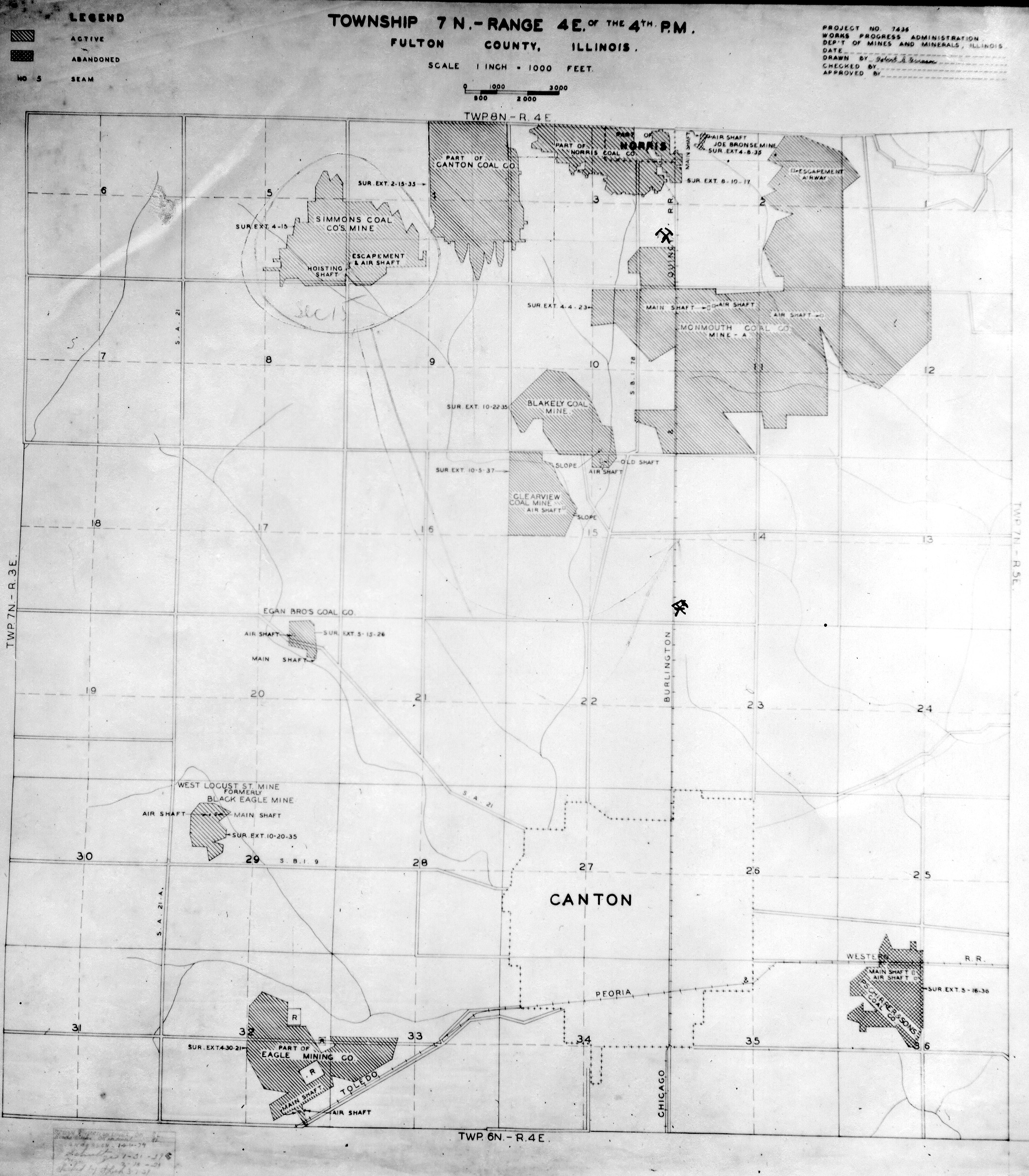
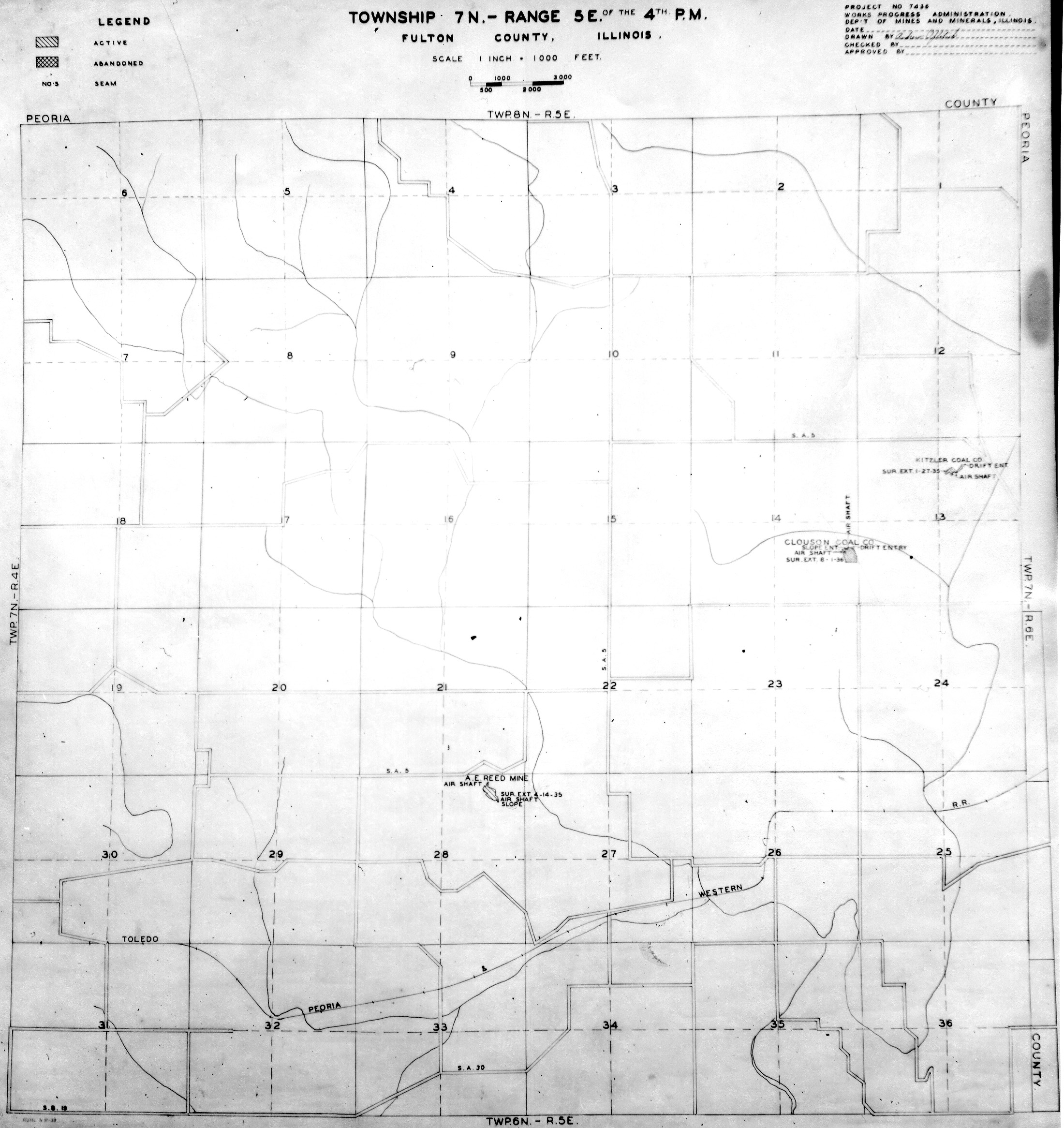
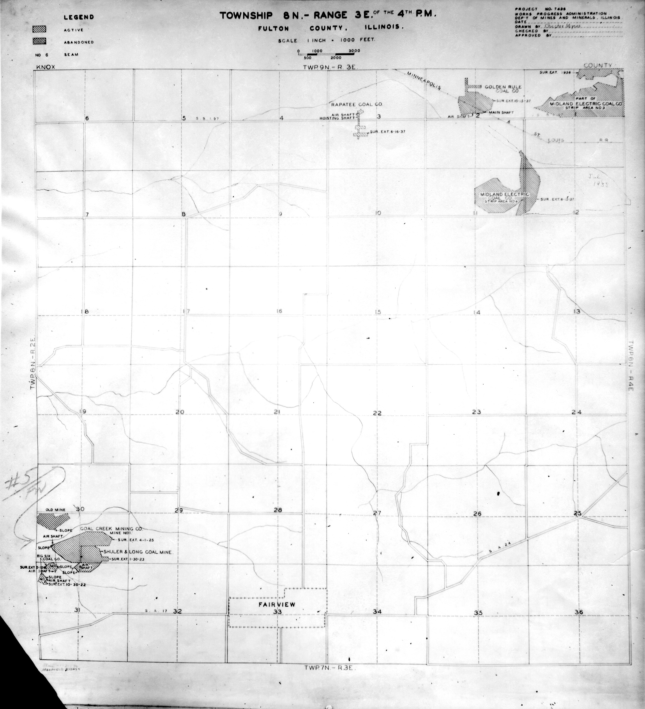
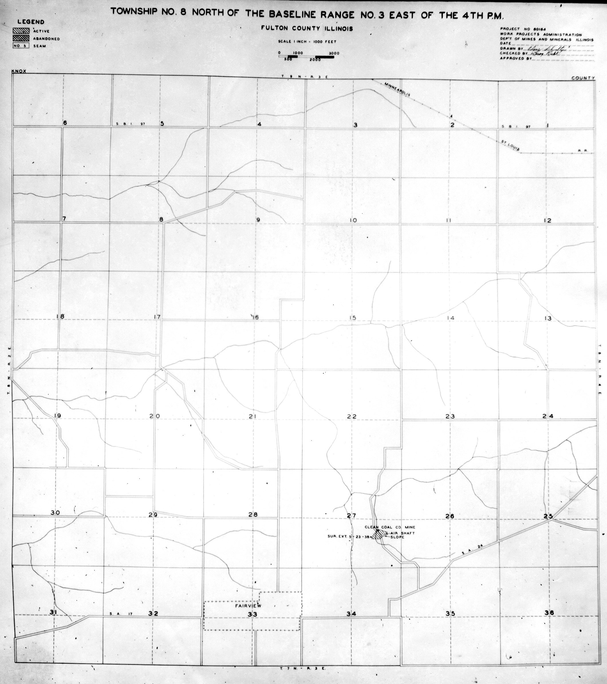
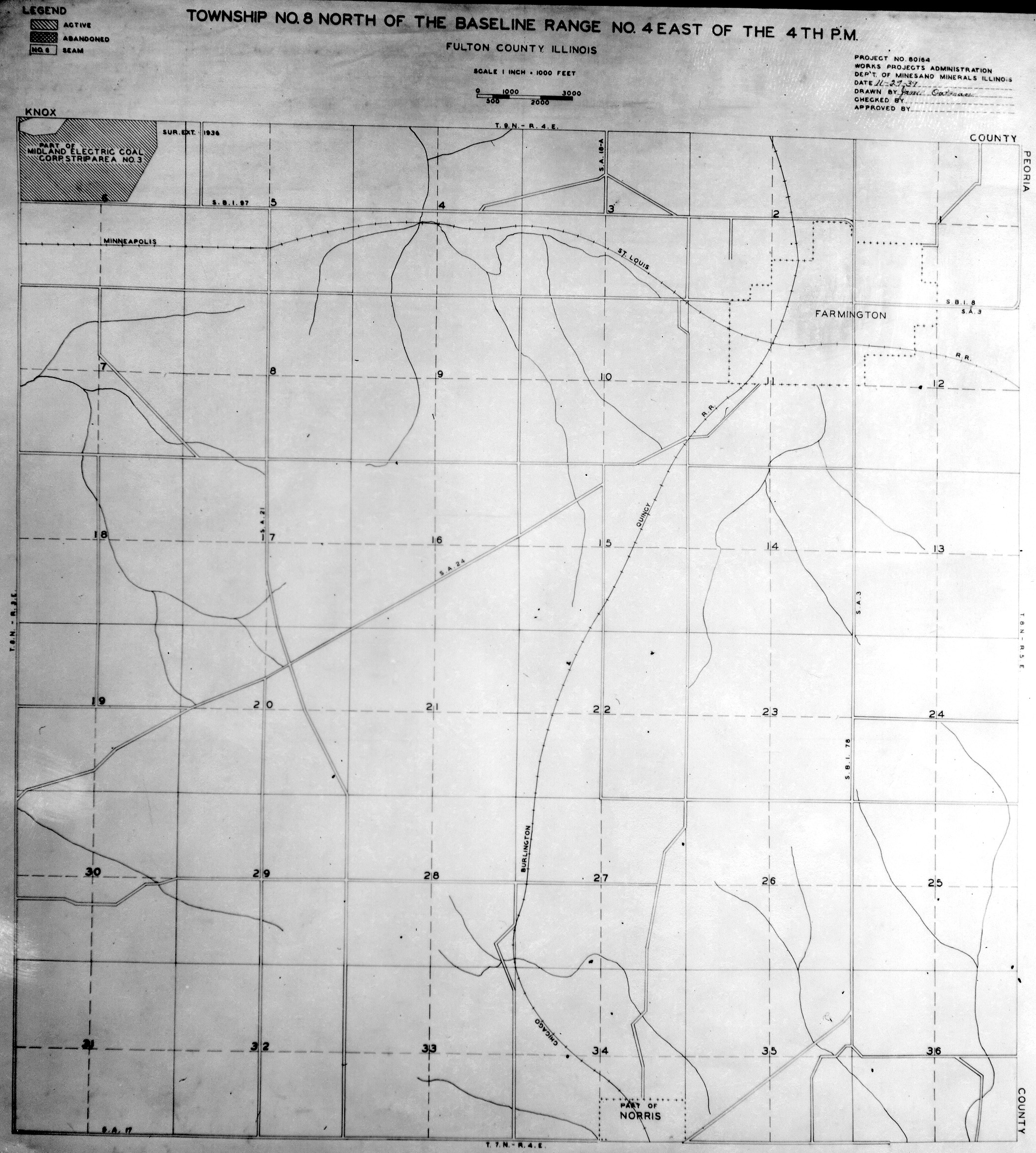
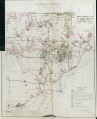
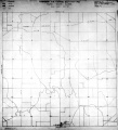
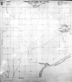
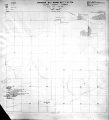
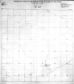
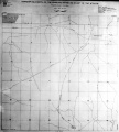
Historical Mined Out Area Maps
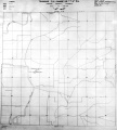
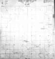
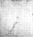
WPA
These maps were constructed as part of the nationwide Works Projects Administration (WPA), generally between 1934 and 1937 with some later updates or revisions,
Disclaimer
Maps for some locations might have multiple versions/seams, please inspected these areas closely for differences.
Notes and corrections were made by ISGS staff.
These maps are reproductions from microfilm, they may be of poor quality with text difficult to read.


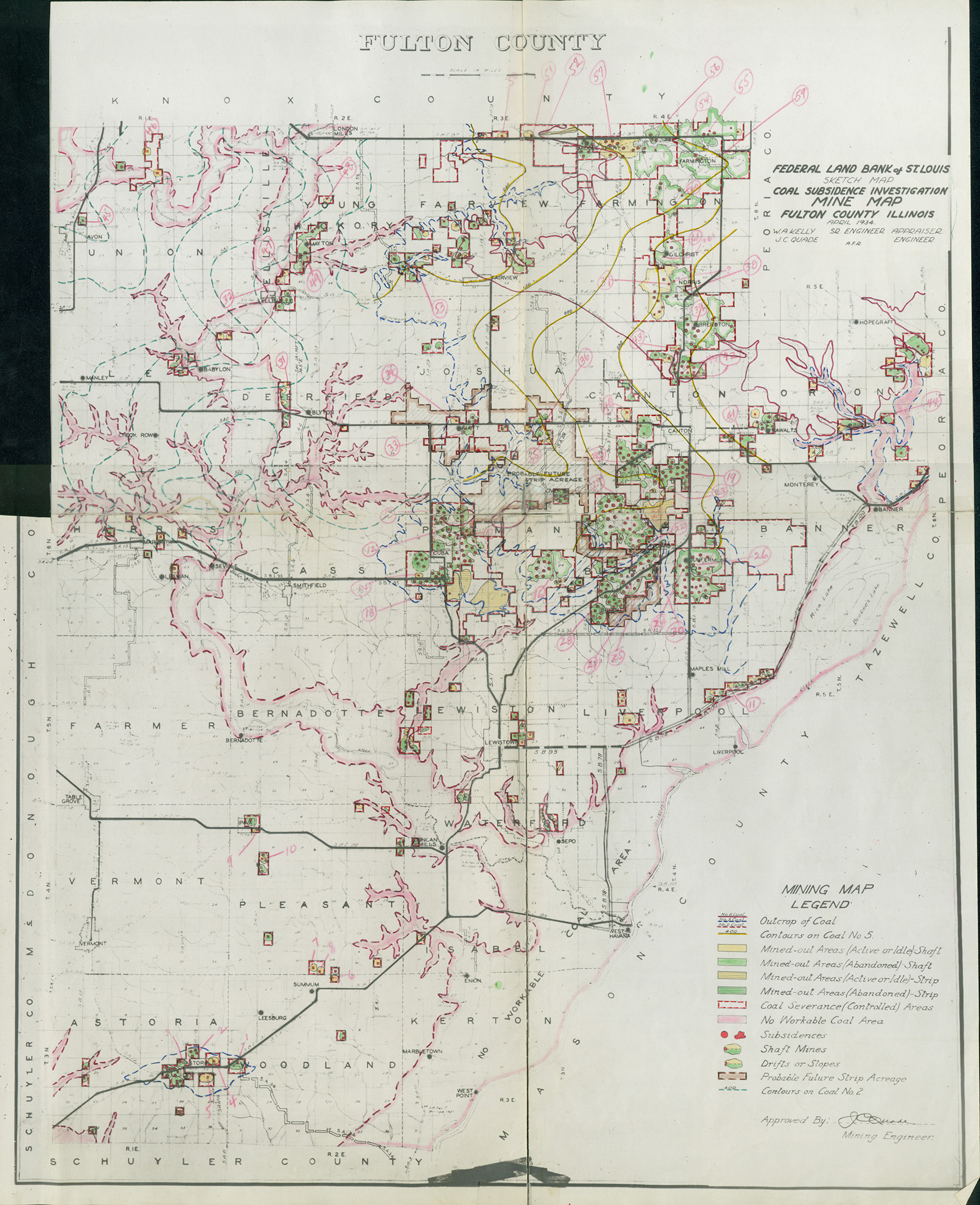
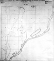
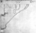
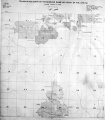
Federal Land Bank of St. Louis, Preliminary Reports on Subsidence Investigations
Federal Land Bank of St. Louis, Preliminary Reports on Subsidence Investigations (refered by Coal Section Staff as "Quade Maps")
Mining engineers working for the Federal Land Bank of St. Louis mapped areas of subsidence due to coal mining in the early 1930s. These reports often include county maps of mine properties with mined-out areas including shaft locations, as well as subsidence areas.
Disclaimer
Maps for some locations might have multiple versions/seams, please inspected these areas closely for differences.
These maps are accompanied by a report, please download and inspect this document.
Notes and corrections were made by ISGS staff.

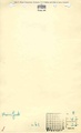
Photographs


Pages in category "Fulton-County"
The following 200 pages are in this category, out of 542 total.
(previous page) (next page)0
2
- 2072
- 2073
- 2077
- 2079
- 2081
- 2082
- 2083
- 2084
- 2085
- 2086
- 2087
- 2088
- 2089
- 2090
- 2091
- 2092
- 2096
- 2097
- 2098
- 2099
- 2100
- 2101
- 2102
- 2103
- 2104
- 2105
- 2106
- 2109
- 2110
- 2115
- 2116
- 2118
- 2120
- 2132
- 2133
- 2136
- 2137
- 2138
- 2139
- 2140
- 2142
- 2143
- 2144
- 2145
- 2146
- 2147
- 2148
- 2149
- 2150
- 2151
- 2152
- 2153
- 2154
- 2155
- 2156
- 2157
- 2158
- 2160
- 2161
- 2162
- 2163
- 2164
- 2165
- 2166
- 2167
- 2168
- 2169
- 2170
- 2171
- 2173
- 2174
- 2175
- 2176
- 2177
- 2178
- 2191
- 2192
- 2196
- 2198
- 2199
- 2200
- 2201
- 2202
- 2203
- 2204
- 2205
- 2225
- 2226
- 2227
- 2228
- 2229
- 2230
- 2231
- 2232
- 2233
- 2234
- 2235
- 2236
- 2237
- 2238
- 2239
- 2240
- 2241
- 2242
- 2243
- 2244
- 2245
- 2246
- 2247
- 2248
- 2249
- 2250
- 2251
- 2252
- 2253
- 2254
- 2503
- 2515
- 2599
- 2637
- 2752
- 2938
Media in category "Fulton-County"
The following 42 files are in this category, out of 42 total.
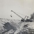 Image 2316.jpg 807 × 830; 185 KB
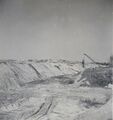 Image 2317.jpg 808 × 859; 190 KB
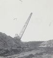 Image 2462.jpg 810 × 886; 155 KB
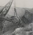 Image 2765.jpg 837 × 893; 227 KB
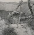 Image 2766.jpg 831 × 856; 217 KB
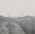 Image 2767.jpg 836 × 807; 166 KB
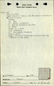
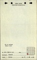
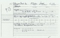
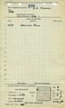
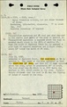
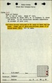
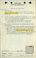
 M0521 minenotes.pdf 731 × 1,202, 3 pages; 617 KB
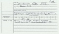
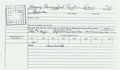
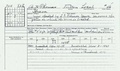
 M2096 fieldnotes.pdf 752 × 1,191, 3 pages; 317 KB
 M2096 minenotes.pdf 731 × 1,202, 3 pages; 572 KB
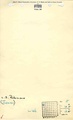
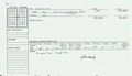
 M2097 mineinspector.pdf 1,266 × 739; 141 KB
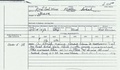
 M2097 minenotes.pdf 731 × 1,202, 3 pages; 624 KB
 M2098 fieldnotes.pdf 752 × 1,204, 2 pages; 212 KB
 M2098 mineinspector.pdf 1,285 × 754; 145 KB
 M2098 minenotes.pdf 731 × 1,202, 3 pages; 575 KB
 M2099 fieldnotes.pdf 752 × 1,204, 2 pages; 211 KB
 M2099 mineinspector.pdf 1,266 × 787; 152 KB
 M2099 minenotes.pdf 731 × 1,202, 2 pages; 498 KB
 M2100 mineinspector.pdf 1,281 × 756; 152 KB
 M2100 minenotes.pdf 731 × 1,202, 2 pages; 322 KB
 M2101 mineinspector.pdf 1,266 × 739; 144 KB
 M2101 minenotes.pdf 731 × 1,202, 3 pages; 628 KB
 M5199 fieldnotes.pdf 752 × 1,191; 181 KB
 M6637 fieldnotes.pdf 750 × 1,193; 191 KB
 M7635 fieldnotes.pdf 750 × 1,191, 2 pages; 286 KB
 M7646 mineinspector.pdf 1,270 × 729; 129 KB
 QUADE FULTON.jpg 1,789 × 2,200; 1.28 MB
 WPA FULTON 3N3E.jpg 2,172 × 2,424; 1.32 MB
 WPA FULTON 4N2E.jpg 2,140 × 2,348; 1.24 MB
 WPA FULTON 5N4E.jpg 2,116 × 2,424; 1.33 MB
 WPA FULTON 5N5E.jpg 2,026 × 1,881; 970 KB
 WPA FULTON 6N3E.jpg 2,104 × 2,408; 1.46 MB
 WPA FULTON 6N4E.jpg 2,152 × 2,424; 1.46 MB
 WPA FULTON 6N5E.jpg 2,200 × 2,440; 1.29 MB
 WPA FULTON 7N2E.jpg 2,140 × 2,372; 1.22 MB
 WPA FULTON 7N3E.jpg 2,176 × 2,424; 1.17 MB
 WPA FULTON 7N4E.jpg 2,120 × 2,424; 1.34 MB
 WPA FULTON 7N5E.jpg 2,200 × 2,332; 1.01 MB
 WPA FULTON 8N2E.jpg 2,160 × 2,390; 1.33 MB
 WPA FULTON 8N3E NO 1.jpg 2,240 × 2,460; 1.12 MB
 WPA FULTON 8N3E NO 2.jpg 2,120 × 2,390; 949 KB
 WPA FULTON 8N4E NO 1.jpg 2,116 × 2,355; 1.33 MB
 WPA FULTON 8N4E NO 2.jpg 2,112 × 2,412; 1.54 MB