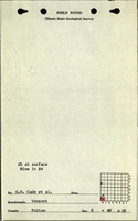
Mine Index Number: 2098
| Company Name:
|
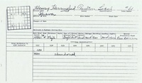
Henry Herriford
|
| Mine Name:
|
Herriford Mine
|
| Start Date:
|
1929
|
End Date:
|
1937
|
| Type of Mine:
|
Underground
|
| Total acres shown:
|
The general area of mining is larger than indicated by reported production. Production indicates approximately 3 acres were mined.
|
| Acres after map date:
|
|
General Area of mining acres shown:
|
62
|
|
|
Shaft, Slope, Drift or Tipple Location(s)
| Type
|
County
|
Township-Range
|
Section
|
Part Section
|
| Main drift
|
Fulton
|
4N 2E
|
8
|
SW SW SW
|
Geology
Geological Problems Reported
Production
| Company
|
Mine Name
|
Date
|
Production (tons)
|
Production Notes
Coal Report production (if available)
Sources of Data
| Federal Land Bank Report
|
4-1934
|
1:124800
|
1:124800
|
Secondary source
|
Annotated Bibliography (Data source - brief description of information)
| Coal Reports - Production, ownership, years of operation.
|
| Directory of Illinois Coal Mines (Fulton County) - Mine names, mine index, ownership, years of operation.
|
| Mine notes (Fulton County) - Mine type, shaft location, seam, depth, thickness.
|
| Mine Inspector's reports, courtesy of Joe Pelc, IDNR - Mine type, thickness, mining method.
|
| Federal Land Bank Report (Fulton County) - Mine location.
|
Mine Notes
Mine Images
 These files may not be true to scale and are not georgistered. These files may not be true to scale and are not georgistered.
|
Map Type:
|
ISGS Coal Section files
|
| Map ID:
|
|
| Company:
|
|
| Mine Name:
|
|
| Caption:
|
|
| Map Date:
|
Undated
|
| Map Status:
|
Secondary
|
| Image Credit:
|
|
| Note:
|
Undated ISGS coal section work map drawn on 1921 15-minute Vermont Quadrangle.
|
| More Info:
|
Vermont15 ipava 4
|
| Full Res Download:These files are true to scale and most are georegistered for gis software. These files may be a very large (>1GB) download!
|
https://go.illinois.edu/ILMImages/fulton/vermont15 ipava 4.zip
|
Photographs
