Mine Index Number: 2613
| Company Name:
|
Joseph Crew
|
| Mine Name:
|
Crew Mine
|
| Start Date:
|
Circa 1866
|
End Date:
|
1888
|
| Type of Mine:
|
Underground
|
| Total acres shown:
|
41
|
| Acres after map date:
|
|
General Area of mining acres shown:
|
|
|
|
Shaft, Slope, Drift or Tipple Location(s)
| Type
|
County
|
Township-Range
|
Section
|
Part Section
|
| Main shaft
|
La Salle
|
31N 3E
|
26
|
NW SE SE
|
| Air shaft
|
La Salle
|
31N 3E
|
26
|
NW SE SE
|
| Slope
|
La Salle
|
31N 3E
|
26
|
NW SE SE
|
Geology
Geological Problems Reported
Production
| Company
|
Mine Name
|
Date
|
Production (tons)
|
| Joseph Crew
|
Crew
|
1881-1884Production before July 1881 is unknown. The 1882 Coal Report indicated 6 acres had been mined.
|
14,828
|
|
|
Production Notes
According to "Biography in Black: A History of Streator, Illinois", the Old Slope Mine opened soon after Colonel Ralph Plumb arrived in January 1866. The location of the slope was said to be at the foot of Adams Street, just north of Cedar Street. The microfilm map, document 352401, labels portions of the Crew Mine “Old Slope Workings” and labels the “Old Slope”, which fits the location described for Vermilion Coal Company. This would explain the large mined area when Crew Mine production would account for only 15 acres.
Coal Report production (if available)
Sources of Data
| Microfilm, mines087.tif
|
Undated
|
Unknown
|
1:4248
|
Secondary source
|
| Microfilm, document 352401
|
3-23-1940
|
1:480
|
1:562
|
Secondary source
|
| Microfilm, document 352441
|
Undated
|
1:1200
|
1:1986
|
Secondary source
|
Annotated Bibliography (Data source - brief description of information)
| Coal Reports - Production, ownership, years of operation, depth, thickness, mining method.
|
| Directory of Illinois Coal Mines (La Salle County) - Mine names, mine index, ownership, years of operation.
|
| Mine notes (La Salle County) - Shaft location.
|
| Microfilm map, Coal Section files, mines087.tif - Mine outline, mining method.
|
| Microfilm map, document 352401, reel 03139, frame 53, map of West Side Mine (mine index 2612) - Shaft locations, mine outline (southern part), mining method.
|
| Microfilm map, document 352441, reel 03139, frame 117, map of Howe Mine (mine index 5707) - Mine outline (portion of southern part of mine).
|
| Angle, Paula, 1962, Biography in Black: a History of Streator, Illinois, Weber Company, 170p. - Ownership, years of operation, mine location.
|
Mine Notes
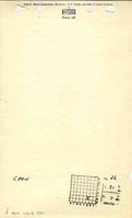
Mine Images
Photographs