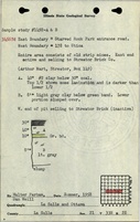
Mine Index Number: 2678
| Company Name:
|
Hydraulic Press Brick Company
|
| Mine Name:
|
Hydraulic Press Brick Mine
|
| Start Date:
|
1941
|
End Date:
|
1959
|
| Type of Mine:
|
Surface
|
| Total acres shown:
|
17Production indicates approximately 5 acres were mined. The map may represent the area mined for clay as well the coal.
|
| Acres after map date:
|
|
General Area of mining acres shown:
|
|
|
|
Shaft, Slope, Drift or Tipple Location(s)
| Type
|
County
|
Township-Range
|
Section
|
Part Section
|
| Pit
|
LaSalle
|
33N-2E
|
21
|
S 1/2 NW
|
Geology
| Colchester
|
10-14
|
|
|
2.5
|
Surface
|
Geological Problems Reported
Production
| Company
|
Mine Name
|
Date
|
Production (tons)
|
Production Notes
Coal Report production (if available)
Sources of Data
| Microfilm, document 350389
|
3-28-1977
|
1:1200
|
Unknown
|
Final
|
| Company, 4103.L32 i5.3-1
|
2-24-1969
|
1:1200
|
1:1200
|
Not final
|
| Coal Section files, 6-85e
|
Undated
|
1:62500
|
1:62500
|
Secondary source
|
Annotated Bibliography (Data source - brief description of information)
| Coal Reports - Production, ownership, years of operation, mining method.
|
| Directory of Illinois Coal Mines (La Salle County) - Mine names, mine index, ownership, years of operation.
|
| Mine notes (La Salle County) - Mine location, seam, depth, thickness.
|
| Microfilm map, document 350389, reel 03132, frame 160 - Mine outline, mining method.
|
| Company map, ISGS map library, 4103.L32 i5.3-1 - Mine outline (northern part).
|
| Coal Section files, Colchester Coal overburden map, 6-85e - Mine outline (northern part).
|
Mine Notes
Mine Images
Photographs