Mine Index Number: 2693
| Company Name:
|
H. K. Porter Company, Inc.
|
| Mine Name:
|
Porter Mine
|
| Start Date:
|
1912
|
End Date:
|
October 1960
|
| Type of Mine:
|
Surface
|
| Total acres shown:
|
159
|
| Acres after map date:
|
|
General Area of mining acres shown:
|
|
|
Production indicates approximately 30 acres were mined at the time of the source map. The coal may have been thin or absent over some of the area shown on the accompanying map The area shown was mined for clay to make brick and tile. The secondary source outline on the accompanying map is the area mined after the source map date. This area is approximately 50 acres, while production indicates a maximum of 30 acres of coal were mined.
|
Shaft, Slope, Drift or Tipple Location(s)
| Type
|
County
|
Township-Range
|
Section
|
Part Section
|
| Pit
|
La Salle
|
33N 4E
|
5
|
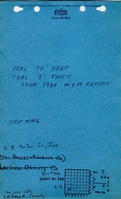
NW SWThe mine notes reported that the company fire their bricks and other products.
|
Geology
| Colchester
|
17-30
|
|
|
2.0-3.0
|
Surface
|
Geological Problems Reported
Production
| Company
|
Mine Name
|
Date
|
Production (tons)
|
|
|
|
|
|
| Total Production: 205,839
|
Production Notes
Coal Report production (if available)
Sources of Data
| Company, 6-261c
|
11-1-1941
|
1:31680
|
1:31680
|
Not final
|
| USGS topographic map
|
1994
|
1:24000
|
1:24000
|
Secondary source
|
Annotated Bibliography (Data source - brief description of information)
| Coal Reports - Production, ownership, years of operation, seam, depth, thickness, mining method.
|
| Directory of Illinois Coal Mines (La Salle County) - Mine names, mine index, ownership, years of operation.
|
| Mine notes (La Salle County) - Mine location, depth, thickness.
|
| Company map, Coal section files, 6-261c - Mine outline, mining method.
|
| Ottawa Quadrangle, USGS 7.5-minute topographic map, 1994 - Mine outline.
|
Mine Notes
Mine Images
Photographs