Mine Index Number: 2747
| Company Name:
|
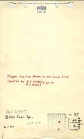
Bliss Coal Company
|
| Mine Name:
|
Bliss Mine
|
| Start Date:
|
1939
|
End Date:
|
1947
|
| Type of Mine:
|
Underground
|
| Total acres shown:
|
6
|
| Acres after map date:
|
Less than 1
|
General Area of mining acres shown:
|
|
|
|
Shaft, Slope, Drift or Tipple Location(s)
| Type
|
County
|
Township-Range
|
Section
|
Part Section
|
| Main shaft
|
Logan
|
20N 3W
|
27
|
2083 FSL, 1137 FEL
|
Geology
Geological Problems Reported
Production
| Company
|
Mine Name
|
Date
|
Production (tons)
|
Production Notes
Coal Report production (if available)
Sources of Data
| Microfilm, document 352534
|
1945
|
1:2400
|
1:4464
|
Not final
|
| Microfilm, document 352536
|
1945
|
1:2400
|
1:4469
|
Not final
|
Annotated Bibliography (Data source - brief description of information)
| Coal Reports - Production, ownership, years of operation.
|
| Directory of Illinois Coal Mines (Logan County) - Mine names, mine index, ownership, years of operation.
|
| Mine notes (Logan County) - Mine type, shaft location, seam, depth, thickness.
|
| Microfilm map, document 352534, reel 03139, frame 257 - Shaft location, mine outline.
|
| Microfilm map, document 352536, reel 03139, frame 262 - Shaft location, mine outline.
|
Mine Notes
Mine Images
Microfilm: 35536
Map Date: 1945
Coal Co.: Bliss Coal Company
Mine Name: Bliss Mine
Full Res Download
Photographs