Mine Index Number: 2774
| Company Name:
|
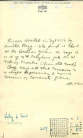
John Kelly and Sons
|
| Mine Name:
|
Kelly Mine
|
| Start Date:
|
1886
|
End Date:
|
1889
|
| Type of Mine:
|
Underground
|
| Total acres shown:
|
None
|
| Production Indicated Acres:
|
2
|
General Area of mining acres shown:
|
|
|
|
Shaft, Slope, Drift or Tipple Location(s)
| Type
|
County
|
Township-Range
|
Section
|
Part Section
|
| Shaft
|
Madison
|
4N 8W
|
4
|
NE NE SE
|
| Shaft
|
Madison
|
4N 8W
|
4
|
NE NE SE
|
Geology
Geological Problems Reported
Production
| Company
|
Mine Name
|
Date
|
Production (tons)
|
Production Notes
Coal Report production (if available)
Sources of Data
| Robert Gibson, IDNR
|
4-2003
|
1:1
|
1:24000 UTM GPS coordinates were converted to Lambert Conformable Conic Projection for plotting onto 1:24000 USGS topographic map.
|
Secondary source
|
| Federal Land Bank Report
|
6-1934
|
1:126720
|
1:126720
|
Secondary source
|
Annotated Bibliography (Data source - brief description of information)
| Coal Reports - Production, ownership, years of operation, mining method.
|
| Directory of Illinois Coal Mines (Madison County) - Mine names, mine index, ownership, years of operation.
|
| Mine notes (Madison County) - Mine type, seam, depth, thickness.
|
| Robert Gibson (AML-OMM), personal communication 4-24-2003 - Shaft locations.
|
| Federal Land Bank Report (Madison County) - General area of mining for this and other mines in 3-T4N-R8W.
|
Mine Notes
Mine Images
Photographs