Mine Index Number: 2778
| Company Name:
|
Madison Coal Company
|
| Mine Name:
|
Madison No. 1 Mine
|
| Start Date:
|
1890
|
End Date:
|
1897
|
| Type of Mine:
|
Underground
|
| Total acres shown:
|
113
|
| Acres after map date:
|
|
General Area of mining acres shown:
|
|
|
|
Shaft, Slope, Drift or Tipple Location(s)
| Type
|
County
|
Township-Range
|
Section
|
Part Section
|
| Main shaft
|
Madison
|
4N 8W
|
34
|
NW NW SW
|
| Air shaft
|
Madison
|
4N 8W
|
34
|
NW NW SW
|
Geology
Geological Problems Reported
Production
| Company
|
Mine Name
|
Date
|
Production (tons)
|
Production Notes
Coal Report production (if available)
Sources of Data
| Microfilm, document 352356
|
Undated
|
1:4800
|
1:6952
|
Final
|
Annotated Bibliography (Data source - brief description of information)
| Coal Reports - Production, ownership, years of operation.
|
| Directory of Illinois Coal Mines (Madison County) - Mine names, mine index, ownership, years of operation.
|
| Mine notes (Madison County) - Mine type, shaft location, seam, depth, thickness.
|
| Microfilm map, document 352356, reel 03138, frame 470 - Shaft locations, mine outline, mining method.
|
Mine Notes
Mine Images
Microfilm: 352356 3138 470
Coal Co.: Madison Coal Corp.
Mine Name: Mine No. 1
Full Res Download
Photographs
Additional Notes
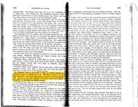
| Map is undated, but states "Final map", and that the shaft was closed in 1897.
|