Mine Index Number: 2898
| Company Name:
|
Ed A. Bauser Coal Company
|
| Mine Name:
|
Bauser Mine
|
| Start Date:
|
1904
|
End Date:
|
1940
|
| Type of Mine:
|
Underground
|
| Total acres shown:
|
14
|
| Production Indicated Acres:
|
40
|
General Area of mining acres shown:
|
|
|
The outline shown on the accompanying map is smaller than expected for the reported production. Production indicates approximately 40 acres were mined. A general area of mining has been added to the accompanying map to illustrate the approximate size of the mined area.
|
Shaft, Slope, Drift or Tipple Location(s)
| Type
|
County
|
Township-Range
|
Section
|
Part Section
|
| Main shaft
|
Macoupin
|
7N 8W
|
13
|
NE SE SW
|
| Air shaft
|
Macoupin
|
7N 8W
|
13
|
NE SE SW
|
Geology
| Herrin
|
240-245
|
|
|
5.0-6.0
|
RPB
|
Geological Problems Reported
Production
| Company
|
Mine Name
|
Date
|
Production (tons)
|
|
|
|
|
|
| Total Production: 195,177
|
Production Notes
Coal Report production (if available)
Sources of Data
| Microfilm, document 352540
|
4-27-1940
|
1:1200
|
1:1738
|
Final The map date is final, but the map must be incomplete because the mine outline is much too small for the reported production. The outline shown on the accompanying map is coded final because the portion of the source map that is missing old workings is not clear.
|
Annotated Bibliography (Data source - brief description of information)
| Coal Reports - Production, ownership, years of operation.
|
| Directory of Illinois Coal Mines (Macoupin County) - Mine names, mine index, ownership, years of operation.
|
| Mine notes (Macoupin County) - Mine type, shaft location, seam, depth, thickness.
|
| Microfilm map, document 352540, reel 03139, frame 271 - Shaft locations, mine outline, mining method.
|
Mine Notes
Mine Images
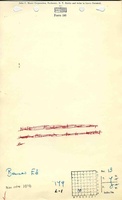
![[[:Bauser|Bauser]]](https://go.illinois.edu/ILMImages/macoupin/thumbnails/m2898_th.jpg) These files may not be true to scale and are not georgistered. These files may not be true to scale and are not georgistered.
|
Map Type:
|
Microfilm
|
| Map ID:
|
352540
|
| Company:
|
Ed A. Bauser
|
| Mine Name:
|
Bauser
|
| Caption:
|
|
| Map Date:
|
04-27-1940
|
| Map Status:
|
Final
|
| Image Credit:
|
|
| Note:
|
|
| More Info:
|
M2898
|
| Full Res Download:These files are true to scale and most are georegistered for gis software. These files may be a very large (>1GB) download!
|
https://go.illinois.edu/ILMImages/macoupin/m2898.zip
|
Photographs