Mine Index Number: 2901
| Company Name:
|
Naylor and McPherson
|
| Mine Name:
|
Naylor and McPherson Mine
|
| Start Date:
|
Unknown
|
End Date:
|
1879
|
| Type of Mine:
|
Underground
|
| Total acres shown:
|
|
| Acres after map date:
|
|
General Area of mining acres shown:
|
|
|
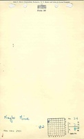
A general area of mining is shown on the accompanying map. The extent of mining is not known.
|
Shaft, Slope, Drift or Tipple Location(s)
| Type
|
County
|
Township-Range
|
Section
|
Part Section
|
| Main shaft
|
Macoupin
|
7N 8W
|
24
|
NE NW NW
|
Geology
Geological Problems Reported
The Worthen report on economic geology indicates the coal was from 5.0 to 7.0 feet thick, but split by a shale parting, with the coal above the parting of better quality.
Production
| Company
|
Mine Name
|
Date
|
Production (tons)
|
| Naylor and McPherson The mine notes indicate this mine was abandoned in 1879. The Coal Reports were published after 1882, and production and years of operation before that year are unknown.
|
Naylor and McPherson
|
-1879
|
unknown Production before 1882 is not known.
|
|
|
Production Notes
Coal Report production (if available)
Sources of Data
| ISGS map library, 4103.M34 i5.1-27
|
3-20-1934
|
1:62500
|
1:62500
|
Secondary source
|
Annotated Bibliography (Data source - brief description of information)
| Directory of Illinois Coal Mines (Macoupin County) - Mine names, mine index, ownership, years of operation.
|
| Mine notes (Macoupin County) - Mine type, shaft location, seam, depth, thickness.
|
| Wanless, A. H., 1882, Economical Geology, Vol. III, Chapter XVII - Mine name, depth, geologic problems.
|
| Wallace, L., 1926, Gillespie-Mt. Olive Folio, USGS Folio 220, 22p - Shaft location.
|
| ISGS map library, 4013.M34 i5.1-27, work map for Federal Land Bank Report - Shaft location, mine outline.
|
Mine Notes
Mine Images
 These files may not be true to scale and are not georgistered. These files may not be true to scale and are not georgistered.
|
Map Type:
|
ISGS map library
|
| Map ID:
|
4103.M34 i5.1-27
|
| Company:
|
|
| Mine Name:
|
|
| Caption:
|
|
| Map Date:
|
03-20-1934
|
| Map Status:
|
Secondary
|
| Image Credit:
|
|
| Note:
|
|
| More Info:
|
M2901
|
| Full Res Download:These files are true to scale and most are georegistered for gis software. These files may be a very large (>1GB) download!
|
https://go.illinois.edu/ILMImages/macoupin/m2901.zip
|
Photographs