Mine Index 2932   Union Fuel Company,   Union Fuel No. 1 Mine

From ILMINES WIKI
Disclaimer
INTERPRETING A MINE SUMMARY SHEET
Unlocated Mines In: Macoupin unlocated
County: Macoupin
Quadrangle: Virden South
County Coal Data: Macoupin
Shown On Map: Yes
Unlocated: No
MSHA ID:

Mine Index Number: 2932

Company Name: Union Fuel Company
Mine Name: Union Fuel No. 1 Mine
Start Date: 1878 End Date: January 1921
Type of Mine: Underground
Total acres shown: 202
Production Indicated Acres: 230 General Area of mining acres shown: 344

The area shown by the source map is smaller than expected for the reported production. A general area of mining has been added to indicate the approximate dimensions of the mined area, as well as the area that a 1934 map indicated the presence of subsidence pits caused by under-mining.

Shaft, Slope, Drift or Tipple Location(s)

Type County Township-Range Section Part Section
Main shaft Macoupin 11N 6W 18 SE NW SW
Air shaft Macoupin 11N 6W 18 SE NW SW

Geology

Thickness (ft)
Seam Depth (ft) Min Max Ave Mining Method
Herrin 325-340 6.0-7.5 RP

Geological Problems Reported

Production

Company Mine Name Date Production (tons)
Henry Cooper and Sons Cooper 1878-1881 600 Production from July 1879 to June 1881 unknown
Dennis Noonan Noonan 1881-1888 227,310
H. Cooper and Son Cooper 1888-1889 26,398
Carbon Coal Company Carbon 1889-1893 190,655
Nilwood Carbon Coal Company Nilwood Carbon 1893-1902 292,137
Weaver Coal and Coke Company Weaver 1902-1903 42,420
Manufacturer’s Fuel Company Manufacturer’s Fuel 1903-1906 Idle 1905, 1906 63,463
Prairie State Coal and Coke Company Prairie State No. 1 1906-1909 Idle 1909 126,542
Nilwood Coal Company Nilwood 1909-1910 1,500
Illinois Central Fuel Company Illinois Central Fuel No. 1 1910-1911 77,877
Illinois Central Fuel Company Illinois Central Fuel No. 1 1911-1917 Idle 1913-1917 30,850 Production after map date
Nilwood Coal Company Nilwood No. 1 1917-1919 49,000 Production after map date
Union Fuel Company Union Fuel No. 1 1919-1921 76,184 Production after map date
Total Production: 1,204,936

Production Notes

Coal Report production (if available)

Sources of Data

Source Map Map Date Original Scale Digitized Scale Map Type
State archive, PB_1029_01 2-17-1921 Unknown 1:24000 Not final
State archive, PB_1096_01 9-12-1924 1:6000 1:6000 Final
Federal Land Bank Report 4-1934 1:189096 1:189096 Secondary source

Annotated Bibliography (Data source - brief description of information)

Coal Reports - Production, ownership, years of operation, mine type, depth, thickness.
Directory of Illinois Coal Mines (Macoupin County) - Mine names, mine index, ownership, years of operation.
Mine notes (Macoupin County) - Shaft location, seam, thickness.
State archive, PB_1029_01 - Mine outline, mining method.
State archive, PB_1096_01 - Shaft locations, mine outline (northwest part of mine).
Federal Land Bank Report (Macoupin County) - General area of mining (subsidence pits).

Mine Notes

Mine Images

[[:Nilwood No. 1|Nilwood No. 1]]These files may not be true to scale and are not georgistered. Map Type: State Archive
Map ID: PB_1096_01
Company:
Mine Name: Nilwood No. 1
Caption:
Map Date: 09-12-1924
Map Status: Final
Image Credit:
Note:
More Info: M2932 PB 1096 01
Full Res Download:These files are true to scale and most are georegistered for gis software. These files may be a very large (>1GB) download! https://go.illinois.edu/ILMImages/macoupin/m2932 PB 1096 01.zip
[[:Nilwood No. 1|Nilwood No. 1]]These files may not be true to scale and are not georgistered. Map Type: State Archive
Map ID: PB_1029_01
Company:
Mine Name: Nilwood No. 1
Caption:
Map Date: 02-17-1921
Map Status: Not Final
Image Credit:
Note:
More Info: M2932 PB 1029 01
Full Res Download:These files are true to scale and most are georegistered for gis software. These files may be a very large (>1GB) download! https://go.illinois.edu/ILMImages/macoupin/m2932 PB 1029 01.zip
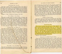
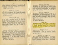
https://go.illinois.edu/ILMImages/macoupin/thumbnails/m2932_quade_th.jpgThese files may not be true to scale and are not georgistered. Map Type: Federal Land Bank Report
Map ID: Macoupin County
Company:
Mine Name:
Caption:
Map Date:
Map Status: Secondary
Image Credit:
Note: Clipped version of the Federal Land Bank Report.

Full Federal Land Bank (Quade) Download

More Info: M2932 quade
Full Res Download:These files are true to scale and most are georegistered for gis software. These files may be a very large (>1GB) download! https://go.illinois.edu/ILMImages/macoupin/m2932 quade.zip

Photographs