Virden South Quadrangle
Mining in the Virden South Quadrangle
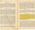
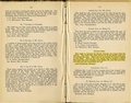
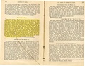
Mining began in the Virden South Quadrangle in 1867, when the Carpenter Mine (mine index 0186) opened. The Herrin Coal was over 300 feet deep in this area, but generally averaged over 6 feet thick. The uniform seam drew others, and mining took place here until 1959, when the Virden Mine (mine index 0067) closed. After a gap when no mining took place, the Crown II Mine (mine index 0933) opened in 1974.
The Herrin Coal had a thick shale roof that was prone to fall and roof support planning was required. Slips and rolls were common. Sandstone channels or faults were present and fractures in the shale over the coal introduced moisture into some mines. The geologic problems in this area were common for the Herrin Coal in the Illinois Basin, without any large structural features (such as the Cottage Grove Fault System of southern Illinois) to add special problems.
Map and Directory PDF Download
Coal Mines In Illinois Virden South Quadrangle
Mines that Appear on the Virden South Quadrangle
Unlocated Mines
Macoupin County
Pages in category "Virden South Quadrangle"
The following 24 pages are in this category, out of 24 total.
M
- FileList:M0067
- FileList:M0067b
- FileList:M0185 IL 1131 03
- FileList:M0186 IL 1115 01
- FileList:M0186 IL 1128 01
- FileList:M0186b
- FileList:M0933 final
- FileList:M0996
- FileList:M0996 6-381L
- FileList:M2931 IL 1125 03
- FileList:M2931 PB 1093 01
- FileList:M2932 PB 1029 01
- FileList:M2932 PB 1096 01
- FileList:M2932 quade
- FileList:M2934 IL 1121 01
- FileList:M2934b
Media in category "Virden South Quadrangle"
The following 27 files are in this category, out of 27 total.
 M0067 fieldnotes.pdf 754 × 1,200, 2 pages; 370 KB
 M0067 minenotes.pdf 731 × 1,202, 29 pages; 7.17 MB
 M0185 coalreport1904.pdf 1,641 × 1,227; 483 KB
 M0185 minenotes.pdf 731 × 1,202, 17 pages; 4.52 MB
 M0186 coalreport1884.pdf 1,520 × 1,320, 2 pages; 712 KB
 M0186 fieldnotes.pdf 750 × 1,195; 203 KB
 M0186 minenotes.pdf 731 × 1,202, 20 pages; 5.4 MB
 M0933 minenotes Part01.pdf 764 × 1,208, 65 pages; 29.79 MB
 M0933 minenotes Part02.pdf 700 × 1,181, 126 pages; 29.75 MB
 M0933 minenotes Part03.pdf 695 × 1,066, 121 pages; 29.83 MB
 M0933 minenotes Part04.pdf 977 × 1,514, 103 pages; 29.65 MB
 M0933 minenotes Part05.pdf 1,235 × 2,041, 80 pages; 29.82 MB
 M0933 minenotes Part06.pdf 1,243 × 2,389, 90 pages; 29.89 MB
 M0933 minenotes Part07.pdf 743 × 1,179, 93 pages; 29.93 MB
 M0933 minenotes Part08.pdf 718 × 797, 93 pages; 29.35 MB
 M0933 minenotes Part09.pdf 752 × 883, 93 pages; 29.67 MB
 M0933 minenotes Part10.pdf 737 × 1,168, 105 pages; 29.97 MB
 M0933 minenotes Part11.pdf 1,112 × 1,508, 6 pages; 2.4 MB
 M0996 minenotes.pdf 737 × 1,202, 131 pages; 37.77 MB
 M2931 coalreport1895.pdf 750 × 1,185; 130 KB
 M2931 minenotes.pdf 731 × 1,202, 9 pages; 1.94 MB
 M2932 coalreport1884.pdf 1,520 × 1,320; 354 KB
 M2932 coalreport1885.pdf 1,652 × 1,293; 821 KB
 M2932 minenotes.pdf 731 × 1,202, 6 pages; 1.44 MB
 M2934 coalreport1884.pdf 1,591 × 1,243; 370 KB
 M2934 coalreport1885.pdf 1,275 × 1,650; 313 KB
 M2934 minenotes.pdf 731 × 1,202, 8 pages; 2.01 MB