Mine Index Number: 0186
| Company Name:
|
Illinois Coal and Coke Corporation
|
| Mine Name:
|
Illinois Coal and Coke No. 4 Mine
|
| Start Date:
|
1867
|
End Date:
|
February 1923
|
| Type of Mine:
|
Underground
|
| Total acres shown:
|
641
|
| Acres after map date:
|
|
General Area of mining acres shown:
|
|
|
Production indicates approximately 1,150 acres were mined, with another 30 acres mined after the map date. Because the mapped area of known workings differed so substantially from the size of the mine calculated from reported production, the area shown on the accompanying map was not coded as a general area of mining, as is the usual custom with the secondary source map from the Federal Land Bank of St. Louis.
|
Shaft, Slope, Drift or Tipple Location(s)
| Type
|
County
|
Township-Range
|
Section
|
Part Section
|
| Main shaft
|
Macoupin
|
12N 6W
|
32
|
SE SE NE
|
| Air / escape shaft
|
Macoupin
|
12N 6W
|
32
|
SW SE NE
|
| Air / escape shaft
|
Macoupin
|
12N 6W
|
32
|
NE SE NE
|
Geology
| Herrin
|
352-365
|
5.0
|
8.5
|
6.0-7.0
|
MRP
|
Geological Problems Reported
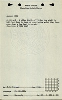
Some small faults, with 12 to 15 inches displacement, were noted. The source map showed a feature in SE SE NE 31-T12N-R6W labeled “Fault”, but may be either two parallel faults or a sand channel. Some gas was present in the rooms. The immediate roof was shale that ranged from black and massive to white and crumbly. The white crumbly shale was present in patches throughout the mine, and was from 1 inch to 6 feet thick. Above the shale was up to 12 inches of lenticular limestone, and above that was 4 feet of green and brown shale and a crumbly gray shale before reaching a persistent and competent limestone. Rolls and slips were present in the coal, one cutting out 4 feet of coal (from the top; the floor remained level). Generally, 14 to 22 inches of top coal was left to help support the shale roof and protect the roof from moisture.
Production
| Company
|
Mine Name
|
Date
|
Production (tons)
|
| Carpenter
|
Carpenter
|
1867-1881
|
996 Production is unknown prior to June 1878, and from July 1879 to June 1881. The 1882 Coal Report indicated 15 acres were mined.
|
|
|
|
|
|
|
|
| Total Production: 6,638,520
|
Production Notes
Coal Report production (if available)
Sources of Data
| State archive, IL_1128_01
|
6-1921
|
1:2400
|
1:2400
|
Not final
|
| State archive, IL_1115_01
|
8-6-1916
|
1:2400
|
1:2400
|
Not final
|
| Federal Land Bank Report
|
4-1934
|
1:126720
|
1:126720
|
Secondary Source
|
Annotated Bibliography (Data source - brief description of information)
| Coal Reports - Production, ownership, years of operation, depth.
|
| Mine notes (Macoupin County) - Mine type, shaft location, seam, depth, thickness, geologic problems.
|
| State archive, IL_1128_01 - Shaft locations, mine outline, mining method.
|
| State archive, IL_1115_01 - Mine outline (southern and southwestern extent).
|
| Federal Land Bank Report (Macoupin County) - Mine outline (eastern and southern extent).
|
Mine Notes
Mine Images
 These files may not be true to scale and are not georgistered. These files may not be true to scale and are not georgistered.
|
Map Type:
|
Federal Land Bank Report
|
| Map ID:
|
Macoupin County
|
| Company:
|
|
| Mine Name:
|
|
| Caption:
|
|
| Map Date:
|
|
| Map Status:
|
|
| Image Credit:
|
|
| Note:
|
Clipped version of the Federal Land Bank Report, the full report can be found here
|
| More Info:
|
M0186b
|
| Full Res Download:These files are true to scale and most are georegistered for gis software. These files may be a very large (>1GB) download!
|
https://go.illinois.edu/ILMImages/macoupin/m0186b.zip
|
Photographs
![[[:Pittsburg No. 403|Pittsburg No. 403]]](https://go.illinois.edu/ILMImages/macoupin/thumbnails/m0186_IL_1128_01_th.jpg)
![[[:Illinois Collieries No. 5|Illinois Collieries No. 5]]](https://go.illinois.edu/ILMImages/macoupin/thumbnails/m0186_IL_1115_01_th.jpg)