Mine Index Number: 0185
| Company Name:
|
Royal Colliery Company
|
| Mine Name:
|
Royal No. 2 Mine
|
| Start Date:
|
1903
|
End Date:
|
1924
|
| Type of Mine:
|
Underground
|
| Total acres shown:
|
1,459
|
| Acres after map date:
|
50
|
General Area of mining acres shown:
|
|
|
|
Shaft, Slope, Drift or Tipple Location(s)
| Type
|
County
|
Township-Range
|
Section
|
Part Section
|
| Main shaft
|
Macoupin
|
12N 6W
|
8
|
SE SW SW
|
| Air shaft
|
Macoupin
|
12N 6W
|
8
|
SE SW SW
|
Geology
| Herrin
|
300-350
|
4.5
|
7.5
|
6.0-6.5
|
MRP
|
Geological Problems Reported
The soft, massive, dark-to-light gray shale roof required timbering. One slip, with a displacement of 1.5 feet and filled with clay gouge, was noted. A few rolls were present in the roof. The principle trouble with the coal was the number and thickness of horizontal shale and pyrite bands. The coal seam contained pyrite bands in lenses and stringers above the blue band. Calcite and gypsum fracture fillings were throughout the bed vertically and laterally.
Production
| Company
|
Mine Name
|
Date
|
Production (tons)
|
|
|
|
|
|
| Total Production: 6,870,840
|
Production Notes
Coal Report production (if available)
Sources of Data
| State archive, IL_1131_03
|
7-1-1923
|
1:2400
|
1:2400
|
Not final
|
Annotated Bibliography (Data source - brief description of information)
| Coal Reports - Production, ownership, years of operation, depth.
|
| Directory of Illinois Coal Mines (Macoupin County) - Mine names, mine index, ownership, years of operation.
|
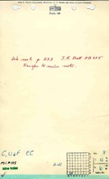
| Mine notes (Macoupin County) - Mine type, shaft location, seam, depth, thickness, geologic problems.
|
| State archive, IL_1131_03 - Shaft locations, mine outline, mining method.
|
Mine Notes
Mine Images
![[[:Royal No. 1|Royal No. 1]]](https://go.illinois.edu/ILMImages/macoupin/thumbnails/m0185_IL_1131_03_th.jpg) These files may not be true to scale and are not georgistered. These files may not be true to scale and are not georgistered.
|
Map Type:
|
State Archive
|
| Map ID:
|
IL_1131_03
|
| Company:
|
Royal Colliery Company
|
| Mine Name:
|
Royal No. 1
|
| Caption:
|
|
| Map Date:
|
07-01-1923
|
| Map Status:
|
Not Final
|
| Image Credit:
|
|
| Note:
|
Map was also used for additional workings (in the Southwest) for mine index 0067
|
| More Info:
|
M0185 IL 1131 03
|
| Full Res Download:These files are true to scale and most are georegistered for gis software. These files may be a very large (>1GB) download!
|
https://go.illinois.edu/ILMImages/macoupin/m0185 IL 1131 03.zip
|
Photographs


![[[:Royal No. 1|Royal No. 1]]](https://go.illinois.edu/ILMImages/macoupin/thumbnails/m0185_IL_1131_03_th.jpg)