Mine Index Number: 3538
| Company Name:
|
Donk Brothers Coal Company
|
| Mine Name:
|
Donk No. 1 Mine
|
| Start Date:
|
1882
|
End Date:
|
1904
|
| Type of Mine:
|
Underground
|
| Total acres shown:
|
103
|
| Acres after map date:
|
50
|
General Area of mining acres shown:
|
|
|
The mine was interconnected underground in three places in the northern half of the west side to National Mine (mine index 4336).
|
Shaft, Slope, Drift or Tipple Location(s)
| Type
|
County
|
Township-Range
|
Section
|
Part Section
|
| Main slope
|
St. Clair
|
1N 8W
|
33
|
NW NE NE
|
| Air shaft
|
St. Clair
|
1N 8W
|
33
|
NW NE NE
|
Geology
| Herrin
|
56-100
|
|
|
6.0-8.0
|
MRP,HERsee Geologic Problems (below)
|
Geological Problems Reported
The Coal Report of 1884 indicates the roof was difficult to hold up (page 576). The Coal Report of 1902 stated that “the pillars had been robbed to such an extent that a general squeeze was induced, resulting in a cave-in under a small creek”, allowing a large quantity of water into the mine. The mine was abandoned two years later, when the remaining coal was in an area of thinning bedrock and the unconsolidated sediments rested directly on the coal.
Production
| Company
|
Mine Name
|
Date
|
Production (tons)
|
| John Maule
|
Maule
|
1882-1883
|
9,650 Production prior to 1882 unknown. The Coal Report of 1882 indicates 16 acres mined.
|
|
|
|
|
|
|
|
| Total Production: 912,840
|
Production Notes
Coal Report production (if available)
Sources of Data
| Microfilm, document 350983
|
1-25-1892
|
1:960
|
1:1721
|
Not final
|
| State archive, PB_168
|
Undated
|
Unknown
|
1:24000
|
Undated
|
Annotated Bibliography (Data source - brief description of information)
| Coal Reports - Production, ownership, years of operation, seam, depth, thickness, geologic problems.
|
| Directory of Illinois Coal Mines (St. Clair County) - Mine names, mine index, ownership, years of operation.
|
| Microfilm map, document 350983, reel 03134, frame 49 - Slope and shaft locations, mine outline, mining method.
|
| State archive, PB_168, compilation of mines in this area - Mine outline (southern).
|
Mine Notes
Mine Images
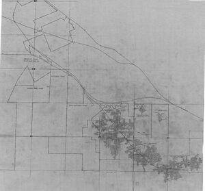
State Archive: PB_168
Map Date: Undated
Coal Co.: Vulcan Coal and Mining Company
Mine Name: Hippard No. 2 Mine
Full Res Download
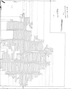
Microfilm: 350983
Map Date: 1-25-1892
Coal Co.: John Maule
Mine Name: Main Guy Mine
Full Res Download
Photographs


