Mine Index Number: 3568
| Company Name:
|
Star Coal Company
|
| Mine Name:
|
Star Mine
|
| Start Date:
|
1909
|
End Date:
|
March 1922
|
| Type of Mine:
|
Underground
|
| Total acres shown:
|
177
|
| Acres after map date:
|
|
General Area of mining acres shown:
|
|
|
|
Shaft, Slope, Drift or Tipple Location(s)
| Type
|
County
|
Township-Range
|
Section
|
Part Section
|
| Main shaft
|
St. Clair
|
1S 7W
|
30
|
NE SW SE
|
| Air shaft
|
St. Clair
|
1S 7W
|
30
|
NE SW SE
|
Geology
| Herrin
|
77
|
6.5
|
10.3
|
6.5-7.3
|
MRP
|
Geological Problems Reported
Slips similar to horsebacks were common in this mine. The black shale above the coal was up to 10 feet thick over the thickest coal, and contained many concretions. Where the black shale was thick, rolls and other offsets were present in the coal, often with cracks up to 12 inches filled with gouge material. The underclay floor heaved a little in some places.
Production
| Company
|
Mine Name
|
Date
|
Production (tons)
|
Production Notes
Coal Report production (if available)
Sources of Data
| Company map
|
6-6-1926
|
1:2400
|
1:2400
|
Final
|
Annotated Bibliography (Data source - brief description of information)
| Coal Reports - Production, ownership, years of operation.
|
| Directory of Illinois Coal Mines (St. Clair County) - Mine names, mine index, ownership, years of operation.
|
| Mine notes (St. Clair County) - Depth, thickness, geologic problems.
|
| Company map - Shaft locations, mine outline, mining method.
|
Mine Notes
Mine Images
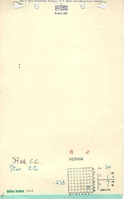
Company:
Map Date: 2-6-1926
Coal Co.: Star Coal Company
Mine Name: Star Mine
Full Res Download
Photographs