Mine Index Number: 3668
| Company Name:
|
Producers Coal Company
|
| Mine Name:
|
Producers No. 22 Mine
|
| Start Date:
|
1904
|
End Date:
|
May 1916
|
| Type of Mine:
|
Underground
|
| Total acres shown:
|
507
|
| Acres after map date:
|
|
General Area of mining acres shown:
|
|
|
|
Shaft, Slope, Drift or Tipple Location(s)
| Type
|
County
|
Township-Range
|
Section
|
Part Section
|
| Main shaft
|
Vermilion
|
18N 12W
|
13
|
SW NW NE
|
| Air shaft
|
Vermilion
|
18N 12W
|
13
|
NW SW NE
|
Geology
| Herrin
|
196-235
|
5.5
|
8.0
|
6.0-7.0
|
MRP,HERsome HER
|
Geological Problems Reported
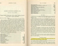
The roof was a fine gray sandy shale. Coal stringers made the roof treacherous. Northeast-southwest trending faults were common. Rolls were common enough to be considered as having a “very important” effect on mining. The source map show a large area designated “not workable” southwest of the shaft.
Production
| Company
|
Mine Name
|
Date
|
Production (tons)
|
|
|
|
|
|
| Total Production: 3,362,825
|
Production Notes
Coal Report production (if available)
Sources of Data
| State Archive, MSHA_775_01
|
5-15-1916
|
1:2400
|
1:2400
|
Final
|
Annotated Bibliography (Data source - brief description of information)
| Coal Reports - Production, ownership, years of operation, thickness.
|
| Directory of Illinois Coal Mines (Vermilion County) - Mine names, mine index, ownership, years of operation.
|
| Mine notes (Vermilion County) - Mine type, seam, depth, thickness, geologic problems.
|
| Company map, State Archive, MSHA_775_01, courtesy Robert Gibson, DNR - Shaft location, mine outline, mining method, geologic problems.
|
Mine Notes
Mine Images
Company: MSHA_775_01
Map Date: 5-15-1916
Coal Co.: Producers Coal Company
Mine Name: Producers No. 22 Mine
Image Credit: Illinois Department of Natural Resources - Office of Mines and Minerals
Full Res Download
Photographs