Mine Index Number: 4554
| Company Name:
|
Lake and Henry
|
| Mine Name:
|
Lake and Henry Mine
|
| Start Date:
|
1937
|
End Date:
|
1937
|
| Type of Mine:
|
Underground
|
| Total acres shown:
|
None
|
| Production Indicated Acres:
|
Less than 1
|
General Area of mining acres shown:
|
|
|
|
Shaft, Slope, Drift or Tipple Location(s)
| Type
|
County
|
Township-Range
|
Section
|
Part Section
|
| Shaft
|
Macoupin
|
12N 9W
|
4
|
SW SE NE
|
Geology
| Herrin
|
65
|
|
|
6.0
|
Underground
|
Geological Problems Reported
Production
| Company
|
Mine Name
|
Date
|
Production (tons)
|
| Lake and Henry Mine notes indicate this mine may have been related to Aaron Lake Mine (mine index 4557).
|
Lake and Henry
|
1937-1937 Mine notes indicate this mine may have opened in 1936 and may have been operated by John Carlson (possibly mine index 91170026), but no further information has been found.
|
240
|
| Total Production: 240
|
Production Notes
Coal Report production (if available)
Sources of Data
| Mine notes
|
6-8-1937
|
1:62500
|
1:62500
|
Secondary source
|
| ISGS map library, 4103.M34 i5.1-27
|
3-20-1934
|
1:62500
|
1:62500
|
Secondary source
|
Annotated Bibliography (Data source - brief description of information)
| Coal Reports - Production, ownership, years of operation.
|
| Directory of Illinois Coal Mines (Macoupin County) - Mine names, mine index, ownership, years of operation.
|
| Mine notes (Macoupin County) - Mine type, mine location, seam, depth, thickness.
|
| ISGS map library, 4103.M34 i5.1-27, work map for Federal Land Bank Report - General area of mining.
|
Mine Notes
Mine Images
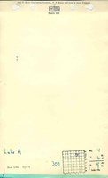
 These files may not be true to scale and are not georgistered. These files may not be true to scale and are not georgistered.
|
Map Type:
|
ISGS map library
|
| Map ID:
|
4103.M34 i5.1-27
|
| Company:
|
|
| Mine Name:
|
|
| Caption:
|
|
| Map Date:
|
3-20-1934
|
| Map Status:
|
Secondary
|
| Image Credit:
|
|
| Note:
|
Work map for Macoupin County Federal Land Bank Report
|
| More Info:
|
Maplib quade1 geo
|
| Full Res Download:These files are true to scale and most are georegistered for gis software. These files may be a very large (>1GB) download!
|
https://go.illinois.edu/ILMImages/macoupin/maplib quade1 geo.zip
|
Photographs