Mine Index Number: 6774
| Company Name:
|
Unknown
|
| Mine Name:
|
Unknown
|
| Start Date:
|
Before 1978
|
End Date:
|
Before 1978
|
| Type of Mine:
|
Surface
|
| Total acres shown:
|
|
| Acres after map date:
|
|
General Area of mining acres shown:
|
|
|
|
Shaft, Slope, Drift or Tipple Location(s)
| Type
|
County
|
Township-Range
|
Section
|
Part Section
|
| Pit (northern)
|
Vermilion
|
19N 11W
|
16
|
SW
|
| Pit (southern)
|
Vermilion
|
19N 11W
|
16
|
SE
|
Geology
Geological Problems Reported
Production
| Company
|
Mine Name
|
Date
|
Production (tons)
|
Production Notes
Coal Report production (if available)
Sources of Data
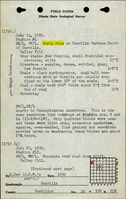
| USGS topographic map, Danville SE Quadrangle
|
PR 1978
|
1:24000
|
1:24000
|
Secondary source
|
Annotated Bibliography (Data source - brief description of information)
| USGS topographic map, Danville SE (7.5') Quadrangle - Mine outlines.
|
Mine Notes
Mine Images
Photographs