File:M-813 Coop 17 fig 30-ps Kellyville Kelly No 3 mine 6ft coal 210 ft deep 4.7 ft sub Coop 2 fig 6.jpg
Size of this preview: 800 × 469 pixels. Other resolution: 2,500 × 1,465 pixels.
Original file (2,500 × 1,465 pixels, file size: 466 KB, MIME type: image/jpeg)
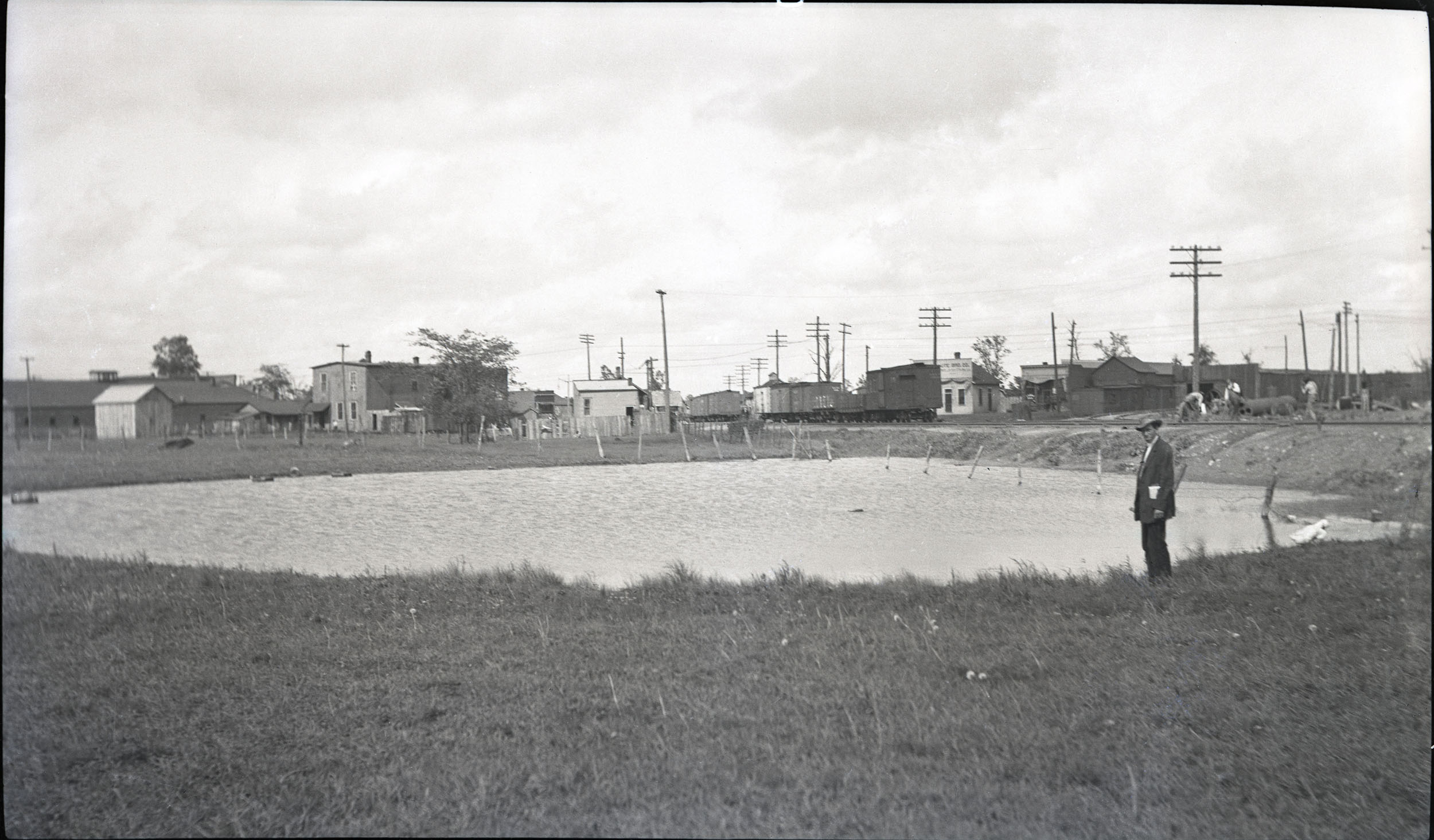
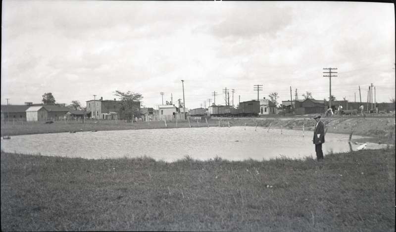
| Mine Index(s): | 3663 |
| Mine Company: | UNITED STATES FUEL COMPANY |
| Mine Name | KELLY No. 3 |
| Photo Date | Pre-1914 |
| Photo Credit | Illinois State Geological Survey |
| ISGS Library Call Number | M-813 |
| Caption | Pond caused by subsidence at Westville, Vermilion County, where 6 feet of coal was removed by room-and-pillar mining at a depth of 210 feet. Levels at surface show maximum depth of sag to by 4.7 feet. |
| Publication | Fig. 30 Cooperative Bulletin 17 – Subsidence in Illinois |
all these photos are for Kellyville No. 3...not sure if this (m.i. 3663) is the correct index number
File history
Click on a date/time to view the file as it appeared at that time.
| Date/Time | Thumbnail | Dimensions | User | Comment | |
|---|---|---|---|---|---|
| current | 14:14, January 24, 2019 | | 2,500 × 1,465 (466 KB) | Alan.Myers (talk | contribs) |
You cannot overwrite this file.
File usage
The following 4 pages use this file: